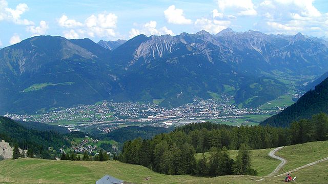
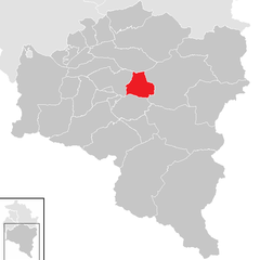
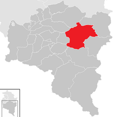
Bludenz District (Bezirk Bludenz)

- district (Bezirk) Bludenz, Vorarlberg, Austria
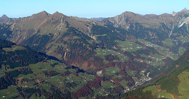
 Hiking in Bludenz District
Bludenz District, located in the western part of Austria, is a fantastic destination for hiking enthusiasts. Nestled in the scenic Vorarlberg region, it offers a diverse landscape that includes lush valleys, towering mountains, and picturesque villages. Here are some highlights and recommendations for hiking in this area:
Scenic Trails
-
Muttersberg: This area features several hiking trails with varying degrees of difficulty. The trail leading to the summit offers stunning views of the surrounding mountains and valleys.
-
Vorarlberger Weg (Vorarlberg Trail): A long-distance hiking route that connects various regions in Vorarlberg. Portions of this trail run through Bludenz District and provide an excellent opportunity to experience the natural beauty of the area.
-
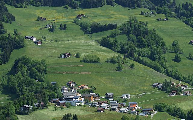
Brandnertal Valley: This valley is known for its extensive network of trails. Hikes here range from easy walks suitable for families to more challenging routes for experienced hikers. Look out for alpine meadows and waterfalls along the way.
-
Schwarzer See: A beautiful alpine lake that is accessible via several hiking paths. The hike to the lake can be a rewarding experience, showcasing the region's diverse flora and fauna.
Seasonal Considerations
-
Spring and Summer: These seasons are ideal for hiking, as the trails are typically clear of snow and the weather is pleasant. Wildflowers bloom, making the scenery even more picturesque.
-
Autumn: Fall is another wonderful time to explore, as the foliage turns vibrant shades of orange and red. The weather can be cooler, so be prepared with the right gear.
-
Winter: While hiking might be more challenging due to snow, some trails are accessible for winter hiking or snowshoeing. Always check trail conditions and be prepared with proper equipment.
Practical Tips
-
Trail Maps: It's advisable to have a detailed map of the hiking trails. The local tourist office can provide information and recommendations based on your skill level.
-
Equipment: Wear sturdy hiking boots, and bring layers for warmth, plenty of water, and snacks. Depending on the trail, consider trekking poles for added stability.
-
Local Guides: If you're unfamiliar with the area or want to learn more about the local flora and fauna, consider hiring a local guide.
-
Safety: Always inform someone of your hiking plans, especially if venturing alone or into less-trafficked areas. Keep an eye on the weather conditions and be prepared to turn back if necessary.
Conclusion
Hiking in Bludenz District offers a unique blend of natural beauty, cultural experiences, and outdoor adventure. Whether you're a novice or an experienced hiker, you'll find trails that suit your needs and showcase the stunning landscapes of Vorarlberg. Enjoy your hike!
- Country:

- Capital: Bludenz
- Licence Plate Code: BZ
- Coordinates: 47° 6' 0" N, 9° 54' 0" E


- GPS tracks (wikiloc): [Link]
- AboveSeaLevel: 566 м m
- Area: 1287.52 sq km
- Web site: http://www.vorarlberg.at/bhbludenz
- Wikipedia en: wiki(en)
- Wikipedia: wiki(de)
- Wikidata storage: Wikidata: Q698606
- Wikipedia Commons Category: [Link]
- Wikipedia Commons Maps Category: [Link]
- Freebase ID: [/m/06tlpz]
- GeoNames ID: Alt: [2781679]
- VIAF ID: Alt: [240918720]
- GND ID: Alt: [4266829-3]
- archINFORM location ID: [14610]
Includes regions:


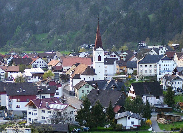
Silbertal
- municipality in Austria
Hiking in Silbertal
Silbertal, located in the Montafon valley of Austria, is a fantastic destination for hiking enthusiasts. This picturesque region is surrounded by stunning Alpine scenery, making it ideal for outdoor activities. Here are some highlights and tips for hiking in Silbertal:...
- Country:
- Postal Code: 6782
- Local Dialing Code: 05556
- Licence Plate Code: BZ
- Coordinates: 47° 5' 41" N, 9° 58' 42" E
- GPS tracks (wikiloc): [Link]
- AboveSeaLevel: 889 м m
- Area: 88.61 sq km
- Population: 834
- Web site: [Link]


Tschagguns
- municipality in Austria
Hiking in Tschagguns
Tschagguns, located in the Montafon valley of Austria, is a fantastic destination for hiking enthusiasts. Surrounded by the stunning peaks of the Alps, Tschagguns offers a variety of trails that cater to different skill levels, from gentle walks to challenging hikes....
- Country:
- Postal Code: 6774
- Local Dialing Code: 05556
- Licence Plate Code: BZ
- Coordinates: 47° 4' 36" N, 9° 54' 3" E
- GPS tracks (wikiloc): [Link]
- AboveSeaLevel: 685 м m
- Area: 57.67 sq km
- Population: 2195
- Web site: [Link]

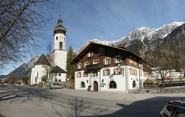
Bludenz
- town in Vorarlberg, Austria
Hiking in Bludenz
Bludenz is a picturesque town located in Vorarlberg, Austria, surrounded by stunning mountain ranges and lush valleys, making it an excellent destination for hiking enthusiasts. The region offers a variety of trails suitable for all skill levels, from leisurely strolls to challenging mountain ascents....
- Country:
- Postal Code: 6700
- Local Dialing Code: 05552
- Licence Plate Code: BZ
- Coordinates: 47° 9' 12" N, 9° 49' 19" E
- GPS tracks (wikiloc): [Link]
- AboveSeaLevel: 587 м m
- Area: 30.0 sq km
- Population: 14539
- Web site: [Link]


Klösterle
- municipality in Austria
Hiking in Klösterle
Klösterle, located in the Arlberg region of Austria, is a charming village that offers beautiful hiking opportunities surrounded by stunning alpine scenery. The area is known for its scenic landscapes, lush green meadows, and imposing mountain peaks, making it a popular destination for outdoor enthusiasts....
- Country:
- Postal Code: 6754
- Local Dialing Code: 05582
- Licence Plate Code: BZ
- Coordinates: 47° 7' 51" N, 10° 5' 19" E
- GPS tracks (wikiloc): [Link]
- AboveSeaLevel: 1073 м m
- Area: 62.31 sq km
- Population: 688
- Web site: [Link]
Innerbraz
- municipality in Austria
Hiking in Innerbraz
Innerbraz is a beautiful area located in Vorarlberg, Austria, and is known for its stunning landscapes and excellent hiking opportunities. Nestled in the Alps, it offers a variety of trails suitable for all levels of hikers, from beginners to experienced adventurers. Here are some highlights and tips for hiking in Innerbraz:...
- Country:
- Postal Code: 6751
- Local Dialing Code: 05552
- Licence Plate Code: BZ
- Coordinates: 47° 8' 43" N, 9° 55' 1" E
- GPS tracks (wikiloc): [Link]
- AboveSeaLevel: 708 м m
- Area: 19.96 sq km
- Population: 994
- Web site: [Link]


Lech
- municipality in Austria
Hiking in Lech
Lech, located in the Vorarlberg region of Austria, is a popular destination for hiking enthusiasts, particularly in the summer months. The breathtaking alpine scenery, idyllic landscapes, and well-maintained trails make it an ideal spot for hikers of all skill levels....
- Country:
- Postal Code: 6764
- Local Dialing Code: 05583
- Licence Plate Code: BZ
- Coordinates: 47° 12' 36" N, 10° 8' 34" E
- GPS tracks (wikiloc): [Link]
- AboveSeaLevel: 1444 м m
- Area: 90 sq km
- Population: 1568
- Web site: [Link]


Schruns
- village in Vorarlberg, Austria
Hiking in Schruns
Schruns is a charming village located in the Montafon valley in the Austrian state of Vorarlberg. It's an excellent destination for hiking enthusiasts, offering a mix of scenic trails, stunning mountain vistas, and various levels of hiking difficulty....
- Country:
- Postal Code: 6780
- Local Dialing Code: 05556
- Licence Plate Code: BZ
- Coordinates: 47° 4' 49" N, 9° 55' 9" E
- GPS tracks (wikiloc): [Link]
- AboveSeaLevel: 700 м m
- Area: 18.04 sq km
- Population: 3818
- Web site: [Link]

Nenzing
- municipality in Austria
Hiking in Nenzing
Nenzing, a beautiful town located in the Vorarlberg region of Austria, offers stunning hiking opportunities amidst picturesque alpine scenery. The area is characterized by lush green valleys, impressive mountain ranges, and charming villages, making it an excellent destination for hikers of all levels....
- Country:
- Postal Code: 6710
- Local Dialing Code: 05525
- Licence Plate Code: BZ
- Coordinates: 47° 10' 0" N, 9° 41' 0" E
- GPS tracks (wikiloc): [Link]
- AboveSeaLevel: 530 м m
- Area: 110.31 sq km
- Population: 6239
- Web site: [Link]


Thüringen
- municipality in the district of Bludenz in Vorarlberg, Austria
Hiking in Thüringen
Thüringen, while often mistaken for the German state, is actually not located in Austria. It seems there may be a mix-up with the name. However, if you are referring to hiking in the region of Thüringen in Germany, I can provide you with details about that area, or if you meant a different region in Austria, please clarify!...
- Country:
- Postal Code: 6712
- Local Dialing Code: 05550
- Licence Plate Code: BZ
- Coordinates: 47° 12' 0" N, 9° 46' 0" E
- GPS tracks (wikiloc): [Link]
- AboveSeaLevel: 573 м m
- Area: 5.67 sq km
- Population: 2222
- Web site: [Link]


Sankt Anton im Montafon
- municipality in Austria
Hiking in Sankt Anton im Montafon
Sankt Anton im Montafon is a beautiful region in the Austrian Alps, renowned for its stunning landscapes and excellent hiking opportunities. Here are some key points to consider if you're planning to hike there:...
- Country:
- Postal Code: 6771
- Local Dialing Code: 05552
- Licence Plate Code: BZ
- Coordinates: 47° 7' 0" N, 9° 52' 0" E
- GPS tracks (wikiloc): [Link]
- AboveSeaLevel: 651 м m
- Area: 3.42 sq km
- Population: 715
- Web site: [Link]


Sankt Gallenkirch
- municipality in Austria
Hiking in Sankt Gallenkirch
Sankt Gallenkirch, located in the Montafon Valley of Austria, is an excellent destination for hiking enthusiasts. The region offers a diverse range of trails that cater to both beginners and experienced hikers, with stunning views of the surrounding mountains....
- Country:
- Postal Code: 6791
- Local Dialing Code: 05557
- Licence Plate Code: BZ
- Coordinates: 47° 1' 0" N, 9° 58' 0" E
- GPS tracks (wikiloc): [Link]
- AboveSeaLevel: 878 м m
- Area: 127.83 sq km
- Population: 2246
- Web site: [Link]


Vandans
- municipality in Austria
Hiking in Vandans
Vandans is a picturesque village located in the Montafon valley in Austria, surrounded by stunning alpine scenery. It’s a great base for hiking enthusiasts due to its access to a variety of trails that cater to different skill levels, from easy walks to more challenging mountain hikes....
- Country:
- Postal Code: 6773
- Local Dialing Code: 05556
- Licence Plate Code: BZ
- Coordinates: 47° 5' 43" N, 9° 51' 56" E
- GPS tracks (wikiloc): [Link]
- AboveSeaLevel: 660 м m
- Area: 53.55 sq km
- Population: 2610
- Web site: [Link]


Raggal
- municipality in Austria
Hiking in Raggal
Raggal is a small village located in the beautiful Vorarlberg region of Austria, surrounded by the stunning landscapes of the Alps. It's a fantastic destination for hiking enthusiasts due to its picturesque trails and natural beauty....
- Country:
- Postal Code: 6741
- Local Dialing Code: 05553
- Licence Plate Code: BZ
- Coordinates: 47° 12' 37" N, 9° 50' 9" E
- GPS tracks (wikiloc): [Link]
- AboveSeaLevel: 1015 м m
- Area: 41.69 sq km
- Population: 868
- Web site: [Link]

Nüziders
- municipality in Austria
Hiking in Nüziders
Nüziders is a charming village located in the Vorarlberg region of Austria, known for its beautiful landscapes and access to numerous hiking trails. The surrounding area offers a mix of picturesque valleys, mountains, and forests, making it a great destination for hikers of all skill levels....
- Country:
- Postal Code: 6714
- Local Dialing Code: 05552
- Licence Plate Code: BZ
- Coordinates: 47° 10' 0" N, 9° 48' 0" E
- GPS tracks (wikiloc): [Link]
- AboveSeaLevel: 562 м m
- Area: 22.16 sq km
- Population: 4962
- Web site: [Link]

Sonntag
- municipality in Austria
Hiking in Sonntag
Sonntag is a charming village located in the Montafon valley in the Austrian state of Vorarlberg. It is a fantastic base for hiking enthusiasts, offering a range of trails that cater to various levels of hikers, from beginners to experienced trekkers....
- Country:
- Postal Code: 6731
- Local Dialing Code: 05554
- Licence Plate Code: BZ
- Coordinates: 47° 14' 21" N, 9° 54' 5" E
- GPS tracks (wikiloc): [Link]
- AboveSeaLevel: 888 м m
- Area: 81.58 sq km
- Population: 671
- Web site: [Link]


Bürserberg
- municipality in Austria
Hiking in Bürserberg
Bürserberg, located in the Vorarlberg region of Austria, is a beautiful destination for hiking enthusiasts. This charming village offers a variety of trails suitable for different skill levels, surrounded by breathtaking alpine scenery and lush greenery....
- Country:
- Postal Code: 6707
- Local Dialing Code: 05552
- Licence Plate Code: BZ
- Coordinates: 47° 8' 36" N, 9° 46' 34" E
- GPS tracks (wikiloc): [Link]
- AboveSeaLevel: 871 м m
- Area: 13.73 sq km
- Population: 572
- Web site: [Link]


Ludesch
- municipality in Austria
Hiking in Ludesch
Ludesch, a charming village in the Austrian state of Vorarlberg, offers a variety of beautiful hiking opportunities for outdoor enthusiasts. Nestled in the scenic surroundings of the Alps, Ludesch provides access to numerous trails that cater to different skill levels, making it an excellent destination for both beginners and experienced hikers....
- Country:
- Postal Code: 6713
- Local Dialing Code: 05550
- Licence Plate Code: BZ
- Coordinates: 47° 11' 40" N, 9° 46' 54" E
- GPS tracks (wikiloc): [Link]
- AboveSeaLevel: 555 м m
- Area: 11.25 sq km
- Population: 3437
- Web site: [Link]


Bürs
- municipality in Austria
Hiking in Bürs
Bürs is a picturesque village located in the Montafon region of Austria, surrounded by stunning alpine scenery, making it a fantastic destination for hiking enthusiasts. Here are some highlights and tips for hiking in Bürs:...
- Country:
- Postal Code: 6706
- Local Dialing Code: 05552
- Licence Plate Code: BZ
- Coordinates: 47° 8' 0" N, 9° 48' 0" E
- GPS tracks (wikiloc): [Link]
- AboveSeaLevel: 570 м m
- Area: 24.62 sq km
- Population: 3275
- Web site: [Link]

Bartholomäberg
- municipality in Austria
Hiking in Bartholomäberg
Bartholomäberg, located in the Montafon valley of Austria, is a fantastic destination for hiking enthusiasts. The region is renowned for its stunning Alpine scenery, diverse landscapes, and a variety of hiking trails suitable for different skill levels....
- Country:
- Postal Code: 6781
- Local Dialing Code: 05556
- Licence Plate Code: BZ
- Coordinates: 47° 5' 31" N, 9° 54' 30" E
- GPS tracks (wikiloc): [Link]
- AboveSeaLevel: 1087 м m
- Area: 27.28 sq km
- Population: 2352
- Web site: [Link]


Thüringerberg
- municipality in Austria
Hiking in Thüringerberg
Thüringerberg, located in the scenic Vorarlberg region of Austria, offers a variety of hiking opportunities amidst stunning natural landscapes. The area is known for its mountainous terrain, lush forests, and panoramic views of the surrounding Alps, making it a great destination for both experienced hikers and beginners....
- Country:
- Postal Code: 6721
- Local Dialing Code: 05550
- Licence Plate Code: BZ
- Coordinates: 47° 12' 54" N, 9° 46' 59" E
- GPS tracks (wikiloc): [Link]
- AboveSeaLevel: 877 м m
- Area: 10.39 sq km
- Population: 714
- Web site: [Link]

Dalaas
- municipality in Austria
Hiking in Dalaas
Dalaas is a small village located in the western part of Austria, in the state of Vorarlberg. It’s nestled in the scenic Arlberg region, which is renowned for its stunning landscapes, making it an excellent destination for hiking enthusiasts....
- Country:
- Postal Code: 6752
- Local Dialing Code: 05585
- Licence Plate Code: BZ
- Coordinates: 47° 7' 20" N, 9° 59' 40" E
- GPS tracks (wikiloc): [Link]
- AboveSeaLevel: 835 м m
- Area: 94.3 sq km
- Population: 1597
- Web site: [Link]

Blons
- municipality in Austria
Hiking in Blons
Blons is a picturesque village located in the Vorarlberg region of Austria, surrounded by beautiful alpine landscapes. The area is relatively less known compared to other hiking destinations, making it an excellent choice for those looking to escape the crowds and enjoy nature....
- Country:
- Postal Code: 6723
- Local Dialing Code: 05553
- Licence Plate Code: BZ
- Coordinates: 47° 13' 25" N, 9° 50' 5" E
- GPS tracks (wikiloc): [Link]
- AboveSeaLevel: 903 м m
- Area: 14.88 sq km
- Population: 349
- Web site: [Link]


Stallehr
- municipality in Austria
Hiking in Stallehr
Stallehr is a stunning hiking destination located in the Austrian Alps, offering spectacular views, diverse landscapes, and a variety of trails suitable for all skill levels. Located in the Tyrol region, the area is characterized by its mountainous terrain, lush valleys, and crystal-clear lakes....
- Country:
- Postal Code: 6700
- Local Dialing Code: 05552
- Licence Plate Code: BZ
- Coordinates: 47° 8' 24" N, 9° 51' 20" E
- GPS tracks (wikiloc): [Link]
- AboveSeaLevel: 600 м m
- Area: 1.66 sq km
- Population: 289
- Web site: [Link]


Gaschurn
- municipality in Austria
Hiking in Gaschurn
Gaschurn is a charming village located in the Montafon Valley in the Austrian Alps, known for its beautiful mountain scenery and a variety of outdoor activities, making it a fantastic destination for hiking enthusiasts....
- Country:
- Postal Code: 6793
- Local Dialing Code: 05558
- Licence Plate Code: BZ
- Coordinates: 46° 59' 13" N, 10° 1' 34" E
- GPS tracks (wikiloc): [Link]
- AboveSeaLevel: 979 м m
- Area: 176.78 sq km
- Population: 1464
- Web site: [Link]


Fontanella
- municipality in Austria
Hiking in Fontanella
Fontanella, located in the Austrian state of Vorarlberg, is a charming village in the Montafon Valley, surrounded by stunning alpine landscapes. It is an excellent destination for hiking enthusiasts, offering a variety of trails suitable for different skill levels....
- Country:
- Postal Code: 6733
- Local Dialing Code: 05554
- Licence Plate Code: BZ
- Coordinates: 47° 14' 51" N, 9° 54' 33" E
- GPS tracks (wikiloc): [Link]
- AboveSeaLevel: 1145 м m
- Area: 31.23 sq km
- Population: 437
- Web site: [Link]


Bludesch
- municipality in Austria
Hiking in Bludesch
Bludesch, a charming village located in the Vorarlberg region of Austria, is surrounded by breathtaking landscapes that make it an excellent destination for hiking enthusiasts. The area offers a variety of hiking trails that cater to different experience levels, making it suitable for both beginners and seasoned hikers....
- Country:
- Postal Code: 6719
- Licence Plate Code: BZ
- Coordinates: 47° 11' 59" N, 9° 44' 50" E
- GPS tracks (wikiloc): [Link]
- AboveSeaLevel: 529 м m
- Area: 7.6 sq km
- Population: 2370
- Web site: [Link]


Sankt Gerold
- municipality in Austria
Hiking in Sankt Gerold
Sankt Gerold is a charming village located in the Vorarlberg region of Austria. Nestled in a picturesque valley surrounded by the Alps, it provides a fantastic backdrop for hiking enthusiasts. The area offers a variety of trails catering to different skill levels, making it accessible for families, casual hikers, and more experienced trekkers alike....
- Country:
- Postal Code: 6722
- Local Dialing Code: 05550
- Licence Plate Code: BZ
- Coordinates: 47° 13' 17" N, 9° 49' 11" E
- GPS tracks (wikiloc): [Link]
- AboveSeaLevel: 920 м m
- Area: 12.58 sq km
- Population: 410
- Web site: [Link]


Brand
- village in Austria
Hiking in Brand
Brand, located in the Vorarlberg region of Austria, is a fantastic destination for hiking enthusiasts. Nestled in the picturesque landscape of the Alps, it offers a range of trails that cater to all skill levels, from gentle walks to challenging climbs....
- Country:
- Postal Code: 6708
- Local Dialing Code: 05559
- Licence Plate Code: BZ
- Coordinates: 47° 6' 14" N, 9° 44' 16" E
- GPS tracks (wikiloc): [Link]
- AboveSeaLevel: 1036 м m
- Area: 40.19 sq km
- Population: 719
- Web site: [Link]


Lorüns
- municipality in Austria
Hiking in Lorüns
Lorüns is a picturesque village located in the Vorarlberg region of Austria, nestled amidst the stunning landscapes of the Alps. It is an excellent base for hiking enthusiasts seeking both challenging trails and more leisurely walks. Here are some highlights of hiking in and around Lorüns:...
- Country:
- Postal Code: 6700
- Local Dialing Code: 05552
- Licence Plate Code: BZ
- Coordinates: 47° 7' 53" N, 9° 51' 0" E
- GPS tracks (wikiloc): [Link]
- AboveSeaLevel: 583 м m
- Area: 8.34 sq km
- Population: 294
- Web site: [Link]
Shares border with regions:

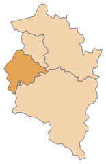
Feldkirch District
- district of Austria
Hiking in Feldkirch District
Feldkirch District, located in the western part of Austria, is known for its stunning landscapes, rich history, and diverse hiking trails. Nestled at the foot of the Alps and bordered by Switzerland and Liechtenstein, this area offers a wide range of hiking opportunities suitable for different skill levels....
- Country:
- Capital: Feldkirch
- Licence Plate Code: FK
- Coordinates: 47° 16' 44" N, 9° 39' 50" E
- GPS tracks (wikiloc): [Link]
- AboveSeaLevel: 450 м m
- Area: 278.26 sq km
- Population: 104048
- Web site: [Link]

Bregenz District
- district in Austria
Hiking in Bregenz District
Bregenz District, located in the western part of Austria in the state of Vorarlberg, offers a variety of stunning hiking opportunities, thanks to its diverse landscapes that include lakes, mountains, and picturesque villages. Here are some highlights and tips for hiking in this beautiful region:...
- Country:
- Capital: Bregenz
- Licence Plate Code: B
- Coordinates: 47° 24' 0" N, 10° 0' 0" E
- GPS tracks (wikiloc): [Link]
- AboveSeaLevel: 771 м m
- Area: 863.34 sq km
- Population: 131350
- Web site: [Link]