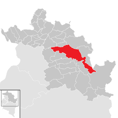
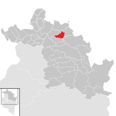
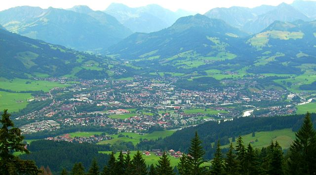
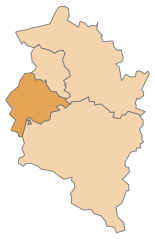
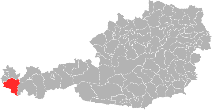
Bregenz District (Bezirk Bregenz)
- district in Austria
 Hiking in Bregenz District
Bregenz District, located in the western part of Austria in the state of Vorarlberg, offers a variety of stunning hiking opportunities, thanks to its diverse landscapes that include lakes, mountains, and picturesque villages. Here are some highlights and tips for hiking in this beautiful region:
Scenic Routes
-
Pfänder Mountain: The Pfänder is a local favorite and provides spectacular views of Lake Constance, the Alps, and the surrounding area. You can hike up the mountain or take a cable car to the summit, where there are various trails to explore.
-
Bregenzerwald: This area is famous for its lush valleys and rolling hills. Popular trails include the "Bregenzerwald cheese trail," which showcases local cheese production, and paths that lead to charming villages like Bezau and Schoppernau.
-
Rappenloch Gorge: Near Dornbirn, this dramatic gorge offers a unique hiking experience with fascinating rock formations, waterfalls, and wooden walkways that take you through the canyon.
-
Lake Constance Trails: The area surrounding Lake Constance has several hiking trails that allow you to enjoy the lakeside views, local flora, and fauna. The "Bodenseeradweg" is a popular cycling and walking route that follows the lake.
Difficulty Levels
Hiking trails in Bregenz District cater to all skill levels, from easy strolls suitable for families to challenging alpine routes intended for experienced hikers. Be sure to check the trail difficulty and prepare accordingly.
Best Time to Hike
The hiking season generally runs from late spring (May) to early autumn (October). Summer months are ideal for hiking, but it's also a good idea to check the weather, especially in the mountains, as conditions can change rapidly.
Essential Gear
- Footwear: Sturdy, comfortable hiking boots with good traction are essential.
- Clothing: Dress in layers, as temperatures can vary significantly. Waterproofs and sun protection are advisable.
- Navigation: A good map or GPS device can be helpful, especially on less marked trails.
Safety Tips
- Always inform someone about your hiking plans.
- Stay on marked trails and respect local wildlife.
- Carry enough water and snacks for your hike.
- Familiarize yourself with the terrain and potential hazards, especially if hiking in remote areas.
Local Highlights
After hiking, enjoy the local cuisine and culture. Bregenz is known for its vibrant art scene, including the famous Bregenz Festival, where operas are performed on a floating stage on Lake Constance.
Hiking in Bregenz District is a rewarding experience, combining outdoor adventure with breathtaking natural beauty and cultural exploration. Enjoy your time on the trails!
- Country:

- Capital: Bregenz
- Licence Plate Code: B
- Coordinates: 47° 24' 0" N, 10° 0' 0" E


- GPS tracks (wikiloc): [Link]
- AboveSeaLevel: 771 м m
- Area: 863.34 sq km
- Population: 131350
- Web site: http://www.vorarlberg.at/vorarlberg/bezirke/bezirkbregenz/uebersichtbezirkbregenz.htm
- Wikipedia en: wiki(en)
- Wikipedia: wiki(de)
- Wikidata storage: Wikidata: Q698621
- Wikipedia Commons Category: [Link]
- Wikipedia Commons Maps Category: [Link]
- Freebase ID: [/m/06tmvk]
- GeoNames ID: Alt: [2781502]
- VIAF ID: Alt: [133693790]
- GND ID: Alt: [4008101-1]
- archINFORM location ID: [14611]
- Library of Congress authority ID: Alt: [n80148144]
Includes regions:


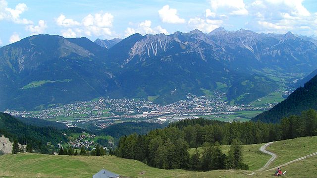
Bregenz
- capital of Vorarlberg, the westernmost federal state of Austria
Hiking in Bregenz
Bregenz, located on the shores of Lake Constance in Austria, is a stunning destination for hiking enthusiasts. The area is characterized by its diverse landscapes, including the scenic shores of the lake, the rolling hills, and the majestic Alps in the background. Here are some highlights of hiking in and around Bregenz:...
- Country:
- Postal Code: 6900
- Local Dialing Code: 05574
- Licence Plate Code: B
- Coordinates: 47° 30' 18" N, 9° 44' 57" E
- GPS tracks (wikiloc): [Link]
- AboveSeaLevel: 427 м m
- Area: 29.51 sq km
- Population: 28697
- Web site: [Link]

Egg
- municipality in Vorarlberg, Austria
Hiking in Egg
Egg, a charming village in the Bregenz Forest region of Austria, offers a variety of hiking opportunities for outdoor enthusiasts of all levels. Nestled in a picturesque landscape with lush greenery, rolling hills, and stunning mountain views, Egg is a perfect base for exploring the natural beauty of the area....
- Country:
- Postal Code: 6863
- Local Dialing Code: 05512
- Licence Plate Code: B
- Coordinates: 47° 25' 55" N, 9° 53' 44" E
- GPS tracks (wikiloc): [Link]
- AboveSeaLevel: 561 м m
- Area: 65.37 sq km
- Population: 3547
- Web site: [Link]
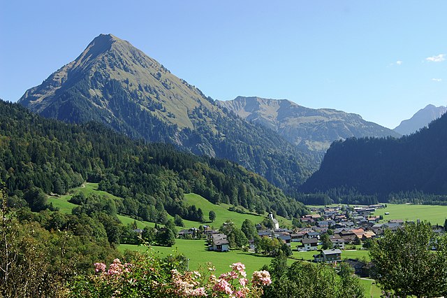

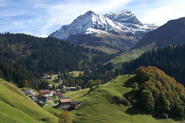
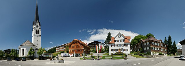
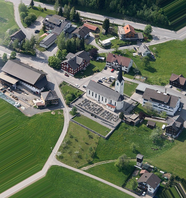
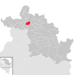
Schoppernau
- town in eastern Vorarlberg, Austria
Hiking in Schoppernau
Schoppernau is a picturesque village located in the Vorarlberg region of Austria, surrounded by the stunning landscapes of the Bregenzerwald mountains. It is a fantastic destination for hiking enthusiasts, offering a variety of trails suitable for different skill levels....
- Country:
- Postal Code: 6886
- Local Dialing Code: 05515
- Licence Plate Code: B
- Coordinates: 47° 18' 48" N, 10° 1' 3" E
- GPS tracks (wikiloc): [Link]
- AboveSeaLevel: 852 м m
- Area: 47.64 sq km
- Population: 950
- Web site: [Link]


Hörbranz
- municipality in Austria
Hiking in Hörbranz
Hörbranz is a charming village located in the Vorarlberg region of Austria, near Lake Constance. It offers a variety of hiking opportunities for outdoor enthusiasts, with beautiful landscapes and views of the surrounding mountains and the lake. Here are some highlights about hiking in Hörbranz:...
- Country:
- Postal Code: 6912
- Local Dialing Code: 05573
- Licence Plate Code: B
- Coordinates: 47° 33' 19" N, 9° 45' 10" E
- GPS tracks (wikiloc): [Link]
- AboveSeaLevel: 426 м m
- Area: 8.73 sq km
- Population: 6346
- Web site: [Link]
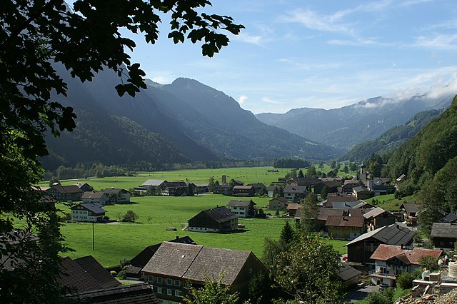

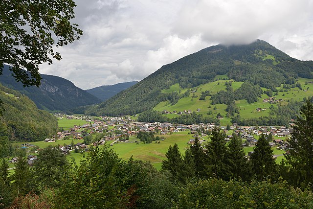
Schnepfau
- municipality in the district of Bregenz, Vorarlberg, Austria
Hiking in Schnepfau
Schnepfau, a picturesque village located in the Bregenzerwald region of Austria, offers a variety of hiking opportunities for both novice and experienced hikers. Here's what you can expect when hiking in the area:...
- Country:
- Postal Code: 6882
- Local Dialing Code: 05518
- Licence Plate Code: B
- Coordinates: 47° 21' 7" N, 9° 56' 44" E
- GPS tracks (wikiloc): [Link]
- AboveSeaLevel: 734 м m
- Area: 16.53 sq km
- Population: 449
- Web site: [Link]

Bizau
- municipality in Vorarlberg, Austria
Hiking in Bizau
Bizau is a charming village located in the Bregenzerwald region of Austria, surrounded by stunning alpine scenery, making it a fantastic destination for hiking enthusiasts. The area offers a variety of hiking trails, catering to different skill levels, from gentle walks to more challenging mountain hikes....
- Country:
- Postal Code: 6874
- Local Dialing Code: 05514
- Licence Plate Code: B
- Coordinates: 47° 22' 8" N, 9° 55' 24" E
- GPS tracks (wikiloc): [Link]
- AboveSeaLevel: 681 м m
- Area: 21.08 sq km
- Population: 1107
- Web site: [Link]


Andelsbuch
- municipality in Austria
Hiking in Andelsbuch
Andelsbuch is a picturesque village located in the Bregenzerwald region of western Austria, surrounded by stunning alpine scenery, making it an excellent destination for hiking enthusiasts. This area features a mix of gentle hills, rugged mountains, and lush forests, offering a variety of hiking trails suitable for all skill levels....
- Country:
- Postal Code: 6866
- Local Dialing Code: 05512
- Licence Plate Code: B
- Coordinates: 47° 24' 48" N, 9° 53' 46" E
- GPS tracks (wikiloc): [Link]
- AboveSeaLevel: 613 м m
- Area: 19.56 sq km
- Population: 2565
- Web site: [Link]


Eichenberg
- municipality in Austria
Hiking in Eichenberg
Eichenberg, located in Austria’s Vorarlberg region, offers beautiful hiking opportunities, especially due to its scenic landscapes and proximity to the Bodensee (Lake Constance). The area is characterized by a range of trails suitable for various skill levels, making it a great destination for both beginner and experienced hikers. Here are some highlights and tips for hiking in the Eichenberg area:...
- Country:
- Postal Code: 6911
- Local Dialing Code: 05574
- Licence Plate Code: B
- Coordinates: 47° 32' 10" N, 9° 46' 47" E
- GPS tracks (wikiloc): [Link]
- AboveSeaLevel: 793 м m
- Area: 11.59 sq km
- Population: 427
- Web site: [Link]


Riefensberg
- municipality in Austria
Hiking in Riefensberg
Riefensberg is a charming village located in the Vorarlberg region of Austria, nestled in the foothills of the Alps. It offers a variety of hiking opportunities, showcasing beautiful landscapes, lush green meadows, and panoramic views of the surrounding mountains. Here are some key highlights for hiking in Riefensberg:...
- Country:
- Postal Code: 6943
- Local Dialing Code: 05513
- Licence Plate Code: B
- Coordinates: 47° 30' 17" N, 9° 57' 50" E
- GPS tracks (wikiloc): [Link]
- AboveSeaLevel: 781 м m
- Area: 14.85 sq km
- Population: 1086
- Web site: [Link]

Schröcken
- town located in the district of Bregenz, Vorarlberg, Austria
Hiking in Schröcken
Schröcken is a charming village located in the Bregenzerwald region of Austria, and it is a fantastic destination for hiking enthusiasts. Nestled within the scenic Alps, Schröcken offers a variety of trails that cater to all skill levels, from beginners to experienced hikers....
- Country:
- Postal Code: 6888
- Local Dialing Code: 05519
- Licence Plate Code: B
- Coordinates: 47° 15' 0" N, 10° 5' 0" E
- GPS tracks (wikiloc): [Link]
- AboveSeaLevel: 1269 м m
- Area: 23.43 sq km
- Population: 224
- Web site: [Link]


Sulzberg
- municipality in Austria
Hiking in Sulzberg
Sulzberg, located in the picturesque Bregenz Forest region of Austria, offers a variety of hiking opportunities that cater to all levels of experience. The stunning landscapes encompass lush forests, rolling hills, and panoramic views of the surrounding mountains, making it a fantastic destination for nature lovers and outdoor enthusiasts....
- Country:
- Postal Code: 6934
- Local Dialing Code: 05516
- Licence Plate Code: B
- Coordinates: 47° 31' 14" N, 9° 54' 44" E
- GPS tracks (wikiloc): [Link]
- AboveSeaLevel: 1013 м m
- Area: 23.06 sq km
- Population: 1818
- Web site: [Link]


Alberschwende
- municipality in Austria
Hiking in Alberschwende
Alberschwende is a picturesque village located in the Vorarlberg region of Austria, known for its beautiful landscapes and outdoor activities, particularly hiking. The area offers a variety of hiking trails that cater to different skill levels, from beginners to experienced hikers....
- Country:
- Postal Code: 6861
- Local Dialing Code: 05579
- Licence Plate Code: B
- Coordinates: 47° 27' 2" N, 9° 49' 53" E
- GPS tracks (wikiloc): [Link]
- AboveSeaLevel: 721 м m
- Area: 21.15 sq km
- Population: 3247
- Web site: [Link]


Lochau
- municipality in Austria
Hiking in Lochau
Lochau, located on the shores of Lake Constance in Austria, is a beautiful area known for its stunning landscapes, waterfalls, and numerous hiking trails. Here are some highlights and tips for hiking in and around Lochau:...
- Country:
- Postal Code: 6911
- Local Dialing Code: 05574
- Licence Plate Code: B
- Coordinates: 47° 31' 48" N, 9° 45' 6" E
- GPS tracks (wikiloc): [Link]
- AboveSeaLevel: 416 м m
- Area: 10.27 sq km
- Population: 5747
- Web site: [Link]

Bezau
- municipality in Austria
Hiking in Bezau
Bezau, located in the beautiful Bregenz Forest in Austria, is a fantastic destination for hiking enthusiasts. The town is surrounded by stunning mountain scenery, lush greenery, and an extensive network of well-marked hiking trails suitable for all levels, from beginners to experienced hikers....
- Country:
- Postal Code: 6870
- Local Dialing Code: 05514
- Licence Plate Code: B
- Coordinates: 47° 23' 6" N, 9° 54' 6" E
- GPS tracks (wikiloc): [Link]
- AboveSeaLevel: 650 м m
- Area: 34.42 sq km
- Population: 2003
- Web site: [Link]


Mittelberg
- municipality in Austria
Hiking in Mittelberg
Mittelberg, situated in the Kleinwalsertal region of Austria, offers a variety of hiking opportunities set against stunning alpine scenery. Known for its picturesque landscapes and diverse terrain, Mittelberg is a fantastic destination for both beginners and experienced hikers....
- Country:
- Local Dialing Code: 05517
- Licence Plate Code: B
- Coordinates: 47° 19' 22" N, 10° 9' 20" E
- GPS tracks (wikiloc): [Link]
- AboveSeaLevel: 1200 м m
- Area: 96.82 sq km
- Population: 4962
- Web site: [Link]

Bildstein
- municipality in Austria
Hiking in Bildstein
Bildstein, located in Austria, is a beautiful area known for its serene landscapes and stunning hiking trails. The region offers a variety of trails suitable for different skill levels, from leisurely walks to more challenging hikes....
- Country:
- Postal Code: 6858
- Local Dialing Code: 05572
- Licence Plate Code: B
- Coordinates: 47° 27' 29" N, 9° 46' 20" E
- GPS tracks (wikiloc): [Link]
- AboveSeaLevel: 659 м m
- Area: 9.14 sq km
- Population: 766
- Web site: [Link]

Mellau
- town in Vorarlberg, Austria
Hiking in Mellau
Mellau is a beautiful village located in the Bregenzerwald region of Austria, surrounded by stunning mountain scenery that offers a variety of hiking opportunities. Here are some details about hiking in Mellau:...
- Country:
- Postal Code: 6881
- Local Dialing Code: 05518
- Licence Plate Code: B
- Coordinates: 47° 21' 4" N, 9° 52' 55" E
- GPS tracks (wikiloc): [Link]
- AboveSeaLevel: 688 м m
- Area: 40.55 sq km
- Population: 1301
- Web site: [Link]


Schwarzenberg
- municipality in Vorarlberg, Austria
Hiking in Schwarzenberg
Schwarzenberg, located in the Austrian state of Vorarlberg, is a picturesque town nestled in the Bregenz Forest region, known for its stunning landscapes and excellent hiking opportunities. Here are some highlights and tips for hiking in Schwarzenberg:...
- Country:
- Postal Code: 6867
- Local Dialing Code: 05512
- Licence Plate Code: B
- Coordinates: 47° 24' 48" N, 9° 51' 11" E
- GPS tracks (wikiloc): [Link]
- AboveSeaLevel: 696 м m
- Area: 25.76 sq km
- Population: 1850
- Web site: [Link]


Warth
- municipality in the district of Bregenz in Vorarlberg in Austria
Hiking in Warth
Warth, a charming village located in the Bregenzerwald region of Vorarlberg, Austria, is an excellent destination for hiking enthusiasts. Nestled within the stunning backdrop of the Alps, it offers a range of trails that cater to different skill levels and preferences....
- Country:
- Postal Code: 6767
- Local Dialing Code: 05583
- Licence Plate Code: B
- Coordinates: 47° 15' 32" N, 10° 10' 55" E
- GPS tracks (wikiloc): [Link]
- AboveSeaLevel: 1495 м m
- Area: 19.34 sq km
- Population: 170
- Web site: [Link]


Wolfurt
- municipality in Austria
Hiking in Wolfurt
Wolfurt, located in the Vorarlberg region of Austria, offers some lovely hiking opportunities, particularly due to its proximity to beautiful landscapes and the foothills of the Alps. Here are some highlights for hiking in and around Wolfurt:...
- Country:
- Local Dialing Code: 05574
- Licence Plate Code: B
- Coordinates: 47° 28' 23" N, 9° 45' 14" E
- GPS tracks (wikiloc): [Link]
- AboveSeaLevel: 434 м m
- Area: 10 sq km
- Population: 8429
- Web site: [Link]


Hard
- municipality in Austria
Hiking in Hard
Hiking in Hard, Austria, can be a delightful experience, as it's situated near the shores of Lake Constance and at the foot of the Bregenz Forest. This picturesque region offers a variety of trails and beautiful landscapes....
- Country:
- Postal Code: 6971
- Local Dialing Code: 05574
- Licence Plate Code: B
- Coordinates: 47° 29' 21" N, 9° 41' 24" E
- GPS tracks (wikiloc): [Link]
- AboveSeaLevel: 398 м m
- Area: 17.46 sq km
- Population: 13495
- Web site: [Link]


Sibratsgfäll
- municipality in the district of Bregenz, Vorarlberg, Austria
Hiking in Sibratsgfäll
Sibratsgfäll, located in Austria's Vorarlberg region, is a picturesque village that offers a wealth of hiking opportunities amidst stunning alpine scenery. The area is characterized by its lush forests, rolling hills, and beautiful mountain vistas, making it an ideal destination for both casual hikers and more experienced trekkers....
- Country:
- Postal Code: 6952
- Local Dialing Code: 05513
- Licence Plate Code: B
- Coordinates: 47° 25' 36" N, 10° 2' 17" E
- GPS tracks (wikiloc): [Link]
- AboveSeaLevel: 929 м m
- Area: 29.25 sq km
- Population: 401
- Web site: [Link]


Lauterach
- municipality in Vorarlberg, Austria
Hiking in Lauterach
Lauterach is a charming village located in the Vorarlberg region of Austria, close to the town of Bregenz and the shores of Lake Constance. While it's relatively small, it serves as a great base for exploring the surrounding landscape, which offers numerous hiking opportunities....
- Country:
- Postal Code: 6923
- Local Dialing Code: 05574
- Licence Plate Code: B
- Coordinates: 47° 28' 38" N, 9° 43' 53" E
- GPS tracks (wikiloc): [Link]
- AboveSeaLevel: 412 м m
- Area: 11.92 sq km
- Population: 10028
- Web site: [Link]


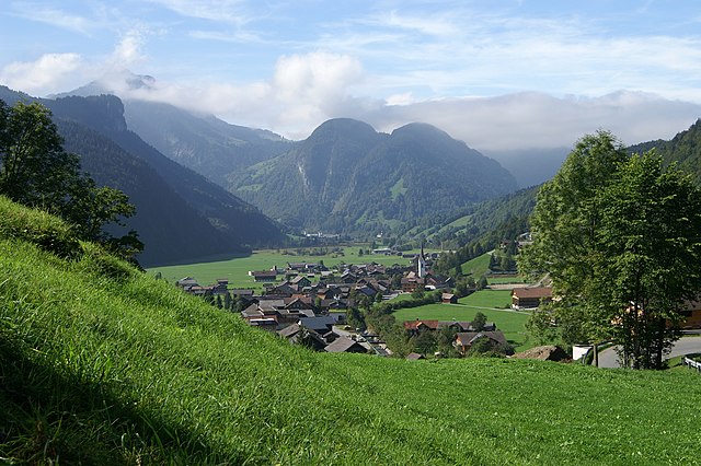
Reuthe
- municipality in Austria
Hiking in Reuthe
Reuthe is a charming village located in the Bregenz Forest region of Austria, known for its beautiful landscapes and outdoor activities, particularly hiking. The surroundings offer a diverse range of trails suitable for all levels, from easy walks to more challenging hikes....
- Country:
- Postal Code: 6870
- Local Dialing Code: 05514
- Licence Plate Code: B
- Coordinates: 47° 22' 12" N, 9° 53' 36" E
- GPS tracks (wikiloc): [Link]
- AboveSeaLevel: 650 м m
- Area: 10.24 sq km
- Population: 658
- Web site: [Link]


Höchst
- municipality in the district of Bregenz, Vorarlberg, Austria
Hiking in Höchst
Höchst, located in the Vorarlberg region of Austria near the borders of Switzerland and Germany, is a beautiful area for hiking enthusiasts. Here are some highlights and tips for hiking in Höchst:...
- Country:
- Postal Code: 6973
- Local Dialing Code: 05578
- Licence Plate Code: B
- Coordinates: 47° 27' 33" N, 9° 38' 24" E
- GPS tracks (wikiloc): [Link]
- AboveSeaLevel: 403 м m
- Area: 20.15 sq km
- Population: 7995
- Web site: [Link]

Kennelbach
- municipality in Austria
Hiking in Kennelbach
Kennelbach is a charming village located in the Vorarlberg region of Austria, close to the shores of Lake Constance and surrounded by the beautiful landscapes of the Alps. Hiking in Kennelbach and its surrounding areas can be quite rewarding, offering a mix of scenic views, lush forests, and varying terrain suitable for different skill levels....
- Country:
- Postal Code: 6921
- Local Dialing Code: 05574
- Licence Plate Code: B
- Coordinates: 47° 28' 59" N, 9° 46' 0" E
- GPS tracks (wikiloc): [Link]
- AboveSeaLevel: 430 м m
- Area: 3.22 sq km
- Population: 1944
- Web site: [Link]

Damüls
- municipality in Austria
Hiking in Damüls
Damüls, located in the Vorarlberg region of Austria, is a stunning destination for hiking enthusiasts. Nestled in the Bregenz Forest, it offers a wide variety of trails that accommodate different skill levels, from easy walks suitable for families to challenging hikes for experienced trekkers....
- Country:
- Postal Code: 6884
- Local Dialing Code: 05510
- Licence Plate Code: B
- Coordinates: 47° 16' 59" N, 9° 52' 59" E
- GPS tracks (wikiloc): [Link]
- AboveSeaLevel: 1432 м m
- Area: 20.92 sq km
- Population: 313
- Web site: [Link]


Möggers
- municipality in Austria
Hiking in Möggers
Möggers, a charming village located in the foothills of the Bregenz Forest in Austria, offers a delightful experience for hikers of all levels. The region is known for its stunning natural landscapes, panoramic views, and diverse trails....
- Country:
- Postal Code: 6900
- Local Dialing Code: 05573
- Licence Plate Code: B
- Coordinates: 47° 34' 0" N, 9° 49' 0" E
- GPS tracks (wikiloc): [Link]
- AboveSeaLevel: 948 м m
- Area: 11.44 sq km
- Population: 534
- Web site: [Link]


Gaißau
- municipality in Austria
Hiking in Gaißau
Gaißau, located in the Salzburg region of Austria, is a beautiful spot for hiking enthusiasts. Nestled at the foot of the Grass Mountain, it offers a variety of trails suitable for all skill levels, from leisurely walks to more challenging hikes. The scenic landscape features lush forests, alpine meadows, and stunning views of the surrounding mountains, making it a great destination for outdoor activities....
- Country:
- Postal Code: 6974
- Local Dialing Code: 05578
- Licence Plate Code: B
- Coordinates: 47° 27' 58" N, 9° 35' 51" E
- GPS tracks (wikiloc): [Link]
- AboveSeaLevel: 400 м m
- Area: 5.32 sq km
- Population: 1827
- Web site: [Link]

Krumbach
- municipality in Vorarlberg, Austria
Hiking in Krumbach
Krumbach, located in Vorarlberg, Austria, offers a beautiful setting for hiking enthusiasts. Nestled in the Alps, this quaint village is surrounded by stunning mountains, lush forests, and picturesque landscapes, making it an excellent base for outdoor activities....
- Country:
- Postal Code: 6942
- Local Dialing Code: 05513
- Licence Plate Code: B
- Coordinates: 47° 28' 59" N, 9° 56' 9" E
- GPS tracks (wikiloc): [Link]
- AboveSeaLevel: 732 м m
- Area: 8.71 sq km
- Population: 1001
- Web site: [Link]


Doren
- municipality in Austria
Hiking in Doren
Doren is a beautiful area for hiking, nestled in the Vorarlberg region of Austria. Although it may not be as widely known as some other hiking destinations, it offers a variety of trails that cater to different skill levels and preferences....
- Country:
- Postal Code: 6933
- Local Dialing Code: 05516
- Licence Plate Code: B
- Coordinates: 47° 29' 34" N, 9° 52' 46" E
- GPS tracks (wikiloc): [Link]
- AboveSeaLevel: 711 м m
- Area: 14.17 sq km
- Population: 1029
- Web site: [Link]

Lingenau
- municipality in Austria
Hiking in Lingenau
Lingenau, located in the picturesque Bregenzerwald region of Austria, offers fantastic opportunities for hiking enthusiasts of all levels. The area is known for its stunning alpine scenery, lush forests, and charming villages, making it a great destination for both day hikes and longer trekking adventures....
- Country:
- Postal Code: 6951
- Local Dialing Code: 05513
- Licence Plate Code: B
- Coordinates: 47° 27' 0" N, 9° 55' 12" E
- GPS tracks (wikiloc): [Link]
- AboveSeaLevel: 685 м m
- Area: 6.89 sq km
- Population: 1466
- Web site: [Link]

Langenegg
- municipality in Austria
Hiking in Langenegg
Langenegg, located in the picturesque Vorarlberg region of Austria, offers beautiful hiking opportunities that cater to various skill levels. It’s surrounded by stunning landscapes, including rolling hills, lush forests, and panoramic mountain views, making it an excellent destination for outdoor enthusiasts....
- Country:
- Postal Code: 6941
- Local Dialing Code: 05513
- Licence Plate Code: B
- Coordinates: 47° 28' 5" N, 9° 53' 49" E
- GPS tracks (wikiloc): [Link]
- AboveSeaLevel: 700 м m
- Area: 10.46 sq km
- Population: 1133
- Web site: [Link]


Hohenweiler
- municipality in Austria
Hiking in Hohenweiler
Hohenweiler is a charming village located in the Bregenz district of Austria, near the borders of Germany and Switzerland. It's a lovely area for hiking enthusiasts, offering beautiful landscapes and scenic trails. Here’s some information you might find helpful for hiking in Hohenweiler:...
- Country:
- Postal Code: 6914
- Local Dialing Code: 05573
- Licence Plate Code: B
- Coordinates: 47° 35' 18" N, 9° 46' 53" E
- GPS tracks (wikiloc): [Link]
- AboveSeaLevel: 503 м m
- Area: 8.43 sq km
- Population: 1271
- Web site: [Link]

Langen bei Bregenz
- municipality in Austria
Hiking in Langen bei Bregenz
Langen bei Bregenz is a charming municipality located in the Vorarlberg region of Austria, close to Lake Constance and the borders of Switzerland and Germany. The area is surrounded by beautiful landscapes, making it an excellent destination for hiking enthusiasts....
- Country:
- Postal Code: 6932
- Local Dialing Code: 05575
- Licence Plate Code: B
- Coordinates: 47° 30' 28" N, 9° 49' 37" E
- GPS tracks (wikiloc): [Link]
- AboveSeaLevel: 658 м m
- Area: 21.88 sq km
- Population: 1405
- Web site: [Link]

Hittisau
- municipality in Austria
Hiking in Hittisau
Hittisau, located in the Bregenz Forest region of Austria, is a picturesque village that offers fantastic opportunities for hiking enthusiasts. The area is known for its stunning natural beauty, charming alpine landscapes, and well-marked hiking trails suitable for various skill levels. Here are some key points to consider when hiking in Hittisau:...
- Country:
- Postal Code: 6952
- Local Dialing Code: 05513
- Licence Plate Code: B
- Coordinates: 47° 27' 37" N, 9° 57' 24" E
- GPS tracks (wikiloc): [Link]
- AboveSeaLevel: 798 м m
- Area: 46.65 sq km
- Population: 2032
- Web site: [Link]


Fußach
- municipality in Austria
Hiking in Fußach
Fußach is a small village located on the shores of Lake Constance (Bodensee) in Austria, near the borders of Switzerland and Germany. It is an excellent starting point for hiking enthusiasts, offering various trails with stunning views of the lake and the surrounding Alps....
- Country:
- Postal Code: 6972
- Local Dialing Code: 05578
- Licence Plate Code: B
- Coordinates: 47° 28' 42" N, 9° 39' 50" E
- GPS tracks (wikiloc): [Link]
- AboveSeaLevel: 398 м m
- Area: 11.5 sq km
- Population: 3871
- Web site: [Link]


Schwarzach
- municipality in Austria
Hiking in Schwarzach
Schwarzach in Vorarlberg, Austria, is a beautiful region that offers various hiking opportunities suitable for different skill levels. Nestled in the picturesque Bregenz Forest, this area provides breathtaking alpine landscapes, lush forests, and scenic views of the surrounding mountains....
- Country:
- Postal Code: 6858
- Local Dialing Code: 05572
- Licence Plate Code: B
- Coordinates: 47° 26' 41" N, 9° 45' 47" E
- GPS tracks (wikiloc): [Link]
- AboveSeaLevel: 433 м m
- Area: 4.91 sq km
- Population: 3949
- Web site: [Link]

Buch
- municipality in Austria
Hiking in Buch
Buch, located in Austria, is known for its scenic landscapes and numerous hiking opportunities. It is situated in the vicinity of the Styrian region, which offers a mix of moderate to challenging trails that cater to various skill levels. Here are some key points about hiking in and around Buch, Austria:...
- Country:
- Postal Code: 6960
- Local Dialing Code: 05579
- Licence Plate Code: B
- Coordinates: 47° 28' 55" N, 9° 49' 6" E
- GPS tracks (wikiloc): [Link]
- AboveSeaLevel: 725 м m
- Area: 6.15 sq km
- Population: 596
- Web site: [Link]


Au
- municipality in Austria
Hiking in Au
Vorarlberg, located in western Austria, is a stunning region known for its beautiful landscapes, including the Alps, lush valleys, and picturesque villages. Hiking in Vorarlberg offers a wide variety of trails that cater to different skill levels, making it a fantastic destination for both novice and experienced hikers. Here are some key highlights about hiking in this area:...
- Country:
- Postal Code: 6883
- Local Dialing Code: 05515
- Licence Plate Code: B
- Coordinates: 47° 19' 19" N, 9° 58' 34" E
- GPS tracks (wikiloc): [Link]
- AboveSeaLevel: 800 м m
- Area: 44.91 sq km
- Population: 1736
- Web site: [Link]
Shares border with regions:
Lindau
- rural district in Bavaria, Germany
Hiking in Lindau
Lindau, located in southern Germany on the shores of Lake Constance (Bodensee), offers a beautiful setting for hiking enthusiasts. The district encompasses a variety of natural landscapes, including picturesque lake views, rolling hills, lush forests, and charming villages. Here are some highlights for hiking in Lindau:...
- Country:

- Capital: Lindau
- Licence Plate Code: LI
- Coordinates: 47° 36' 0" N, 9° 51' 36" E
- GPS tracks (wikiloc): [Link]
- AboveSeaLevel: 496 м m
- Area: 323.00 sq km
- Population: 69522
- Web site: [Link]
Oberallgäu
- district in Bavaria, Germany
Hiking in Oberallgäu
Oberallgäu, located in Bavaria, Germany, is a stunning region known for its breathtaking landscapes, rolling hills, and majestic Alps. It offers a wide range of hiking opportunities suitable for all levels of experience, from leisurely walks to challenging mountain ascents. Here are some highlights and tips for hiking in Oberallgäu:...
- Country:
- Capital: Sonthofen
- Licence Plate Code: OA
- Coordinates: 47° 34' 48" N, 10° 15' 0" E
- GPS tracks (wikiloc): [Link]
- AboveSeaLevel: 711 м m
- Area: 1528.00 sq km
- Population: 128665
- Web site: [Link]

Feldkirch District
- district of Austria
Hiking in Feldkirch District
Feldkirch District, located in the western part of Austria, is known for its stunning landscapes, rich history, and diverse hiking trails. Nestled at the foot of the Alps and bordered by Switzerland and Liechtenstein, this area offers a wide range of hiking opportunities suitable for different skill levels....
- Country:
- Capital: Feldkirch
- Licence Plate Code: FK
- Coordinates: 47° 16' 44" N, 9° 39' 50" E
- GPS tracks (wikiloc): [Link]
- AboveSeaLevel: 450 м m
- Area: 278.26 sq km
- Population: 104048
- Web site: [Link]

Dornbirn District
- district of Austria
Hiking in Dornbirn District
Dornbirn District, located in the western part of Austria, is a beautiful region known for its stunning landscapes, diverse hiking trails, and outdoor activities. Situated at the northern edge of the Alps, it offers a mix of mountainous terrain, lush valleys, and scenic views of the Rhine Valley and Lake Constance....
- Country:
- Capital: Dornbirn
- Licence Plate Code: DO
- Coordinates: 47° 25' 0" N, 9° 45' 0" E
- GPS tracks (wikiloc): [Link]
- AboveSeaLevel: 956 м m
- Area: 172.37 sq km
- Population: 86272
- Web site: [Link]
Bludenz District
- district (Bezirk) Bludenz, Vorarlberg, Austria
Hiking in Bludenz District
Bludenz District, located in the western part of Austria, is a fantastic destination for hiking enthusiasts. Nestled in the scenic Vorarlberg region, it offers a diverse landscape that includes lush valleys, towering mountains, and picturesque villages. Here are some highlights and recommendations for hiking in this area:...
- Country:
- Capital: Bludenz
- Licence Plate Code: BZ
- Coordinates: 47° 6' 0" N, 9° 54' 0" E
- GPS tracks (wikiloc): [Link]
- AboveSeaLevel: 566 м m
- Area: 1287.52 sq km
- Web site: [Link]