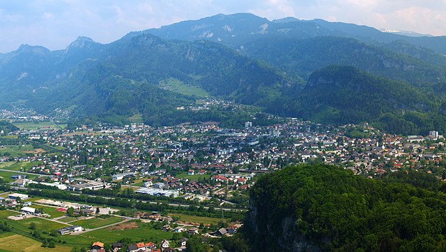
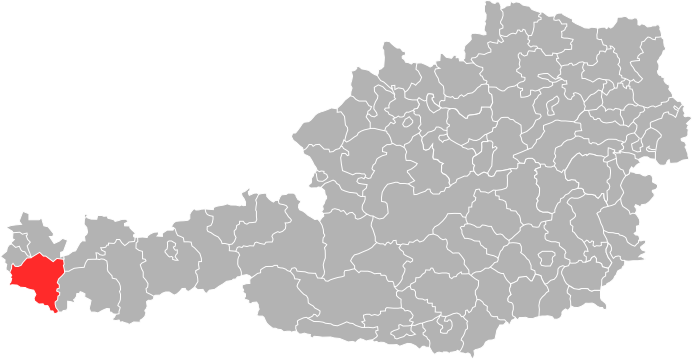
Feldkirch District (Bezirk Feldkirch)

- district of Austria
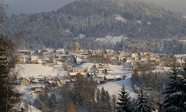
 Hiking in Feldkirch District
Feldkirch District, located in the western part of Austria, is known for its stunning landscapes, rich history, and diverse hiking trails. Nestled at the foot of the Alps and bordered by Switzerland and Liechtenstein, this area offers a wide range of hiking opportunities suitable for different skill levels.
Hiking Trails
-
Schwarzrunde Trail: This popular loop offers a moderate hike with breathtaking views of the surrounding landscapes. The trail features a mix of forest paths, meadows, and rocky terrain, leading you to scenic overlooks.
-
Küpfstein Trail: A gem for those seeking a more challenging hike, this trail takes you up to the Küpfstein peak, rewarding you with panoramic views of the Rhine valley and the surrounding mountains.
-
Walgau Valley Trails: The Walgau area offers various trails that vary in difficulty. You can enjoy both nature and cultural experiences as you hike past traditional alpine farms and small villages.
-
Liechtenstein Trail: This trail runs along the border between Austria and Liechtenstein and showcases the beautiful natural scenery of both countries. It can be a fantastic way to experience the cultural and natural heritage of the region.
Scenic Highlights
- Views of the Alps: The district provides stunning vistas of the Austrian Alps, especially from higher elevation trails. Make sure to pack your camera!
- Rich Flora and Fauna: As you hike, you'll have the opportunity to see a variety of wildlife and plant species native to the region.
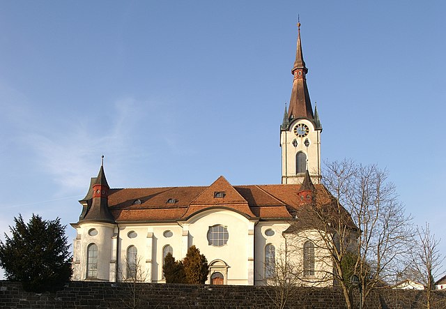
- Historical Landmarks: Along some trails, you might encounter historical sites and ruins, giving you insight into the area's rich history.
Best Times to Hike
- Summer (June to September): This is the most popular time for hiking, with warm weather and well-maintained trails. Be prepared for some snow at higher elevations even in summer.
- Autumn (October): The fall foliage makes hiking particularly beautiful, although the weather can be unpredictable. Trails may be less crowded.
- Winter (December to March): While many trails may be covered in snow, some lower elevation paths remain accessible for winter hiking or snowshoeing.
Safety Tips
- Stay Hydrated: Carry enough water, especially on longer hikes.
- Wear Proper Footwear: Good hiking boots are essential for navigating rocky and uneven terrain.
- Check Weather Conditions: Weather can change rapidly in the Alps, so be prepared for all conditions.
- Tell Someone Your Plans: Always inform someone about your hiking plans and expected return time.
Conclusion
Feldkirch District offers a remarkable hiking experience for outdoor enthusiasts. With its breathtaking scenery, varied trails, and the charm of the surrounding villages, hikers of all abilities can find something to enjoy. Whether you're looking for a leisurely stroll or a challenging trek, it's a place that'll inspire your love for nature!
- Country:

- Capital: Feldkirch
- Licence Plate Code: FK
- Coordinates: 47° 16' 44" N, 9° 39' 50" E


- GPS tracks (wikiloc): [Link]
- AboveSeaLevel: 450 м m
- Area: 278.26 sq km
- Population: 104048
- Web site: http://www.feldkirch.at
- Wikipedia en: wiki(en)
- Wikipedia: wiki(de)
- Wikidata storage: Wikidata: Q384914
- Wikipedia Commons Category: [Link]
- Wikipedia Commons Maps Category: [Link]
- Freebase ID: [/m/06tl4l]
- GeoNames ID: Alt: [2779673]
- VIAF ID: Alt: [132582987]
- GND ID: Alt: [4239425-9]
- archINFORM location ID: [14613]
Includes regions:


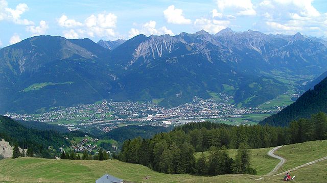
Feldkirch
- city in Vorarlberg, Austria
Hiking in Feldkirch
Feldkirch is a picturesque town in the Vorarlberg region of Austria, surrounded by the stunning beauty of the Alps. The area offers a variety of hiking opportunities that cater to different skill levels, making it an excellent destination for outdoor enthusiasts....
- Country:
- Postal Code: 6800
- Local Dialing Code: 05522
- Licence Plate Code: FK
- Coordinates: 47° 14' 17" N, 9° 35' 54" E
- GPS tracks (wikiloc): [Link]
- AboveSeaLevel: 458 м m
- Area: 34.35 sq km
- Population: 33420
- Web site: [Link]
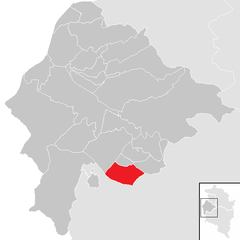
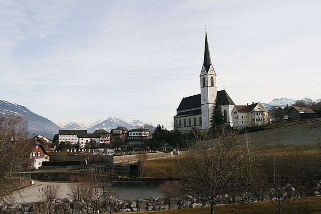
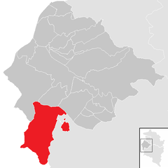
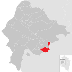
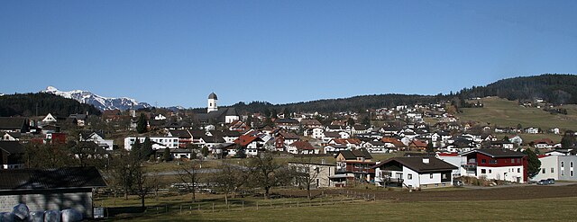
Zwischenwasser
- municipality in Austria
Hiking in Zwischenwasser
Zwischenwasser is a small municipality in Austria, located in the Vorarlberg region. The area is known for its picturesque landscapes, rolling hills, and proximity to the Alps, making it a great destination for hiking enthusiasts....
- Country:
- Postal Code: 6835
- Local Dialing Code: 05522
- Licence Plate Code: FK
- Coordinates: 47° 16' 45" N, 9° 39' 56" E
- GPS tracks (wikiloc): [Link]
- AboveSeaLevel: 525 м m
- Area: 22.63 sq km
- Population: 3203
- Web site: [Link]


Übersaxen
- municipality in Austria
Hiking in Übersaxen
Übersaxen is a quaint village located in the Montafon region of Austria, surrounded by stunning natural beauty, making it a wonderful destination for hiking enthusiasts. The area offers a variety of hiking trails that cater to all skill levels, from gentle walks to more challenging mountain hikes....
- Country:
- Postal Code: 6834
- Local Dialing Code: 05522
- Licence Plate Code: FK
- Coordinates: 47° 15' 12" N, 9° 40' 16" E
- GPS tracks (wikiloc): [Link]
- AboveSeaLevel: 899 м m
- Area: 5.76 sq km
- Population: 629
- Web site: [Link]

Schlins
- municipality in Austria
Hiking in Schlins
Schlins, a small community in the Vorarlberg region of Austria, is surrounded by beautiful landscapes, making it a great destination for hiking enthusiasts. Here’s an overview of what you can expect when hiking in the Schlins area:...
- Country:
- Postal Code: 6824
- Local Dialing Code: 05524
- Licence Plate Code: FK
- Coordinates: 47° 12' 22" N, 9° 41' 59" E
- GPS tracks (wikiloc): [Link]
- AboveSeaLevel: 502 м m
- Area: 6.05 sq km
- Population: 2404
- Web site: [Link]


Altach
- municipality in Austria
Hiking in Altach
Altach, located in the Vorarlberg region of Austria, is a quaint village that offers beautiful scenic views and various hiking opportunities in the surrounding areas. The region is characterized by its lush valleys, rolling hills, and proximity to the Alps, making it an excellent destination for both casual walkers and more serious hikers....
- Country:
- Postal Code: 6844
- Local Dialing Code: 05576
- Licence Plate Code: FK
- Coordinates: 47° 21' 0" N, 9° 39' 0" E
- GPS tracks (wikiloc): [Link]
- AboveSeaLevel: 412 м m
- Area: 5.36 sq km
- Population: 6624
- Web site: [Link]

Koblach
- municipality in Austria
Hiking in Koblach
Koblach is a charming municipality located in Austria, near the borders of Germany and Switzerland, which offers a variety of hiking opportunities in an idyllic setting. The region is characterized by its scenic landscapes, lush forests, and picturesque views of the surrounding mountains and valleys....
- Country:
- Postal Code: 6842
- Local Dialing Code: 05523
- Licence Plate Code: FK
- Coordinates: 47° 20' 0" N, 9° 36' 0" E
- GPS tracks (wikiloc): [Link]
- AboveSeaLevel: 456 м m
- Area: 10.24 sq km
- Population: 4577
- Web site: [Link]


Laterns
- municipality in Austria
Hiking in Laterns
Laterns is a beautiful area located in the Vorarlberg region of Austria, well-known for its stunning landscapes, lush greenery, and picturesque hiking trails. Here are some key points to consider if you're planning a hiking trip to Laterns:...
- Country:
- Postal Code: 6830
- Local Dialing Code: 05526
- Licence Plate Code: FK
- Coordinates: 47° 16' 0" N, 9° 42' 0" E
- GPS tracks (wikiloc): [Link]
- AboveSeaLevel: 921 м m
- Area: 43.79 sq km
- Population: 662
- Web site: [Link]

Viktorsberg
- municipality in Austria
Hiking in Viktorsberg
Viktorsberg is a beautiful village located in Austria, specifically in the Vorarlberg region, nestled in the foothills of the Alps. It's an excellent destination for hiking, offering a variety of trails that cater to different skill levels and preferences....
- Country:
- Postal Code: 6836
- Local Dialing Code: 05523
- Licence Plate Code: FK
- Coordinates: 47° 18' 7" N, 9° 40' 30" E
- GPS tracks (wikiloc): [Link]
- AboveSeaLevel: 879 м m
- Area: 12.51 sq km
- Population: 411
- Web site: [Link]

Düns
- municipality in Austria
Hiking in Düns
Düns is a small municipality located in the Vorarlberg region of Austria, and while it may not be as widely known as some larger hiking destinations, it offers access to beautiful mountain scenery and enjoyable trails. Here are some general tips and highlights for hiking in and around Düns:...
- Country:
- Postal Code: 6822
- Local Dialing Code: 05524
- Licence Plate Code: FK
- Coordinates: 47° 13' 20" N, 9° 43' 0" E
- GPS tracks (wikiloc): [Link]
- AboveSeaLevel: 753 м m
- Area: 3.47 sq km
- Population: 411
- Web site: [Link]


Röns
- municipality in Austria
Hiking in Röns
Röns is a picturesque village in the beautiful region of the Alps, often overlooked by tourists in favor of more popular destinations. When it comes to hiking, Röns and its surrounding areas offer stunning landscapes, diverse trails, and a variety of experiences suitable for different skill levels....
- Country:
- Postal Code: 6822
- Local Dialing Code: 05524
- Licence Plate Code: FK
- Coordinates: 47° 13' 0" N, 9° 42' 0" E
- GPS tracks (wikiloc): [Link]
- AboveSeaLevel: 610 м m
- Area: 1.44 sq km
- Population: 352
- Web site: [Link]


Fraxern
- municipality in Austria
Hiking in Fraxern
Fraxern is a small community located in Austria, known for its picturesque landscapes and outdoor activities, including hiking. The region offers a variety of trails suitable for all levels, from easy walks to more challenging hikes. Here are some key points about hiking in Fraxern:...
- Country:
- Postal Code: 6833
- Local Dialing Code: 05523
- Licence Plate Code: FK
- Coordinates: 47° 19' 0" N, 9° 40' 30" E
- GPS tracks (wikiloc): [Link]
- AboveSeaLevel: 817 м m
- Area: 8.87 sq km
- Population: 701
- Web site: [Link]


Mäder
- municipality in Austria
Hiking in Mäder
Mäder, located in the Vorarlberg region of Austria, is surrounded by beautiful landscapes and offers a range of hiking opportunities for all skill levels. Here are some key details about hiking in and around Mäder:...
- Country:
- Postal Code: 6841
- Local Dialing Code: 05523
- Licence Plate Code: FK
- Coordinates: 47° 21' 0" N, 9° 37' 0" E
- GPS tracks (wikiloc): [Link]
- AboveSeaLevel: 414 м m
- Area: 3.42 sq km
- Population: 4031
- Web site: [Link]

Götzis
- municipality in Austria
Hiking in Götzis
Götzis is a charming municipality located in the Vorarlberg region of Austria, near the border with Switzerland. The surrounding natural landscape offers a variety of hiking opportunities, making it a great destination for outdoor enthusiasts....
- Country:
- Postal Code: 6840
- Local Dialing Code: 05523
- Licence Plate Code: FK
- Coordinates: 47° 20' 3" N, 9° 38' 43" E
- GPS tracks (wikiloc): [Link]
- AboveSeaLevel: 448 м m
- Area: 14.64 sq km
- Population: 11473
- Web site: [Link]
Frastanz
- municipality in Austria
Hiking in Frastanz
Frastanz, located in the Vorarlberg region of Austria, offers excellent hiking opportunities with its picturesque landscapes and well-marked trails. Nestled at the foot of the impressive Alps, this area is perfect for both novice and experienced hikers. Here are some highlights and tips for hiking in Frastanz:...
- Country:
- Postal Code: 6820
- Local Dialing Code: 05522
- Licence Plate Code: FK
- Coordinates: 47° 13' 12" N, 9° 37' 12" E
- GPS tracks (wikiloc): [Link]
- AboveSeaLevel: 510 м m
- Area: 32.25 sq km
- Population: 6434
- Web site: [Link]

Klaus
- municipality in Austria
Hiking in Klaus
Klaus, a picturesque village in Vorarlberg, Austria, offers stunning hiking opportunities amidst the breathtaking landscapes of the Austrian Alps. Here are some details about hiking in this region:...
- Country:
- Postal Code: 6833
- Local Dialing Code: 05523
- Licence Plate Code: FK
- Coordinates: 47° 18' 31" N, 9° 38' 48" E
- GPS tracks (wikiloc): [Link]
- AboveSeaLevel: 507 м m
- Area: 5.24 sq km
- Population: 3118
- Web site: [Link]


Weiler
- municipality in Austria
Hiking in Weiler
Weiler, located in the picturesque region of Vorarlberg in Austria, is surrounded by beautiful alpine landscapes, making it a fantastic destination for hiking enthusiasts. Here are some key points about hiking in Weiler and the surrounding area:...
- Country:
- Postal Code: 6837
- Local Dialing Code: 05523
- Licence Plate Code: FK
- Coordinates: 47° 17' 59" N, 9° 39' 0" E
- GPS tracks (wikiloc): [Link]
- AboveSeaLevel: 486 м m
- Area: 3.09 sq km
- Population: 2075
- Web site: [Link]


Meiningen
- municipality in Austria
Hiking in Meiningen
Meiningen, located in the beautiful region of Austria, offers a variety of hiking opportunities for outdoor enthusiasts. Nestled in the foothills of the Alps, this area boasts stunning landscapes, lush forests, and picturesque trails suitable for all levels of hikers....
- Country:
- Postal Code: 6812
- Local Dialing Code: 05522
- Licence Plate Code: FK
- Coordinates: 47° 18' 0" N, 9° 35' 0" E
- GPS tracks (wikiloc): [Link]
- AboveSeaLevel: 425 м m
- Area: 5.37 sq km
- Population: 2245
- Web site: [Link]


Dünserberg
- municipality in Austria
Hiking in Dünserberg
Dünserberg is a beautiful mountain located in the Vorarlberg region of Austria, known for its stunning landscapes and excellent hiking opportunities. The area is characterized by picturesque alpine scenery, diverse flora and fauna, and well-marked hiking trails that cater to various skill levels, making it a fantastic destination for both novice and experienced hikers....
- Country:
- Postal Code: 6822
- Local Dialing Code: 05524
- Licence Plate Code: FK
- Coordinates: 47° 14' 8" N, 9° 42' 36" E
- GPS tracks (wikiloc): [Link]
- AboveSeaLevel: 1270 м m
- Area: 5.55 sq km
- Population: 147
- Web site: [Link]

Schnifis
- municipality in Austria
Hiking in Schnifis
Schnifis is a beautiful area located in Vorarlberg, Austria, known for its stunning natural landscapes and excellent hiking opportunities. The region is surrounded by the picturesque mountains of the Alps, which provide a variety of trails suitable for hikers of all skill levels....
- Country:
- Postal Code: 6822
- Local Dialing Code: 05524
- Licence Plate Code: FK
- Coordinates: 47° 12' 51" N, 9° 43' 36" E
- GPS tracks (wikiloc): [Link]
- AboveSeaLevel: 657 м m
- Area: 4.87 sq km
- Population: 798
- Web site: [Link]


Röthis
- municipality in Austria
Hiking in Röthis
Röthis is a charming village located in the Vorarlberg region of Austria, near the borders of Switzerland and Liechtenstein. The surrounding area offers a variety of hiking opportunities suitable for different skill levels, making it an excellent destination for outdoor enthusiasts....
- Country:
- Postal Code: 6832
- Local Dialing Code: 05522
- Licence Plate Code: FK
- Coordinates: 47° 17' 30" N, 9° 39' 50" E
- GPS tracks (wikiloc): [Link]
- AboveSeaLevel: 508 м m
- Area: 2.72 sq km
- Population: 1942
- Web site: [Link]


Sulz
- municipality in Austria
Hiking in Sulz
Sulz, located in the Vorarlberg region of Austria, offers a variety of hiking opportunities that cater to different skill levels, from casual walkers to experienced trekkers. The striking landscapes of Vorarlberg, characterized by rolling hills, mountains, and lush greenery, provide a beautiful backdrop for your hiking adventures....
- Country:
- Postal Code: 6832
- Local Dialing Code: 05522
- Licence Plate Code: FK
- Coordinates: 47° 17' 18" N, 9° 39' 12" E
- GPS tracks (wikiloc): [Link]
- AboveSeaLevel: 495 м m
- Area: 3.01 sq km
- Population: 2527
- Web site: [Link]

Göfis
- municipality in Austria
Hiking in Göfis
Göfis is a small village located in the Vorarlberg region of Austria, nestled in the beautiful landscape of the Alps. Although it may not be as widely known as some other hiking destinations in Austria, it offers lovely opportunities for outdoor enthusiasts looking to explore nature....
- Country:
- Postal Code: 6811
- Local Dialing Code: 05522
- Licence Plate Code: FK
- Coordinates: 47° 13' 59" N, 9° 37' 59" E
- GPS tracks (wikiloc): [Link]
- AboveSeaLevel: 558 м m
- Area: 9.05 sq km
- Population: 3312
- Web site: [Link]


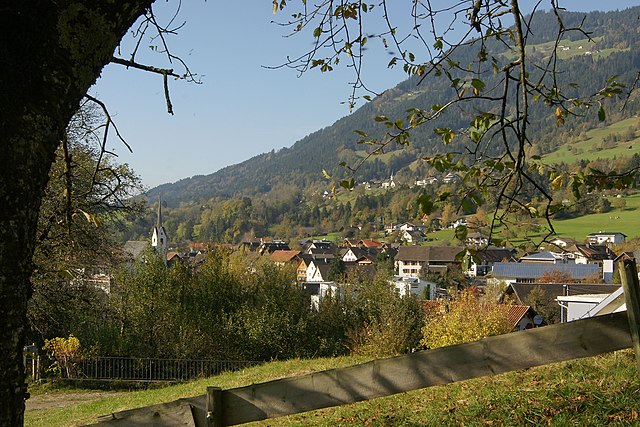
Rankweil
- municipality in Austria
Hiking in Rankweil
Rankweil, located in the picturesque Vorarlberg region of Austria, offers a variety of hiking opportunities that cater to different skill levels and preferences. Nestled in the foothills of the Alps, this charming town is surrounded by stunning landscapes, including vineyards, forests, and majestic mountains....
- Country:
- Postal Code: 6830
- Local Dialing Code: 05522
- Licence Plate Code: FK
- Coordinates: 47° 16' 0" N, 9° 39' 0" E
- GPS tracks (wikiloc): [Link]
- AboveSeaLevel: 468 м m
- Area: 21.87 sq km
- Population: 11852
- Web site: [Link]


Satteins
- municipality in Austria
Hiking in Satteins
Satteins is a small village located in the Vorarlberg region of Austria, known for its beautiful landscapes and outdoor recreational opportunities, including hiking. The surrounding area offers a range of hiking trails suitable for various skill levels, from leisurely strolls to more challenging hikes. Here are some highlights about hiking in and around Satteins:...
- Country:
- Postal Code: 6822
- Local Dialing Code: 05524
- Licence Plate Code: FK
- Coordinates: 47° 13' 30" N, 9° 40' 19" E
- GPS tracks (wikiloc): [Link]
- AboveSeaLevel: 495 м m
- Area: 12.71 sq km
- Population: 2703
- Web site: [Link]
Shares border with regions:

Dornbirn District
- district of Austria
Hiking in Dornbirn District
Dornbirn District, located in the western part of Austria, is a beautiful region known for its stunning landscapes, diverse hiking trails, and outdoor activities. Situated at the northern edge of the Alps, it offers a mix of mountainous terrain, lush valleys, and scenic views of the Rhine Valley and Lake Constance....
- Country:
- Capital: Dornbirn
- Licence Plate Code: DO
- Coordinates: 47° 25' 0" N, 9° 45' 0" E
- GPS tracks (wikiloc): [Link]
- AboveSeaLevel: 956 м m
- Area: 172.37 sq km
- Population: 86272
- Web site: [Link]
Bludenz District
- district (Bezirk) Bludenz, Vorarlberg, Austria
Hiking in Bludenz District
Bludenz District, located in the western part of Austria, is a fantastic destination for hiking enthusiasts. Nestled in the scenic Vorarlberg region, it offers a diverse landscape that includes lush valleys, towering mountains, and picturesque villages. Here are some highlights and recommendations for hiking in this area:...
- Country:
- Capital: Bludenz
- Licence Plate Code: BZ
- Coordinates: 47° 6' 0" N, 9° 54' 0" E
- GPS tracks (wikiloc): [Link]
- AboveSeaLevel: 566 м m
- Area: 1287.52 sq km
- Web site: [Link]

Bregenz District
- district in Austria
Hiking in Bregenz District
Bregenz District, located in the western part of Austria in the state of Vorarlberg, offers a variety of stunning hiking opportunities, thanks to its diverse landscapes that include lakes, mountains, and picturesque villages. Here are some highlights and tips for hiking in this beautiful region:...
- Country:
- Capital: Bregenz
- Licence Plate Code: B
- Coordinates: 47° 24' 0" N, 10° 0' 0" E
- GPS tracks (wikiloc): [Link]
- AboveSeaLevel: 771 м m
- Area: 863.34 sq km
- Population: 131350
- Web site: [Link]