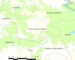
Bossieu (Bossieu)

- commune in Isère, France
 Hiking in Bossieu
Bossieu, a small commune in the Isère department of southeastern France, offers some charming opportunities for hiking enthusiasts. The region is characterized by its picturesque landscapes, which include rolling hills, forests, and views of the surrounding mountains.
Popular Hiking Trails:
-
Local Trails: There are various trails around Bossieu that cater to different skill levels. The trails will often take you through beautiful natural scenery and may pass historical landmarks or local farms.
-
Forests and Vineyards: Many routes lead through the surrounding woodlands and vineyards, providing a peaceful ambiance and a chance to see local flora and fauna.
-
Scenic Views: Some trails may offer panoramic views of the Alps or the Rhône Valley, perfect for photography enthusiasts or those wanting to enjoy a quiet moment in nature.
Tips for Hiking in Bossieu:
- Seasonal Considerations: Spring and fall are ideal for hiking, as the weather is mild, and the landscapes are vibrant with color.
- Trail Conditions: It’s always good to check the trail conditions, especially after heavy rains, as some paths may become muddy or difficult to navigate.
- Gear: Wear good-quality hiking boots and dress in layers. Always carry water and snacks, and consider bringing a map or GPS device.
- Local Regulations: Be mindful of any local regulations regarding trails and respecting nature, especially if you’re in agricultural areas.
Resources:
- Local Guides: Consider contacting local hiking groups or guides who can provide insights and organize hikes.
- Maps and Information: Look for informational brochures or maps at local tourist offices, which can outline the best routes and points of interest.
Hiking in Bossieu can be a delightful experience, combining both physical activity and an opportunity to immerse yourself in the beautiful landscape of the Isère region.
- Country:

- Postal Code: 38260
- Coordinates: 45° 25' 1" N, 5° 8' 53" E


- GPS tracks (wikiloc): [Link]
- Area: 13.48 sq km
- Population: 281
- Web site: http://www.bossieu.fr
- Wikipedia en: wiki(en)
- Wikipedia: wiki(fr)
- Wikidata storage: Wikidata: Q1003912
- Wikipedia Commons Category: [Link]
- Freebase ID: [/m/03g_6zg]
- GeoNames ID: Alt: [6455081]
- SIREN number: [213800493]
- BnF ID: [152578782]
- INSEE municipality code: 38049
Shares border with regions:


Villeneuve-de-Marc
- commune in Isère, France
Hiking in Villeneuve-de-Marc
Villeneuve-de-Marc is a charming village located in the Auvergne-Rhône-Alpes region of France. It's situated near the Rhône River and offers a picturesque landscape that is perfect for hiking enthusiasts. Here are some details to help you plan a hiking trip in and around Villeneuve-de-Marc:...
- Country:
- Postal Code: 38440
- Coordinates: 45° 28' 33" N, 5° 6' 8" E
- GPS tracks (wikiloc): [Link]
- Area: 26.18 sq km
- Population: 1140
- Web site: [Link]

Saint-Julien-de-l'Herms
- commune in Isère, France
Hiking in Saint-Julien-de-l'Herms
Saint-Julien-de-l'Herms is a charming village located in the French Alps, known for its stunning natural landscapes and outdoor recreational opportunities....
- Country:
- Postal Code: 38122
- Coordinates: 45° 25' 57" N, 5° 5' 40" E
- GPS tracks (wikiloc): [Link]
- Area: 9.17 sq km
- Population: 144


Pommier-de-Beaurepaire
- commune in Isère, France
Hiking in Pommier-de-Beaurepaire
Pommier-de-Beaurepaire is a small commune in the Auvergne-Rhône-Alpes region of France, known for its scenic landscapes and rural charm. While it may not be as well-known as some major hiking destinations, it offers opportunities for outdoor enthusiasts to explore the beauty of the surrounding countryside....
- Country:
- Postal Code: 38260
- Coordinates: 45° 24' 0" N, 5° 7' 11" E
- GPS tracks (wikiloc): [Link]
- Area: 19.16 sq km
- Population: 710


Penol
- commune in Isère, France
Hiking in Penol
Penol is a scenic destination in Colombia, particularly known for its stunning landscape dominated by the iconic El Peñol Rock (La Piedra del Peñol), which offers incredible views and challenging hikes. Here are some key points about hiking in the Penol area:...
- Country:
- Postal Code: 38260
- Coordinates: 45° 23' 25" N, 5° 11' 27" E
- GPS tracks (wikiloc): [Link]
- Area: 12.16 sq km
- Population: 340


Ornacieux
- commune in Isère, France
Hiking in Ornacieux
Ornacieux is a charming village located in the Rhône-Alpes region of France, surrounded by beautiful natural landscapes, making it a great destination for hiking enthusiasts. The area offers a variety of trails that cater to different skill levels, from leisurely walks to more challenging hikes....
- Country:
- Postal Code: 38260
- Coordinates: 45° 24' 2" N, 5° 12' 40" E
- GPS tracks (wikiloc): [Link]
- Area: 4.89 sq km
- Population: 416

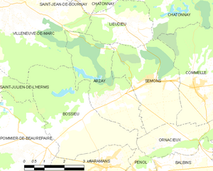
Arzay
- commune in Isère, France
Hiking in Arzay
As of my last update, there's limited information specifically about "Arzay" as a hiking destination. It's possible that you might be referring to a less-known area or there might be a misspelling. However, I can provide general hiking tips and suggestions for exploring regions that might include areas like Arzay if they are situated near popular hiking destinations....
- Country:
- Postal Code: 38260
- Coordinates: 45° 25' 32" N, 5° 10' 13" E
- GPS tracks (wikiloc): [Link]
- Area: 9.79 sq km
- Population: 226
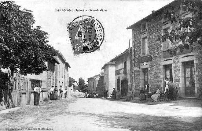

Faramans
- commune in Isère, France
Hiking in Faramans
Faramans is a small commune located in the Isère department in the Auvergne-Rhône-Alpes region of southeastern France. While it may not be as well-known as some of the larger hiking destinations in the area, it offers beautiful landscapes and a chance to enjoy nature in a quieter setting....
- Country:
- Postal Code: 38260
- Coordinates: 45° 23' 36" N, 5° 9' 49" E
- GPS tracks (wikiloc): [Link]
- Area: 10.79 sq km
- Population: 1017
- Web site: [Link]