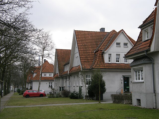
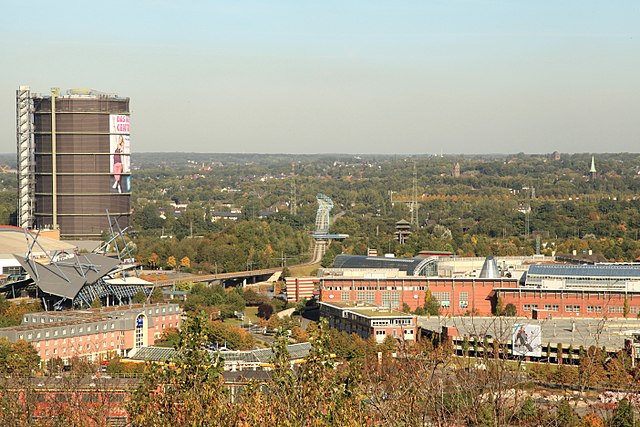
Bottrop (Bottrop)

- town in North Rhine-Westphalia, Germany
 Hiking in Bottrop
Bottrop, a city in North Rhine-Westphalia, Germany, is not primarily known for extensive hiking trails compared to more renowned natural areas. However, there are still some opportunities for hiking and enjoying the outdoors in and around Bottrop.
Local Parks and Natural Areas:
-
Kaiserpark Bottrop: This park offers nice walking paths through green spaces and is suitable for a leisurely hike or stroll.
-
Tetraeder Bottrop: This is a notable landmark in Bottrop and offers a short hike up to an observation platform with scenic views of the surrounding area. The surrounding area has some paths suited for walking.
-
Prosper Haniel Mine: The area surrounding this former coal mine site has been transformed into a landscape park. There are trails for walking, allowing visitors to enjoy the remnants of industrial history alongside nature.
Nearby Hiking Areas:
If you’re willing to travel a bit outside Bottrop, you can find more extensive hiking opportunities:
-
Hohe Mark Nature Park: Located to the northwest, this park offers various trails through forests and fields, providing a more immersive nature experience.
-
Zwillbrocker Venn Nature Reserve: This area is a little further away but offers a beautiful landscape and dedicated hiking paths, particularly good for birdwatchers and nature enthusiasts.
Hiking Tips:
-
Map and GPS: Always carry a map or a GPS device to help navigate trails, especially if you venture into less-marked areas.
-
Trail Conditions: Depending on the season, check trail conditions beforehand, especially in wet or icy weather.
-
Gear: Wear proper hiking shoes and dress in layers, as weather can change quickly.
-
Local Resources: Check local tourism websites or a hiking app for updated trail information and to find community events or guided hikes.
Overall, while Bottrop may not be a hiking hotspot, it offers a few options for those who enjoy the outdoors, with potential for exploration in nearby natural areas.
- Country:

- Postal Code: 46236
- Local Dialing Code: 02045; 02041
- Licence Plate Code: BOT
- Coordinates: 51° 31' 29" N, 6° 55' 22" E


- GPS tracks (wikiloc): [Link]
- AboveSeaLevel: 55 м m
- Area: 100.61 sq km
- Population: 117409
- Web site: https://www.bottrop.de/
- Wikipedia en: wiki(en)
- Wikipedia: wiki(de)
- Wikidata storage: Wikidata: Q3069
- Wikipedia Commons Gallery: [Link]
- Wikipedia Commons Category: [Link]
- Wikipedia Commons Maps Category: [Link]
- Freebase ID: [/m/01lsgk]
- GeoNames ID: Alt: [2945756]
- BnF ID: [12063466f]
- VIAF ID: Alt: [152471683]
- OSM relation ID: [62634]
- GND ID: Alt: [4007862-0]
- archINFORM location ID: [365]
- Library of Congress authority ID: Alt: [n82152969]
- MusicBrainz area ID: [c1bd5de7-c55c-4cd6-800a-e59cca42604b]
- Quora topic ID: [Bottrop]
- TGN ID: [7004945]
- Encyclopædia Britannica Online ID: [place/Bottrop]
- Facebook Places ID: [110486925638115]
- Great Russian Encyclopedia Online ID: [1880283]
- National Library of Israel ID: [000995970]
- NUTS code: [DEA31]
- Klexikon article ID: [Bottrop]
- German municipality key: 05512000
- German district key: 05512
Includes regions:


Grafenwald
- quarter of Bottrop, Germany
Hiking in Grafenwald
Grafenwald in Bottrop, Germany, offers a unique hiking experience, primarily due to its combination of natural beauty and accessible trails, making it suitable for hikers of various skill levels. Here’s what you can expect when hiking in this area:...
- Country:
- Postal Code: 46244
- Local Dialing Code: 02045
- Coordinates: 51° 34' 30" N, 6° 53' 46" E
- GPS tracks (wikiloc): [Link]
- AboveSeaLevel: 293 м m

Kirchhellen
- quarter of Bottrop, Germany
Hiking in Kirchhellen
Bottrop-Kirchhellen, located in the North Rhine-Westphalia region of Germany, offers a range of hiking opportunities suitable for various skill levels. The area is characterized by its mix of natural landscapes and historical sites, making it an interesting destination for outdoor enthusiasts....
- Country:
- Postal Code: 46244
- Local Dialing Code: 02045
- Coordinates: 51° 36' 17" N, 6° 55' 19" E
- GPS tracks (wikiloc): [Link]
- AboveSeaLevel: 60 м m
Batenbrock
- quarter of Bottrop, Germany
Hiking in Batenbrock
Batenbrock is a beautiful area located in Germany, often characterized by its lush landscapes and diverse trails suitable for various hiking experiences. While it may not be as renowned as some of Germany's larger national parks, it offers a charming escape into nature for hiking enthusiasts....
- Country:
- Postal Code: 46238
- Local Dialing Code: 02041
- Coordinates: 51° 31' 59" N, 6° 58' 1" E
- GPS tracks (wikiloc): [Link]
- AboveSeaLevel: 50 м m
Boy
- quarter of Bottrop, Germany
Hiking in Boy
Hiking in Boy, a district of Bottrop in North Rhine-Westphalia, Germany, offers a unique experience thanks to its blend of industrial landscapes and natural surroundings. While Boy itself may not have extensive hiking trails typical of larger nature reserves or national parks, there are several considerations and nearby areas that can enhance your hiking experience....
- Country:
- Postal Code: 46240
- Local Dialing Code: 02041
- Coordinates: 51° 32' 19" N, 6° 58' 4" E
- GPS tracks (wikiloc): [Link]
- AboveSeaLevel: 50 м m


Ebel
- quarter of Bottrop, Germany
Hiking in Ebel
Ebel is a district located in the city of Bottrop in North Rhine-Westphalia, Germany. While Bottrop is primarily known for its industrial history and urban landscape, Ebel offers a more tranquil environment with some potential for hiking and outdoor activities....
- Country:
- Postal Code: 46242
- Local Dialing Code: 02041
- Coordinates: 51° 30' 10" N, 6° 56' 40" E
- GPS tracks (wikiloc): [Link]
- AboveSeaLevel: 40 м m
- Area: 1.1 sq km
Eigen
- quarter of Bottrop, Germany
Hiking in Eigen
Eigen is a district located in Bottrop, Germany, which is part of the Ruhr area. While Bottrop itself is more urbanized, there are opportunities for hiking and enjoying nature in the surrounding regions....
- Country:
- Postal Code: 46240
- Local Dialing Code: 02041
- Coordinates: 51° 32' 52" N, 6° 56' 6" E
- GPS tracks (wikiloc): [Link]
- AboveSeaLevel: 45 м m
Fuhlenbrock
- quarter of Bottrop, Germany
Hiking in Fuhlenbrock
Fuhlenbrock is a lesser-known area, so specific hiking information might be limited. However, if you are looking for general hiking experiences in areas that could be similar, here are some tips and suggestions based on common traits of the region:...
- Country:
- Postal Code: 46242
- Local Dialing Code: 02041
- Coordinates: 51° 31' 59" N, 6° 53' 53" E
- GPS tracks (wikiloc): [Link]
- AboveSeaLevel: 57 м m
- Area: 5.5 sq km
Lehmkuhle
- quarter of Bottrop, Germany
Hiking in Lehmkuhle
Lehmkuhle, located in Bottrop, Germany, is not widely known as a major hiking destination, but it offers some local trails and natural areas that can be enjoyed by outdoor enthusiasts. The region around Bottrop is generally characterized by mixed forests, meadows, and some hilly terrain, making it suitable for a variety of outdoor activities, including hiking....
- Country:
- Postal Code: 46242
- Local Dialing Code: 02041
- Coordinates: 51° 30' 43" N, 6° 56' 0" E
- GPS tracks (wikiloc): [Link]
- AboveSeaLevel: 45 м m

Welheim
- quarter of Bottrop, Germany
Hiking in Welheim
Welheim is a lesser-known yet beautiful area for hiking, situated in Germany's Baden-Württemberg region. The landscape is characterized by rolling hills, lush forests, and scenic views that make for enjoyable hikes for all skill levels. Here are some key aspects you may want to consider if you're planning a hiking trip in and around Welheim:...
- Country:
- Postal Code: 46238
- Local Dialing Code: 02041
- Coordinates: 51° 31' 36" N, 6° 58' 55" E
- GPS tracks (wikiloc): [Link]
- AboveSeaLevel: 30 м m
Shares border with regions:


Essen
- city in North Rhine-Westphalia, Germany
Hiking in Essen
Essen, located in the Ruhr area of Germany, is surrounded by a mix of industrial heritage and natural landscapes, offering some unique hiking opportunities. While it's a city that has undergone significant transformations, nature enthusiasts can find various trails and parks that provide a nice escape from urban life. Here are some highlights for hiking in and around Essen:...
- Country:
- Postal Code: 45001; 45359
- Local Dialing Code: 02054; 0201
- Licence Plate Code: E
- Coordinates: 51° 27' 3" N, 7° 0' 47" E
- GPS tracks (wikiloc): [Link]
- AboveSeaLevel: 116 м m
- Area: 210.34 sq km
- Population: 590194
- Web site: [Link]

Oberhausen
- city in North Rhine-Westphalia, Germany
Hiking in Oberhausen
Oberhausen, located in the Ruhr area of Germany, is not typically known for its natural hiking trails, as it is an industrial city. However, there are several options in and around the city for those looking to explore the outdoors....
- Country:
- Postal Code: 46001–46149
- Local Dialing Code: 0208
- Licence Plate Code: OB
- Coordinates: 51° 33' 0" N, 6° 51' 0" E
- GPS tracks (wikiloc): [Link]
- AboveSeaLevel: 25 м m
- Area: 77.09 sq km
- Population: 211382
- Web site: [Link]


Recklinghausen
- German district of North Rhine-Westphalia
Hiking in Recklinghausen
Recklinghausen, located in the state of North Rhine-Westphalia in Germany, offers a variety of hiking opportunities, primarily in the form of trails that showcase the region's natural beauty and cultural heritage. Here are some aspects to consider when planning a hike in and around Recklinghausen:...
- Country:
- Licence Plate Code: RE
- Coordinates: 51° 40' 12" N, 7° 10' 12" E
- GPS tracks (wikiloc): [Link]
- AboveSeaLevel: 52 м m
- Web site: [Link]


Wesel
- district in North Rhine-Westphalia, Germany
Hiking in Wesel
Wesel is a beautiful district located in North Rhine-Westphalia, Germany, and offers some lovely hiking opportunities. The area is characterized by a mix of natural landscapes, including rivers, forests, and scenic countryside, making it ideal for hiking enthusiasts. Here are some highlights and tips for hiking in the Wesel district:...
- Country:
- Licence Plate Code: WES
- Coordinates: 51° 40' 12" N, 6° 40' 12" E
- GPS tracks (wikiloc): [Link]
- AboveSeaLevel: 17 м m
- Area: 1042.47 sq km
- Web site: [Link]