
Essen (Essen)
- city in North Rhine-Westphalia, Germany
Essen, located in the Ruhr area of Germany, is surrounded by a mix of industrial heritage and natural landscapes, offering some unique hiking opportunities. While it's a city that has undergone significant transformations, nature enthusiasts can find various trails and parks that provide a nice escape from urban life. Here are some highlights for hiking in and around Essen:
Key Hiking Areas
-
Grugapark Essen: This large park features beautiful gardens, walking paths, and sculptures. It's perfect for a leisurely hike and offers a mix of natural and cultivated landscapes. The park's well-maintained paths make it accessible for all fitness levels.
-
Kaiser-Wilhelm-Park: Located near the city center, this park boasts lovely walking trails, expansive green areas, and scenic views. It's a great spot for a short hike combined with enjoying the local flora.
-
Bottrop and the Hohe Mark Region: Just a short distance from Essen, the Hohe Mark region offers more extensive hiking trails through forests and hilly terrains. The area includes well-marked paths like the "Rothaarsteig" trail, suitable for more experienced hikers looking for a challenge.
-
Hiking Trails around the Ruhr River: The Ruhr river itself provides various walking paths and hiking opportunities along its banks. Trails run through picturesque landscapes and past historical industrial sites, providing a unique blend of nature and history.
-
The Baldeneysee: Located not too far from Essen, this reservoir is surrounded by beautiful hiking trails. The circular paths around the lake are ideal for a more relaxed hike, with opportunities for birdwatching and enjoying the scenic views.
Tips for Hiking in Essen
-
Trail Maps: Make sure to get updated trail maps or use hiking apps to ensure you are on the correct path, as some areas might have multiple routes.
-
Weather Preparedness: The weather can change rapidly, so dressing in layers and bringing rain gear is advisable.
-
Local Resources: Check with local tourist offices for guided hikes or events, as they often have schedules of group hikes that can enrich your experience.
-
Safety: Always inform someone about your hiking plans, especially if you're heading into more remote areas outside the city.
Whether you're looking for a quick nature escape or a more challenging hike, Essen and the surrounding region offer diverse landscapes to explore. Enjoy your hiking adventure!
- Country:

- Postal Code: 45001; 45359
- Local Dialing Code: 02054; 0201
- Licence Plate Code: E
- Coordinates: 51° 27' 3" N, 7° 0' 47" E


- GPS tracks (wikiloc): [Link]
- AboveSeaLevel: 116 м m
- Area: 210.34 sq km
- Population: 590194
- Web site: https://www.essen.de/
- Wikipedia en: wiki(en)
- Wikipedia: wiki(de)
- Wikidata storage: Wikidata: Q2066
- Wikipedia Commons Gallery: [Link]
- Wikipedia Commons Category: [Link]
- Wikipedia Commons Maps Category: [Link]
- Freebase ID: [/m/017gry]
- GeoNames ID: Alt: [2928810]
- VIAF ID: Alt: [125488872]
- OSM relation ID: [62713]
- GND ID: Alt: [4015557-2]
- archINFORM location ID: [392]
- Library of Congress authority ID: Alt: [n80089415]
- MusicBrainz area ID: [3ff0283e-871a-4c6d-96ad-ba871ab216f1]
- Quora topic ID: [Essen-Germany]
- UN/LOCODE: [DEESS]
- Encyclopædia Britannica Online ID: [place/Essen]
- Encyclopædia Universalis ID: [essen]
- Facebook Places ID: [108402229182110]
- Twitter username: Alt: [Essen_Ruhr]
- DMOZ ID: Alt: [World/Deutsch/Regional/Europa/Deutschland/Nordrhein-Westfalen/Städte_und_Gemeinden/E/Essen/]
- National Library of Israel ID: [000980323]
- YouTube channel ID: [UCFBHjMgem5MfkJxJPMvpO7A]
- NUTS code: [DEA13]
- YSO ID: [147489]
- Klexikon article ID: [Essen]
- Facebook ID: Alt: [StadtportalEssen]
- SELIBR ID: [144384]
- BAV ID: [ADV12564372]
- Instagram username: [essen_ruhr]
- German municipality key: 05113000
- US National Archives Identifier: 10044753
- German district key: 05113
Shares border with regions:


Ennepe-Ruhr-Kreis
- district in North Rhine-Westphalia, Germany
Ennepe-Ruhr-Kreis, located in North Rhine-Westphalia, Germany, is an excellent destination for hiking enthusiasts. The region is characterized by its diverse landscapes, which include forests, hills, and scenic views of the Ruhr area. Here are some key points to consider when hiking in this region:...
- Country:

- Capital: Schwelm
- Licence Plate Code: WIT; EN
- Coordinates: 51° 21' 5" N, 7° 18' 26" E


- GPS tracks (wikiloc): [Link]
- AboveSeaLevel: 226 м m
- Area: 408.44 sq km
- Population: 322731
- Web site: [Link]

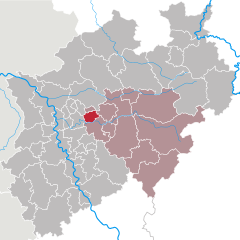
Bochum
- city in North Rhine-Westphalia, Germany
Bochum, located in the North Rhine-Westphalia region of Germany, is not traditionally known as a hiking destination, but it offers some interesting opportunities for outdoor enthusiasts. Here are a few highlights for hiking in and around Bochum:...
- Country:

- Postal Code: 44701–44894
- Local Dialing Code: 02327; 0234
- Licence Plate Code: BO
- Coordinates: 51° 29' 0" N, 7° 13' 0" E


- GPS tracks (wikiloc): [Link]
- AboveSeaLevel: 100 м m
- Area: 145.66 sq km
- Population: 364920
- Web site: [Link]
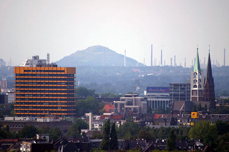

Gelsenkirchen
- town in North Rhine-Westphalia, Germany
Gelsenkirchen, located in North Rhine-Westphalia, Germany, is primarily known as an industrial city, but it also offers some opportunities for hiking and enjoying nature. Here are a few highlights for hiking in the area:...
- Country:

- Postal Code: 45801–45899; 4660; 4650
- Local Dialing Code: 0209
- Licence Plate Code: GE
- Coordinates: 51° 31' 0" N, 7° 6' 0" E


- GPS tracks (wikiloc): [Link]
- AboveSeaLevel: 48 м m
- Area: 104.94 sq km
- Population: 262528
- Web site: [Link]
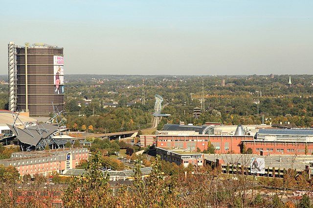

Oberhausen
- city in North Rhine-Westphalia, Germany
Oberhausen, located in the Ruhr area of Germany, is not typically known for its natural hiking trails, as it is an industrial city. However, there are several options in and around the city for those looking to explore the outdoors....
- Country:

- Postal Code: 46001–46149
- Local Dialing Code: 0208
- Licence Plate Code: OB
- Coordinates: 51° 33' 0" N, 6° 51' 0" E


- GPS tracks (wikiloc): [Link]
- AboveSeaLevel: 25 м m
- Area: 77.09 sq km
- Population: 211382
- Web site: [Link]
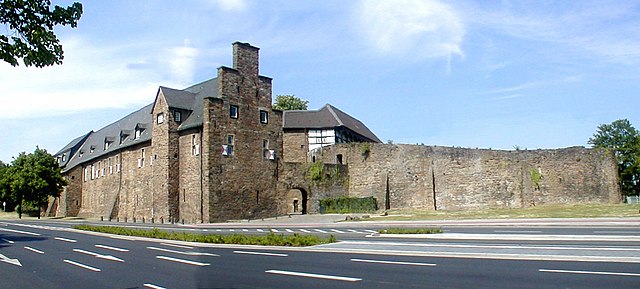

Mülheim an der Ruhr
- city in North Rhine-Westphalia, Germany
Mülheim an der Ruhr, a city located in the Ruhr area of Germany, offers some interesting hiking opportunities for outdoor enthusiasts. While it may not be as renowned for hiking as some mountainous regions of Germany, it has several beautiful parks, forests, and paths that make for pleasant experiences. Here are a few highlights for hiking in and around Mülheim:...
- Country:

- Postal Code: 45401–45481
- Local Dialing Code: 0208
- Licence Plate Code: MH
- Coordinates: 51° 25' 42" N, 6° 52' 44" E


- GPS tracks (wikiloc): [Link]
- AboveSeaLevel: 153 м m
- Area: 91.28 sq km
- Population: 170936
- Web site: [Link]

Bottrop
- town in North Rhine-Westphalia, Germany
Bottrop, a city in North Rhine-Westphalia, Germany, is not primarily known for extensive hiking trails compared to more renowned natural areas. However, there are still some opportunities for hiking and enjoying the outdoors in and around Bottrop....
- Country:

- Postal Code: 46236
- Local Dialing Code: 02045; 02041
- Licence Plate Code: BOT
- Coordinates: 51° 31' 29" N, 6° 55' 22" E


- GPS tracks (wikiloc): [Link]
- AboveSeaLevel: 55 м m
- Area: 100.61 sq km
- Population: 117409
- Web site: [Link]


Recklinghausen
- German district of North Rhine-Westphalia
Recklinghausen, located in the state of North Rhine-Westphalia in Germany, offers a variety of hiking opportunities, primarily in the form of trails that showcase the region's natural beauty and cultural heritage. Here are some aspects to consider when planning a hike in and around Recklinghausen:...
- Country:

- Licence Plate Code: RE
- Coordinates: 51° 40' 12" N, 7° 10' 12" E


- GPS tracks (wikiloc): [Link]
- AboveSeaLevel: 52 м m
- Web site: [Link]


Mettmann
- district in North Rhine-Westphalia, Germany
Mettmann, located in North Rhine-Westphalia, Germany, offers a variety of hiking opportunities that cater to different skill levels and preferences. The region features picturesque landscapes, including forests, hills, and scenic views, making it ideal for outdoor activities....
- Country:

- Licence Plate Code: ME
- Coordinates: 51° 15' 0" N, 7° 0' 0" E


- GPS tracks (wikiloc): [Link]
- AboveSeaLevel: 143 м m
- Web site: [Link]


