Bougé-Chambalud (Bougé-Chambalud)

- commune in Isère, France
 Hiking in Bougé-Chambalud
Bougé-Chambalud is a picturesque village located in the Auvergne-Rhône-Alpes region of France, specifically within the department of Drôme. Its setting offers several opportunities for hiking and enjoying the natural beauty of the area.
Hiking Trails and Nature
The region around Bougé-Chambalud features a variety of hiking trails that cater to different skill levels. You can find scenic paths through forests, hills, and along the riverbanks, which provide stunning views of the surrounding landscapes.
Popular Hike Recommendations:
-
Le Sentier de la Montagne: This trail takes you through forested areas and offers panoramic views over the Rhône valley. It's suitable for families and less experienced hikers.
-
Vallée de l'Escoutay: A more challenging route that leads you to beautiful natural spots, including opportunities to see local wildlife and enjoy the flora of the region.
-
Historic Routes: Some paths lead to historical sites, including ancient ruins and old farms, making for a more culturally enriching experience.
Preparation and Safety
- Gear: Make sure to wear proper hiking boots and dress in layers to accommodate changes in weather.
- Hydration: Bring enough water, especially during warmer months, as some trails may not have facilities.
- Maps: It’s advisable to have a map or GPS device, as some trails can be less marked.
Additional Activities
Aside from hiking, the region is great for cycling, bird-watching, and even picnicking in some of the scenic spots. If you're interested in local culture, consider visiting Bourdeaux or other nearby towns to explore local markets and cuisine.
Conclusion
Hiking in Bougé-Chambalud offers a serene escape into nature, with trails that range from easy to more challenging. Whether you are a novice or an experienced hiker, the area promises a fulfilling outdoor experience. Make sure to check local weather conditions and trail statuses before heading out for a hike!
- Country:

- Postal Code: 38150
- Coordinates: 45° 19' 49" N, 4° 54' 5" E


- GPS tracks (wikiloc): [Link]
- Area: 15.85 sq km
- Population: 1395
- Web site: http://www.bouge-chambalud.fr
- Wikipedia en: wiki(en)
- Wikipedia: wiki(fr)
- Wikidata storage: Wikidata: Q1046431
- Wikipedia Commons Category: [Link]
- Freebase ID: [/m/03g_6sz]
- GeoNames ID: Alt: [6448733]
- SIREN number: [213800519]
- BnF ID: [15257880m]
- VIAF ID: Alt: [316738449]
- INSEE municipality code: 38051
Shares border with regions:

Épinouze
- commune in Drôme, France
Hiking in Épinouze
Épinouze is a charming commune located in the Drôme department of southeastern France. It is surrounded by picturesque landscapes, making it a great spot for hiking enthusiasts. Here are some highlights and tips for hiking in the Épinouze area:...
- Country:
- Postal Code: 26210
- Coordinates: 45° 18' 33" N, 4° 55' 40" E
- GPS tracks (wikiloc): [Link]
- Area: 11.21 sq km
- Population: 1594
- Web site: [Link]

Agnin
- commune in Isère, France
- Country:
- Postal Code: 38150
- Coordinates: 45° 20' 24" N, 4° 51' 26" E
- GPS tracks (wikiloc): [Link]
- Area: 7.96 sq km
- Population: 1091
- Web site: [Link]

Saint-Rambert-d'Albon
- commune in Drôme, France
- Country:
- Postal Code: 26140
- Coordinates: 45° 17' 38" N, 4° 49' 1" E
- GPS tracks (wikiloc): [Link]
- Area: 13.41 sq km
- Population: 6313
- Web site: [Link]
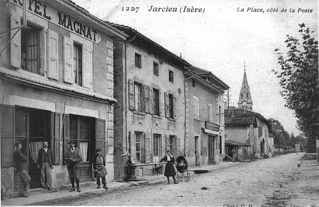
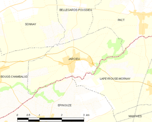
Jarcieu
- commune in Isère, France
Hiking in Jarcieu
Jarcieu is a charming village located in the Isère department in southeastern France. The area is surrounded by beautiful landscapes and offers a variety of opportunities for hiking enthusiasts, ranging from leisurely walks to more challenging trails. Here are some highlights and tips for hiking in Jarcieu:...
- Country:
- Postal Code: 38270
- Coordinates: 45° 20' 2" N, 4° 56' 47" E
- GPS tracks (wikiloc): [Link]
- Area: 6.31 sq km
- Population: 1028
- Web site: [Link]


Sonnay
- commune in Isère, France
Hiking in Sonnay
Sonnay is a charming village located in the Isère department of the Auvergne-Rhône-Alpes region in southeastern France. While Sonnay itself may not be as well-known as some other hiking destinations, it serves as a great starting point for exploring the surrounding natural beauty of the region....
- Country:
- Postal Code: 38150
- Coordinates: 45° 21' 17" N, 4° 54' 25" E
- GPS tracks (wikiloc): [Link]
- Area: 14.17 sq km
- Population: 1236
- Web site: [Link]
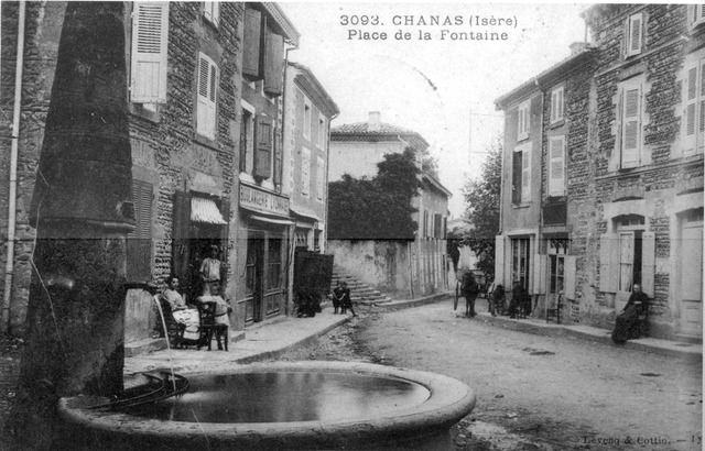
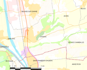
Chanas
- commune in Isère, France
- Country:
- Postal Code: 38150
- Coordinates: 45° 19' 6" N, 4° 49' 9" E
- GPS tracks (wikiloc): [Link]
- Area: 11.65 sq km
- Population: 2524
- Web site: [Link]

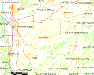
Anneyron
- commune in Drôme, France
Hiking in Anneyron
Anneyron is a charming town located in the Drôme department in southeastern France. Nestled in the Rhône Valley, it's a great starting point for exploring the surrounding natural landscapes. Here are some highlights and tips for hiking in and around Anneyron:...
- Country:
- Postal Code: 26140
- Coordinates: 45° 16' 16" N, 4° 53' 16" E
- GPS tracks (wikiloc): [Link]
- Area: 36.23 sq km
- Population: 3924
- Web site: [Link]


Anjou
- commune in Isère, France
Hiking in Anjou
Anjou, located in the Isère department in the Auvergne-Rhône-Alpes region of southeastern France, offers a variety of beautiful landscapes and hiking opportunities. The area is known for its picturesque scenery, mixed forests, rolling hills, and views of the surrounding mountains, including the Alps....
- Country:
- Postal Code: 38150
- Coordinates: 45° 20' 49" N, 4° 52' 55" E
- GPS tracks (wikiloc): [Link]
- AboveSeaLevel: 182 м m
- Area: 5.03 sq km
- Population: 1012
- Web site: [Link]