Jarcieu (Jarcieu)

- commune in Isère, France
 Hiking in Jarcieu
Jarcieu is a charming village located in the Isère department in southeastern France. The area is surrounded by beautiful landscapes and offers a variety of opportunities for hiking enthusiasts, ranging from leisurely walks to more challenging trails. Here are some highlights and tips for hiking in Jarcieu:
Scenic Trails
- Local Nature Trails: Jarcieu is surrounded by picturesque countryside, including forests, hills, and fields. Look for well-marked trails that take you through natural landscapes, offering a chance to spot local flora and fauna.
- Views of the Massif Central: Some trails provide stunning views of the Massif Central and the surrounding mountains, making for great photo opportunities.
Difficulty Levels
- Beginner Trails: There are numerous beginner-friendly trails suitable for families or those new to hiking. These typically have gentle slopes and well-maintained paths.
- Intermediate to Advanced Trails: For those looking for more of a challenge, there are steeper paths and longer routes that can test your endurance and skills.
Planning Your Hike
- Season: Spring and fall are ideal seasons for hiking in Jarcieu, with mild temperatures and vibrant landscapes. Summer can get hot, so plan hikes for early morning or later in the afternoon.
- Gear: Make sure to wear appropriate hiking shoes and carry essentials such as water, snacks, a first-aid kit, and a map or GPS device. A hiking stick may also be useful for navigating uneven terrain.
Local Attractions
- Cultural Sites: Consider exploring nearby historical sites and villages to enrich your hiking experience. Local churches, farms, and quaint village squares can provide a cultural backdrop to your outdoor adventures.
Safety Tips
- Stay on Marked Trails: To protect the local ecosystem and ensure your safety, stick to marked hiking paths.
- Check Weather Conditions: Always check the weather forecast before heading out, as conditions in mountainous areas can change rapidly.
Conclusion
Hiking in Jarcieu allows you to immerse yourself in the natural beauty of the region while enjoying a healthy outdoor activity. Whether you're an experienced hiker or a casual walker, exploring this area can be a rewarding experience.
- Country:

- Postal Code: 38270
- Coordinates: 45° 20' 2" N, 4° 56' 47" E


- GPS tracks (wikiloc): [Link]
- Area: 6.31 sq km
- Population: 1028
- Web site: http://www.jarcieu.fr
- Wikipedia en: wiki(en)
- Wikipedia: wiki(fr)
- Wikidata storage: Wikidata: Q525352
- Wikipedia Commons Category: [Link]
- Freebase ID: [/m/03nvjxw]
- GeoNames ID: Alt: [6612508]
- SIREN number: [213801988]
- BnF ID: [152580156]
- INSEE municipality code: 38198
Shares border with regions:

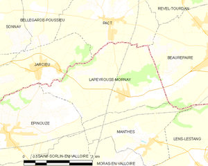
Lapeyrouse-Mornay
- commune in Drôme, France
Hiking in Lapeyrouse-Mornay
Lapeyrouse-Mornay is a charming commune located in the Auvergne-Rhône-Alpes region of France, known for its picturesque landscapes and natural beauty. While it might not be as widely recognized as some of the larger hiking destinations in the region, there are still opportunities for exploring the surrounding countryside....
- Country:
- Postal Code: 26210
- Coordinates: 45° 19' 23" N, 4° 59' 42" E
- GPS tracks (wikiloc): [Link]
- Area: 11.45 sq km
- Population: 1214
- Web site: [Link]

Épinouze
- commune in Drôme, France
Hiking in Épinouze
Épinouze is a charming commune located in the Drôme department of southeastern France. It is surrounded by picturesque landscapes, making it a great spot for hiking enthusiasts. Here are some highlights and tips for hiking in the Épinouze area:...
- Country:
- Postal Code: 26210
- Coordinates: 45° 18' 33" N, 4° 55' 40" E
- GPS tracks (wikiloc): [Link]
- Area: 11.21 sq km
- Population: 1594
- Web site: [Link]


Bougé-Chambalud
- commune in Isère, France
Hiking in Bougé-Chambalud
Bougé-Chambalud is a picturesque village located in the Auvergne-Rhône-Alpes region of France, specifically within the department of Drôme. Its setting offers several opportunities for hiking and enjoying the natural beauty of the area....
- Country:
- Postal Code: 38150
- Coordinates: 45° 19' 49" N, 4° 54' 5" E
- GPS tracks (wikiloc): [Link]
- Area: 15.85 sq km
- Population: 1395
- Web site: [Link]


Pact
- commune in Isère, France
Hiking in Pact
Hiking in Pact, located in the Isère department of the Auvergne-Rhône-Alpes region in France, offers an excellent opportunity to explore the natural beauty of the Alps and the surrounding landscapes. Here are some key points to consider when hiking in and around Pact:...
- Country:
- Postal Code: 38270
- Coordinates: 45° 21' 10" N, 4° 59' 29" E
- GPS tracks (wikiloc): [Link]
- Area: 9.74 sq km
- Population: 840
- Web site: [Link]


Bellegarde-Poussieu
- commune in Isère, France
Hiking in Bellegarde-Poussieu
Bellegarde-Poussieu is a charming commune located in the Isère department in the Auvergne-Rhône-Alpes region of southeastern France. The area is known for its beautiful landscapes, rolling hills, and proximity to both the Rhône Valley and the foothills of the Alps, making it a great location for hiking enthusiasts....
- Country:
- Postal Code: 38270
- Coordinates: 45° 22' 30" N, 4° 57' 3" E
- GPS tracks (wikiloc): [Link]
- Area: 16.79 sq km
- Population: 982


Sonnay
- commune in Isère, France
Hiking in Sonnay
Sonnay is a charming village located in the Isère department of the Auvergne-Rhône-Alpes region in southeastern France. While Sonnay itself may not be as well-known as some other hiking destinations, it serves as a great starting point for exploring the surrounding natural beauty of the region....
- Country:
- Postal Code: 38150
- Coordinates: 45° 21' 17" N, 4° 54' 25" E
- GPS tracks (wikiloc): [Link]
- Area: 14.17 sq km
- Population: 1236
- Web site: [Link]