Thoraise (Thoraise)
- commune in Doubs, France
Thoraise is a charming location in France, situated near the city of Besançon in the Bourgogne-Franche-Comté region. While it may not be a widely known hiking destination, the surrounding area offers beautiful landscapes and a variety of trails that cater to hikers of different abilities.
Hiking Opportunities in Thoraise:
-
Natural Landscape: The region boasts lush greenery, rolling hills, and scenic views of the Doubs River. Hikers can enjoy the beauty of nature while exploring the local flora and fauna.
-
Trail Networks: There are various hiking trails in and around Thoraise that connect to larger regional networks. You might find trails suitable for leisurely walks, as well as more challenging routes for seasoned hikers looking for elevation gain and longer distances.
-
Nearby Natural Reserves: Explore nearby natural parks or reserves, such as the Parc Naturel Régional du Doubs, which offers diverse trails amidst protected natural beauty.
-
Local Routes: Be sure to check local maps or online resources for specific trails in the Thoraise area. Some may lead to historical sites, viewpoints, or through quaint villages and local vineyards.
-
Accessibility: The trails in and around Thoraise can vary in accessibility. Ensure you choose a hike that matches your fitness level and experience.
-
Seasonal Hiking: The best time to hike in Thoraise would generally be during the spring to fall months, when the weather is more favorable and the scenery is vibrant with blossoming flowers and lush greenery.
Tips for Hiking in Thoraise:
- Check Weather Conditions: Before heading out, check the weather forecast to ensure safe hiking conditions.
- Pack Accordingly: Bring plenty of water, snacks, and appropriate gear (hiking boots, weather-appropriate clothing, etc.).
- Trail Maps: Carry a map or use a reliable hiking app to stay on track.
- Leave No Trace: Respect the environment by following Leave No Trace principles.
If you’re planning to hike in Thoraise, it’s advisable to research specific trails ahead of time or contact local hiking clubs for recommendations. Enjoy your hiking adventure in this scenic part of France!
- Country:

- Postal Code: 25320
- Coordinates: 47° 10' 26" N, 5° 54' 11" E


- GPS tracks (wikiloc): [Link]
- Area: 3.99 sq km
- Population: 353
- Wikipedia en: wiki(en)
- Wikipedia: wiki(fr)
- Wikidata storage: Wikidata: Q906665
- Wikipedia Commons Category: [Link]
- Freebase ID: [/m/03mhdc6]
- GeoNames ID: Alt: [6430010]
- SIREN number: [212505614]
- BnF ID: [15252787j]
- PACTOLS thesaurus ID: [pcrtXN4D8ZH8aS]
- INSEE municipality code: 25561
Shares border with regions:


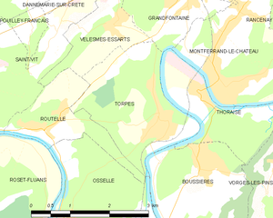
Torpes
- commune in Doubs, France
Torpes is a charming village located in the Doubs department of France, known for its picturesque landscapes and natural beauty. If you're interested in hiking in and around Torpes, here are some key points to consider:...
- Country:

- Postal Code: 25320
- Coordinates: 47° 10' 9" N, 5° 53' 26" E


- GPS tracks (wikiloc): [Link]
- Area: 5.55 sq km
- Population: 1060
- Web site: [Link]


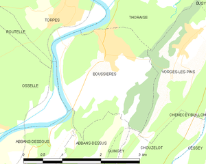
Boussières
- commune in Doubs, France
Boussières is a charming commune located in the Doubs department of the Bourgogne-Franche-Comté region in eastern France. It's surrounded by beautiful natural landscapes, making it a great destination for hiking enthusiasts....
- Country:

- Postal Code: 25320
- Coordinates: 47° 9' 27" N, 5° 54' 5" E


- GPS tracks (wikiloc): [Link]
- Area: 5.58 sq km
- Population: 1089
- Web site: [Link]


Grandfontaine
- commune in Doubs, France
Grandfontaine, located in the Doubs department of France, is a picturesque area that offers a range of hiking opportunities amidst beautiful natural scenery. This region is part of the Jura Mountains, characterized by lush forests, rolling hills, and stunning views. Here are some key highlights for hiking in Grandfontaine:...
- Country:

- Postal Code: 25320
- Coordinates: 47° 11' 51" N, 5° 54' 2" E


- GPS tracks (wikiloc): [Link]
- Area: 5.68 sq km
- Population: 1539
- Web site: [Link]


Montferrand-le-Château
- commune in Doubs, France
 Hiking in Montferrand-le-Château
Montferrand-le-Château, located near the city of Besançon in the Franche-Comté region of France, offers a range of hiking opportunities that showcase the natural beauty of the area. The region is characterized by its rolling hills, forests, and panoramic views, making it an ideal location for both casual hikers and more experienced outdoor enthusiasts....
- Country:

- Postal Code: 25320
- Coordinates: 47° 10' 59" N, 5° 54' 28" E


- GPS tracks (wikiloc): [Link]
- Area: 7.48 sq km
- Population: 2086
- Web site: [Link]


Vorges-les-Pins
- commune in Doubs, France
Vorges-les-Pins is a great destination for hiking enthusiasts, offering a variety of trails that cater to different skill levels. While it may not be as well-known as some larger hiking areas in France, its natural beauty and tranquil setting make it a charming spot for outdoor activities....
- Country:

- Postal Code: 25320
- Coordinates: 47° 9' 28" N, 5° 55' 43" E


- GPS tracks (wikiloc): [Link]
- Area: 4.76 sq km
- Population: 596


Busy
- commune in Doubs, France
Busy is a charming village located in the Doubs department in the Bourgogne-Franche-Comté region of eastern France. The area is known for its picturesque landscapes, dense woodlands, and scenic views, making it an excellent destination for hiking enthusiasts....
- Country:

- Postal Code: 25320
- Coordinates: 47° 10' 4" N, 5° 56' 52" E


- GPS tracks (wikiloc): [Link]
- Area: 5.2 sq km
- Population: 618


Rancenay
- commune in Doubs, France
Rancenay is a small commune located in the Doubs department in the Bourgogne-Franche-Comté region of eastern France. The area is known for its beautiful natural landscapes, making it a great destination for hiking and outdoor activities. Here are some highlights about hiking in Rancenay:...
- Country:

- Postal Code: 25320
- Coordinates: 47° 11' 13" N, 5° 57' 1" E


- GPS tracks (wikiloc): [Link]
- Area: 3.66 sq km
- Population: 293
