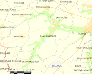
Boutervilliers (Boutervilliers)

- commune in Essonne, France
- Country:

- Postal Code: 91150
- Coordinates: 48° 27' 9" N, 2° 3' 20" E


- GPS tracks (wikiloc): [Link]
- Area: 7.01 sq km
- Population: 427
- Web site: http://www.boutervilliers.fr
- Wikipedia en: wiki(en)
- Wikipedia: wiki(fr)
- Wikidata storage: Wikidata: Q256642
- Wikipedia Commons Category: [Link]
- Freebase ID: [/m/03mgcq_]
- Freebase ID: [/m/03mgcq_]
- GeoNames ID: Alt: [3030762]
- GeoNames ID: Alt: [3030762]
- SIREN number: [219100989]
- SIREN number: [219100989]
- BnF ID: [152800732]
- BnF ID: [152800732]
- INSEE municipality code: 91098
- INSEE municipality code: 91098
Shares border with regions:

Richarville
- commune in Essonne, France
- Country:
- Postal Code: 91410
- Coordinates: 48° 28' 18" N, 2° 0' 3" E
- GPS tracks (wikiloc): [Link]
- Area: 10.35 sq km
- Population: 401
- Web site: [Link]

Étampes
- commune in Essonne, France
- Country:
- Postal Code: 91150
- Coordinates: 48° 26' 6" N, 2° 9' 44" E
- GPS tracks (wikiloc): [Link]
- Area: 40.92 sq km
- Population: 24271
- Web site: [Link]

Chalo-Saint-Mars
- commune in Essonne, France
- Country:
- Postal Code: 91780
- Coordinates: 48° 25' 37" N, 2° 3' 58" E
- GPS tracks (wikiloc): [Link]
- Area: 28.67 sq km
- Population: 1133
- Web site: [Link]

La Forêt-le-Roi
- commune in Essonne, France
- Country:
- Postal Code: 91410
- Coordinates: 48° 28' 43" N, 2° 2' 31" E
- GPS tracks (wikiloc): [Link]
- Area: 7.94 sq km
- Population: 517
- Web site: [Link]

Boissy-le-Sec
- commune in Essonne, France
- Country:
- Postal Code: 91870
- Coordinates: 48° 28' 38" N, 2° 5' 25" E
- GPS tracks (wikiloc): [Link]
- Area: 19.06 sq km
- Population: 677
- Web site: [Link]

Plessis-Saint-Benoist
- commune in Essonne, France
- Country:
- Postal Code: 91410
- Coordinates: 48° 26' 36" N, 2° 0' 21" E
- GPS tracks (wikiloc): [Link]
- Area: 9.16 sq km
- Population: 317

Saint-Hilaire
- commune in Essonne, France
- Country:
- Postal Code: 91780
- Coordinates: 48° 26' 1" N, 2° 4' 34" E
- GPS tracks (wikiloc): [Link]
- Area: 6.79 sq km
- Population: 400