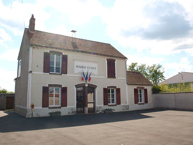
La Forêt-le-Roi (La Forêt-le-Roi)

- commune in Essonne, France
- Country:

- Postal Code: 91410
- Coordinates: 48° 28' 43" N, 2° 2' 31" E


- GPS tracks (wikiloc): [Link]
- Area: 7.94 sq km
- Population: 517
- Web site: http://laforetleroi.wordpress.com
- Wikipedia en: wiki(en)
- Wikipedia: wiki(fr)
- Wikidata storage: Wikidata: Q257234
- Wikipedia Commons Category: [Link]
- Freebase ID: [/m/03mgtwz]
- Freebase ID: [/m/03mgtwz]
- GeoNames ID: Alt: [3009350]
- GeoNames ID: Alt: [3009350]
- SIREN number: [219102472]
- SIREN number: [219102472]
- BnF ID: [15280125g]
- BnF ID: [15280125g]
- VIAF ID: Alt: [128192506]
- VIAF ID: Alt: [128192506]
- TGN ID: [6003282]
- TGN ID: [6003282]
- INSEE municipality code: 91247
- INSEE municipality code: 91247
Shares border with regions:

Richarville
- commune in Essonne, France
- Country:
- Postal Code: 91410
- Coordinates: 48° 28' 18" N, 2° 0' 3" E
- GPS tracks (wikiloc): [Link]
- Area: 10.35 sq km
- Population: 401
- Web site: [Link]
Boutervilliers
- commune in Essonne, France
- Country:
- Postal Code: 91150
- Coordinates: 48° 27' 9" N, 2° 3' 20" E
- GPS tracks (wikiloc): [Link]
- Area: 7.01 sq km
- Population: 427
- Web site: [Link]

Boissy-le-Sec
- commune in Essonne, France
- Country:
- Postal Code: 91870
- Coordinates: 48° 28' 38" N, 2° 5' 25" E
- GPS tracks (wikiloc): [Link]
- Area: 19.06 sq km
- Population: 677
- Web site: [Link]

Les Granges-le-Roi
- commune in Essonne, France
- Country:
- Postal Code: 91410
- Coordinates: 48° 30' 6" N, 2° 1' 9" E
- GPS tracks (wikiloc): [Link]
- Area: 12.68 sq km
- Population: 1201
- Web site: [Link]
Roinville
- commune in Essonne, France
- Country:
- Postal Code: 91410
- Coordinates: 48° 31' 53" N, 2° 2' 43" E
- GPS tracks (wikiloc): [Link]
- Area: 13.4 sq km
- Population: 1363
- Web site: [Link]