Brand-Laaben (Brand-Laaben)
- municipality in Austria
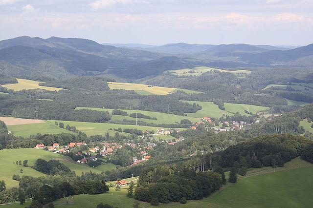
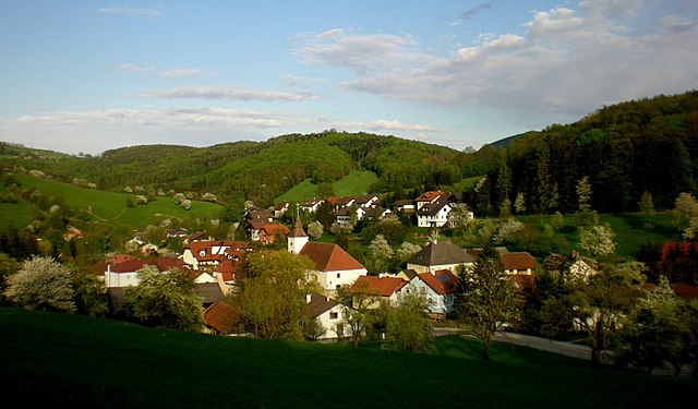
Brand-Laaben is a charming area located in Lower Austria, known for its beautiful landscapes and outdoor activities, including hiking. Here are some key points about hiking in this region:
1.
- Natural Surroundings: The area features lush forests, hills, and serene valleys, providing a picturesque backdrop for your hikes.
- Varied Difficulty: Trails cater to a range of skill levels, from easy walks suitable for families to more challenging hikes for seasoned adventurers.
2.
- Local Trails: Explore nearby marked trails that might take you through fields, along rivers, or up into wooded areas with panoramic views.
- Nordic Walking: Some routes are specifically designed for Nordic walking, offering a great way to enjoy the outdoors while getting a good workout.
3.
- Keep an eye out for local wildlife like deer, various bird species, and diverse plant life. The natural ecosystems found in the area can be quite rich.
4.
- Trail Markings: Many trails are well-marked, making navigation easier.
- Rest Areas: Look out for rest areas or viewpoints along the trails where you can pause and take in the scenery.
5.
- Seasonal Considerations: Spring and fall are particularly beautiful times for hiking due to pleasant temperatures and vibrant foliage, but summer can also be great if you’re prepared for the heat.
6.
- Safety: Always carry plenty of water, wear appropriate footwear, and check the weather before heading out.
- Navigation: While many trails are well-marked, it's helpful to have a local map or a hiking app for reference.
7.
- The area is accessible by car, and there are often local public transportation options depending on where you are coming from.
If you're planning a hike in Brand-Laaben, remember to check local hiking guides and resources for up-to-date trail information and any community events that might be taking place. Enjoy your hike in this beautiful region!
- Country:

- Postal Code: 3053
- Local Dialing Code: 02774
- Licence Plate Code: PL
- Coordinates: 48° 8' 0" N, 15° 53' 0" E


- GPS tracks (wikiloc): [Link]
- AboveSeaLevel: 347 м m
- Area: 34.61 sq km
- Population: 1232
- Web site: http://www.brand-laaben.at/
- Wikipedia en: wiki(en)
- Wikipedia: wiki(de)
- Wikidata storage: Wikidata: Q676582
- Wikipedia Commons Category: [Link]
- Freebase ID: [/m/02r5bt5]
- GeoNames ID: Alt: [7873009]
- VIAF ID: Alt: [240107212]
- GND ID: Alt: [4738693-9]
- archINFORM location ID: [10397]
- Austrian municipality key: [31904]
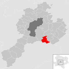
Shares border with regions:

Altenmarkt an der Triesting
- municipality in Austria
 Hiking in Altenmarkt an der Triesting
Altenmarkt an der Triesting is a scenic area located in Austria, surrounded by the beautiful landscapes of Lower Austria. Hiking in this region offers a variety of trails suitable for different skill levels, allowing hikers to experience the natural beauty, cultural sites, and peaceful rural life....
- Country:

- Local Dialing Code: 02673
- Licence Plate Code: BN
- Coordinates: 48° 1' 0" N, 15° 59' 38" E


- GPS tracks (wikiloc): [Link]
- AboveSeaLevel: 390 м m
- Area: 63.43 sq km
- Population: 2113
- Web site: [Link]

Kaumberg
- municipality in Austria
Kaumberg, located in the beautiful region of Lower Austria, offers a variety of hiking opportunities for enthusiasts of all levels. The area is rich in scenic landscapes, featuring lush forests, rolling hills, and breathtaking views of the surrounding countryside....
- Country:

- Postal Code: 2572
- Local Dialing Code: 02765
- Licence Plate Code: LF
- Coordinates: 48° 1' 25" N, 15° 53' 42" E


- GPS tracks (wikiloc): [Link]
- AboveSeaLevel: 494 м m
- Area: 43 sq km
- Population: 1016
- Web site: [Link]

Hainfeld
- municipality in Austria
Hainfeld, located in Lower Austria, is surrounded by picturesque landscapes, making it a great destination for hiking enthusiasts. The area offers various trails that cater to different skill levels, from easy walks through lush forests to more challenging hikes with steep ascents....
- Country:

- Postal Code: 3170
- Local Dialing Code: 02764
- Licence Plate Code: LF
- Coordinates: 48° 2' 0" N, 15° 46' 0" E


- GPS tracks (wikiloc): [Link]
- AboveSeaLevel: 439 м m
- Area: 44.73 sq km
- Population: 3726
- Web site: [Link]
Stössing
- municipality in Austria
Stössing, a quaint village in the Lower Austria region, offers a variety of hiking opportunities that are perfect for both casual walkers and more experienced trekkers. The surrounding landscapes consist of rolling hills, lush forests, and picturesque views, making it an ideal destination for nature lovers....
- Country:

- Postal Code: 3073
- Local Dialing Code: 02744
- Licence Plate Code: PL
- Coordinates: 48° 7' 0" N, 15° 49' 0" E


- GPS tracks (wikiloc): [Link]
- AboveSeaLevel: 344 м m
- Area: 27.47 sq km
- Population: 838
- Web site: [Link]
Neustift-Innermanzing
- municipality in Austria
 Hiking in Neustift-Innermanzing
Neustift-Innermanzing, located in Austria, is a charming area that offers a variety of hiking opportunities with beautiful landscapes and scenic views. Here are some key highlights to consider when hiking in this region:...
- Country:

- Postal Code: 3052
- Local Dialing Code: 02774
- Licence Plate Code: PL
- Coordinates: 48° 7' 0" N, 15° 54' 0" E


- GPS tracks (wikiloc): [Link]
- AboveSeaLevel: 298 м m
- Area: 14.9 sq km
- Population: 1543
- Web site: [Link]


Michelbach, Lower Austria
- municipality in Austria
 Hiking in Michelbach, Lower Austria
Michelbach is a picturesque area in Lower Austria known for its beautiful landscapes, rolling hills, and access to various hiking trails that offer both beginners and experienced hikers opportunities to enjoy nature....
- Country:

- Postal Code: 3074
- Local Dialing Code: 02744
- Licence Plate Code: PL
- Coordinates: 48° 5' 0" N, 15° 45' 0" E


- GPS tracks (wikiloc): [Link]
- AboveSeaLevel: 376 м m
- Area: 24.95 sq km
- Population: 915
- Web site: [Link]