Hainfeld (Hainfeld)
- municipality in Austria
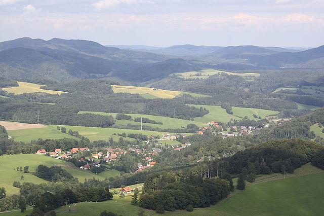
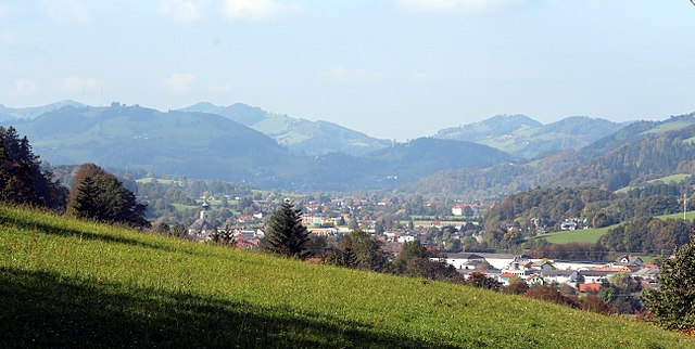
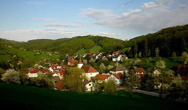
Hainfeld, located in Lower Austria, is surrounded by picturesque landscapes, making it a great destination for hiking enthusiasts. The area offers various trails that cater to different skill levels, from easy walks through lush forests to more challenging hikes with steep ascents.
Popular Hiking Trails in Hainfeld:
-
Hainfeld Circular Trail:
- This trail provides stunning views of the surrounding landscape and is ideal for beginners. It's a relatively easy loop that takes you through scenic woodlands and alongside streams.
-
Kübelberg Trail:
- A bit more challenging, this trail involves some elevation gain and rewards hikers with panoramic views. It’s suitable for those looking for a moderate hike.
-
Natural Wonders Trail:
- This trail focuses on the local flora and fauna, making it a perfect option for nature lovers. Along the way, you can learn about local biodiversity.
-
Austrian Alpine Trail:
- For a more extensive adventure, consider parts of the Austrian Alpine Trail that pass through this region. It's best suited for experienced hikers.
Tips for Hiking in Hainfeld:
-
Seasonal Considerations: Spring and autumn offer the best weather for hiking, while summer can get warm. Winter hiking is also possible with the right gear, but trails may be less maintained.
-
Equipment: Good hiking shoes, weather-appropriate clothing, and plenty of water and snacks are essential. Consider bringing trekking poles for more challenging terrain.
-
Local Regulations: Always respect local wildlife and nature, stick to marked trails, and follow any guidelines provided by local authorities.
-
Maps and Guides: It's helpful to have a physical map or a reliable GPS device. Local visitor centers can provide information on current trail conditions and suggestions for itineraries.
Before heading out, it’s a good idea to check weather conditions and trail accessibility, as they can vary seasonally. Happy hiking!
- Country:

- Postal Code: 3170
- Local Dialing Code: 02764
- Licence Plate Code: LF
- Coordinates: 48° 2' 0" N, 15° 46' 0" E


- GPS tracks (wikiloc): [Link]
- AboveSeaLevel: 439 м m
- Area: 44.73 sq km
- Population: 3726
- Web site: http://www.hainfeld.at
- Wikipedia en: wiki(en)
- Wikipedia: wiki(de)
- Wikidata storage: Wikidata: Q671275
- Wikipedia Commons Category: [Link]
- Freebase ID: [/m/02qxf8j]
- GeoNames ID: Alt: [7872929]
- GND ID: Alt: [4526890-3]
- archINFORM location ID: [15842]
- Library of Congress authority ID: Alt: [nb2006015350]
- Austrian municipality key: [31403]
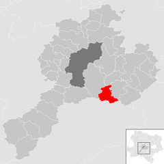
Shares border with regions:

Kaumberg
- municipality in Austria
Kaumberg, located in the beautiful region of Lower Austria, offers a variety of hiking opportunities for enthusiasts of all levels. The area is rich in scenic landscapes, featuring lush forests, rolling hills, and breathtaking views of the surrounding countryside....
- Country:

- Postal Code: 2572
- Local Dialing Code: 02765
- Licence Plate Code: LF
- Coordinates: 48° 1' 25" N, 15° 53' 42" E


- GPS tracks (wikiloc): [Link]
- AboveSeaLevel: 494 м m
- Area: 43 sq km
- Population: 1016
- Web site: [Link]

Ramsau
- town in Lower Austria, Austria
Ramsau, located in Lower Austria, is a picturesque village surrounded by stunning natural landscapes, making it a fantastic destination for hiking enthusiasts. The region offers a variety of trails suited for different skill levels, from easy walks to challenging mountain hikes. Here are some highlights and tips for hiking in Ramsau:...
- Country:

- Postal Code: 3172
- Local Dialing Code: 02764
- Licence Plate Code: LF
- Coordinates: 48° 0' 0" N, 15° 48' 0" E


- GPS tracks (wikiloc): [Link]
- AboveSeaLevel: 470 м m
- Area: 54.69 sq km
- Population: 850
- Web site: [Link]
Kleinzell
- municipality in Austria
Kleinzell is a picturesque area located in Austria, known for its scenic landscapes and outdoor activities, including hiking. The region offers a variety of trails suitable for different skill levels, making it a great destination for both novice and experienced hikers....
- Country:

- Postal Code: 3171
- Local Dialing Code: 02766
- Licence Plate Code: LF
- Coordinates: 47° 59' 0" N, 15° 45' 0" E


- GPS tracks (wikiloc): [Link]
- AboveSeaLevel: 480 м m
- Area: 93.02 sq km
- Population: 831
- Web site: [Link]

Sankt Veit an der Gölsen
- municipality in Austria
 Hiking in Sankt Veit an der Gölsen
Sankt Veit an der Gölsen, located in Lower Austria, offers a variety of hiking opportunities set against beautiful landscapes, including rolling hills, forests, and picturesque views. Here are some key points for hiking in this area:...
- Country:

- Postal Code: 3161
- Local Dialing Code: 02763
- Licence Plate Code: LF
- Coordinates: 48° 2' 0" N, 15° 40' 0" E


- GPS tracks (wikiloc): [Link]
- AboveSeaLevel: 369 м m
- Area: 78.14 sq km
- Population: 3915
- Web site: [Link]

Brand-Laaben
- municipality in Austria
Brand-Laaben is a charming area located in Lower Austria, known for its beautiful landscapes and outdoor activities, including hiking. Here are some key points about hiking in this region:...
- Country:

- Postal Code: 3053
- Local Dialing Code: 02774
- Licence Plate Code: PL
- Coordinates: 48° 8' 0" N, 15° 53' 0" E


- GPS tracks (wikiloc): [Link]
- AboveSeaLevel: 347 м m
- Area: 34.61 sq km
- Population: 1232
- Web site: [Link]


Michelbach, Lower Austria
- municipality in Austria
 Hiking in Michelbach, Lower Austria
Michelbach is a picturesque area in Lower Austria known for its beautiful landscapes, rolling hills, and access to various hiking trails that offer both beginners and experienced hikers opportunities to enjoy nature....
- Country:

- Postal Code: 3074
- Local Dialing Code: 02744
- Licence Plate Code: PL
- Coordinates: 48° 5' 0" N, 15° 45' 0" E


- GPS tracks (wikiloc): [Link]
- AboveSeaLevel: 376 м m
- Area: 24.95 sq km
- Population: 915
- Web site: [Link]
Rohrbach an der Gölsen
- municipality in Austria
 Hiking in Rohrbach an der Gölsen
Rohrbach an der Gölsen, a charming village located in Lower Austria, offers beautiful hiking opportunities with scenic views and diverse landscapes. The area is characterized by its rolling hills, lush forests, and the Gölsen river, making it an ideal spot for outdoor enthusiasts....
- Country:

- Postal Code: 3163
- Local Dialing Code: 02764
- Licence Plate Code: LF
- Coordinates: 48° 2' 53" N, 15° 44' 30" E


- GPS tracks (wikiloc): [Link]
- AboveSeaLevel: 402 м m
- Area: 14.77 sq km
- Population: 1556
- Web site: [Link]