Brans (Brans)

- commune in Jura, France
- Country:

- Postal Code: 39290
- Coordinates: 47° 13' 56" N, 5° 34' 2" E


- GPS tracks (wikiloc): [Link]
- Area: 8.77 sq km
- Population: 223
- Wikipedia en: wiki(en)
- Wikipedia: wiki(fr)
- Wikidata storage: Wikidata: Q614511
- Wikipedia Commons Category: [Link]
- Freebase ID: [/m/03nnz64]
- GeoNames ID: Alt: [6448804]
- SIREN number: [213900749]
- BnF ID: [15258438z]
- INSEE municipality code: 39074
Shares border with regions:


Thervay
- commune in Jura, France
- Country:
- Postal Code: 39290
- Coordinates: 47° 15' 2" N, 5° 36' 56" E
- GPS tracks (wikiloc): [Link]
- Area: 15.75 sq km
- Population: 382


Dammartin-Marpain
- commune in Jura, France
- Country:
- Postal Code: 39290
- Coordinates: 47° 15' 22" N, 5° 32' 39" E
- GPS tracks (wikiloc): [Link]
- AboveSeaLevel: 238 м m
- Area: 11.32 sq km
- Population: 324


Malange
- commune in Jura, France
- Country:
- Postal Code: 39700
- Coordinates: 47° 10' 34" N, 5° 36' 52" E
- GPS tracks (wikiloc): [Link]
- Area: 8.4 sq km
- Population: 321


Offlanges
- commune in Jura, France
- Country:
- Postal Code: 39290
- Coordinates: 47° 12' 30" N, 5° 33' 2" E
- GPS tracks (wikiloc): [Link]
- Area: 8.73 sq km
- Population: 197


Serre-les-Moulières
- commune in Jura, France
- Country:
- Postal Code: 39700
- Coordinates: 47° 12' 18" N, 5° 37' 1" E
- GPS tracks (wikiloc): [Link]
- AboveSeaLevel: 269 м m
- Area: 5.67 sq km
- Population: 190

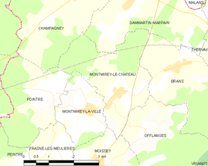
Montmirey-le-Château
- commune in Jura, France
- Country:
- Postal Code: 39290
- Coordinates: 47° 13' 24" N, 5° 32' 4" E
- GPS tracks (wikiloc): [Link]
- Area: 8.02 sq km
- Population: 190