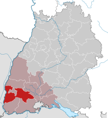
Breisgau-Hochschwarzwald (Landkreis Breisgau-Hochschwarzwald)
- district of Baden-Württemberg, Germany
 Hiking in Breisgau-Hochschwarzwald
Breisgau-Hochschwarzwald is a spectacular region in southwestern Germany, known for its diverse landscapes, lush forests, and scenic trails. It's located in the state of Baden-Württemberg and offers a myriad of hiking opportunities suitable for all skill levels. Here are some highlights about hiking in the area:
1.
- The region is home to numerous marked hiking trails that lead through beautiful forests, rolling hills, and picturesque villages. Popular destinations include the Black Forest, which features trails offering stunning views of the valleys and vineyards.
2.
- This is one of the most famous long-distance hiking trails in the area, providing breathtaking panoramic views of the Black Forest and the Rhine Valley. The trail is well-marked and showcases the unique natural beauty of the region.
3.
- Both of these lakes are surrounded by well-maintained hiking paths and offer opportunities for swimming, picnicking, and enjoying the tranquility of nature. The trails around these lakes cater to various fitness levels.
4.
- A portion of this long-distance trail runs through the Breisgau-Hochschwarzwald region, connecting hikers to beautiful natural landscapes, cultural sites, and charming villages.
5.
- The area is rich in biodiversity. Hikers may encounter a variety of wildlife, including deer and diverse bird species. The rich flora adds to the picturesque scenery, especially in spring and summer.
6.
- While hiking, you can explore historical sites, traditional villages, and local breweries. The region is known for its hearty Black Forest cuisine and wine culture.
7.
- In the winter months, specific trails are suitable for snowshoeing and winter hiking. The region attracts winter sports enthusiasts, particularly in areas that receive good snowfall.
8.
- Many trails are accessible from nearby towns and cities, making it easy to plan day hikes or longer excursions. Public transport options, including trains and buses, allow for convenient access to trailheads.
9.
- As with any hiking, it's essential to be well-prepared. Keep an eye on weather conditions, carry adequate water and snacks, and wear suitable footwear. Also, be aware of the trail markings to stay on the correct path.
Overall, hiking in Breisgau-Hochschwarzwald offers a wonderful blend of nature, fitness, and culture. Whether you are a seasoned hiker or a casual walker, there's something for everyone to enjoy in this beautiful part of Germany. Happy hiking!
- Country:

- Capital: Freiburg im Breisgau
- Licence Plate Code: FR
- Coordinates: 47° 57' 0" N, 7° 51' 0" E


- GPS tracks (wikiloc): [Link]
- AboveSeaLevel: 394 м m
- Area: 1378.30 sq km
- Population: 247711
- Web site: http://www.breisgau-hochschwarzwald.de
- Wikipedia en: wiki(en)
- Wikipedia: wiki(de)
- Wikidata storage: Wikidata: Q8195
- Wikipedia Commons Category: [Link]
- Freebase ID: [/m/01chmn]
- GeoNames ID: Alt: [2944796]
- BnF ID: [14519799s]
- VIAF ID: Alt: [148340730]
- OSM relation ID: [1946367]
- GND ID: Alt: [4008111-4]
- archINFORM location ID: [2416]
- Library of Congress authority ID: Alt: [n80139575]
- TGN ID: [7202950]
- NUTS code: [DE132]
- German district key: 08315
Includes regions:


Eisenbach
- municipality in Baden-Württemberg, Germany
Eisenbach, located in the beautiful Black Forest region of Germany, offers numerous hiking opportunities for both beginners and experienced hikers. The region is known for its stunning landscapes, thick forests, rolling hills, and diverse flora and fauna. Here are some highlights of hiking in Eisenbach:...
- Country:

- Postal Code: 79871
- Local Dialing Code: 07657
- Licence Plate Code: FR
- Coordinates: 47° 57' 50" N, 8° 16' 19" E


- GPS tracks (wikiloc): [Link]
- AboveSeaLevel: 944 м m
- Area: 28.78 sq km
- Population: 2139
- Web site: [Link]


Merdingen
- municipality in Baden-Württemberg, Germany
Merdingen is a small village located in Germany, near the scenic Black Forest region. Hiking around Merdingen offers a blend of beautiful landscapes, lush vineyards, and the serenity of nature. Here’s what you can expect when hiking in and around Merdingen:...
- Country:

- Postal Code: 79291
- Local Dialing Code: 07668
- Licence Plate Code: FR
- Coordinates: 48° 1' 0" N, 7° 41' 0" E


- GPS tracks (wikiloc): [Link]
- AboveSeaLevel: 193 м m
- Area: 14.39 sq km
- Population: 2558
- Web site: [Link]


Hartheim am Rhein
- municipality in Baden-Württemberg, Germany
Hartheim am Rhein is a picturesque village located in the state of Baden-Württemberg, Germany, near the Rhine River. The area is known for its beautiful landscapes, including vineyards, forests, and riverside paths, making it a great destination for hiking enthusiasts....
- Country:

- Postal Code: 79258
- Local Dialing Code: 07633
- Licence Plate Code: FR
- Coordinates: 47° 56' 12" N, 7° 37' 40" E


- GPS tracks (wikiloc): [Link]
- AboveSeaLevel: 206 м m
- Area: 26.05 sq km
- Population: 4832
- Web site: [Link]


Badenweiler
- municipality in Baden-Württemberg, Germany
Badenweiler, located in the southwest of Germany in the state of Baden-Württemberg, is a charming spa town nestled in the Black Forest region. It is known for its beautiful landscapes, thermal baths, and rich history, making it a fantastic destination for hiking enthusiasts. Here are some key aspects to consider about hiking in Badenweiler:...
- Country:

- Postal Code: 79410
- Local Dialing Code: 07632
- Licence Plate Code: FR
- Coordinates: 47° 48' 6" N, 7° 40' 19" E


- GPS tracks (wikiloc): [Link]
- AboveSeaLevel: 425 м m
- Area: 13.02 sq km
- Population: 4055
- Web site: [Link]


Auggen
- municipality in Baden-Württemberg, Germany
Auggen is a small town in the state of Baden-Württemberg, Germany, located near the western edge of the Black Forest region. While it may not be the most well-known hiking destination, the surrounding area offers various trails and beautiful landscapes that can make for a delightful hiking experience....
- Country:

- Postal Code: 79424
- Local Dialing Code: 07631
- Licence Plate Code: FR
- Coordinates: 47° 47' 13" N, 7° 35' 46" E


- GPS tracks (wikiloc): [Link]
- AboveSeaLevel: 264 м m
- Area: 14.15 sq km
- Population: 2661
- Web site: [Link]


Münstertal/Schwarzwald
- municipality in Baden-Württemberg, Germany
 Hiking in Münstertal/Schwarzwald
Münstertal is a picturesque valley located in the Black Forest region of Germany, known for its stunning landscapes, diverse trails, and charming villages. Here are some key highlights and tips for hiking in Münstertal:...
- Country:

- Postal Code: 79242–79244
- Local Dialing Code: 07636
- Licence Plate Code: FR
- Coordinates: 47° 51' 17" N, 7° 47' 3" E


- GPS tracks (wikiloc): [Link]
- AboveSeaLevel: 592 м m
- Area: 67.74 sq km
- Population: 5091
- Web site: [Link]
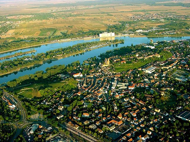

Breisach
- town in Baden-Württemberg, Germany
Breisach am Rhein, located in the southwestern part of Germany, near the borders of France and Switzerland, offers a charming backdrop for hiking enthusiasts. The region is characterized by its scenic landscapes, vineyards, and the picturesque Rhine River....
- Country:

- Postal Code: 79206
- Local Dialing Code: 07668; 07664; 07667
- Licence Plate Code: FR
- Coordinates: 48° 1' 44" N, 7° 34' 48" E


- GPS tracks (wikiloc): [Link]
- AboveSeaLevel: 191 м m
- Area: 54.61 sq km
- Population: 15315
- Web site: [Link]


Bad Krozingen
- town in Baden-Württemberg, Germany
Bad Krozingen is a charming town located in the Black Forest region of Germany, known for its scenic beauty and natural thermal springs. Hiking in this area offers a wonderful mix of stunning landscapes, lush forests, and various trails that cater to different skill levels. Here are some key points to consider when hiking in Bad Krozingen:...
- Country:

- Postal Code: 79189
- Local Dialing Code: 07633
- Licence Plate Code: FR
- Coordinates: 47° 55' 5" N, 7° 42' 9" E


- GPS tracks (wikiloc): [Link]
- AboveSeaLevel: 233 м m
- Area: 35.66 sq km
- Population: 17839
- Web site: [Link]

Müllheim
- town in Baden-Württemberg, Germany
Müllheim, located in the beautiful Baden-Württemberg region of Germany, is a great destination for hiking enthusiasts. Nestled in the foothills of the Black Forest and near the scenic Markgräflerland region, Müllheim offers a variety of trails that cater to different skill levels, from gentle walks to more challenging hikes....
- Country:

- Postal Code: 79379
- Local Dialing Code: 07631
- Licence Plate Code: FR
- Coordinates: 47° 48' 30" N, 7° 37' 51" E


- GPS tracks (wikiloc): [Link]
- AboveSeaLevel: 267 м m
- Area: 57.91 sq km
- Population: 18999
- Web site: [Link]
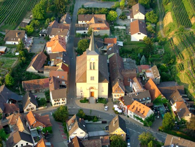

Vogtsburg im Kaiserstuhl
- town in Baden-Württemberg, Germany
 Hiking in Vogtsburg im Kaiserstuhl
Vogtsburg, located in the Baden-Württemberg region of Germany, is nestled in the beautiful Kaiserstuhl area, which is known for its scenic landscapes, vineyards, and diverse hiking trails. Here are some highlights of hiking in Vogtsburg:...
- Country:

- Postal Code: 79235
- Local Dialing Code: 07662
- Licence Plate Code: FR
- Coordinates: 48° 5' 21" N, 7° 37' 54" E


- GPS tracks (wikiloc): [Link]
- AboveSeaLevel: 302 м m
- Area: 37.36 sq km
- Population: 5853
- Web site: [Link]


Titisee-Neustadt
- town in Baden-Württemberg, Germany
Titisee-Neustadt is a beautiful destination in the Black Forest region of Germany, known for its stunning landscapes, lush forests, and a picturesque lake, Lake Titisee. Hiking in this area offers a variety of trails suitable for different skill levels, making it an excellent option for both beginners and experienced hikers....
- Country:

- Postal Code: 79822
- Local Dialing Code: 07651
- Licence Plate Code: FR
- Coordinates: 47° 54' 44" N, 8° 12' 53" E


- GPS tracks (wikiloc): [Link]
- AboveSeaLevel: 849 м m
- Area: 89.66 sq km
- Population: 11908
- Web site: [Link]


Sulzburg
- town in Baden-Württemberg, Germany
Sulzburg, located in the beautiful Baden-Württemberg region of Germany, offers a variety of hiking opportunities that showcase the stunning landscapes and natural beauty of the area. Here are some highlights and tips for hiking in and around Sulzburg:...
- Country:

- Postal Code: 79295
- Local Dialing Code: 07634
- Licence Plate Code: FR
- Coordinates: 47° 50' 25" N, 7° 42' 33" E


- GPS tracks (wikiloc): [Link]
- AboveSeaLevel: 337 м m
- Area: 22.73 sq km
- Population: 2771
- Web site: [Link]


Heitersheim
- town in Baden-Württemberg, Germany
Heitersheim is a charming village located in the Baden-Württemberg region of Germany, nestled near the southern Black Forest and the Kaiserstuhl mountains. The area provides a variety of hiking opportunities, showcasing picturesque landscapes, vineyards, and historical sites....
- Country:

- Postal Code: 79423
- Local Dialing Code: 07634
- Licence Plate Code: FR
- Coordinates: 47° 52' 31" N, 7° 39' 17" E


- GPS tracks (wikiloc): [Link]
- AboveSeaLevel: 254 м m
- Area: 11.71 sq km
- Population: 5968
- Web site: [Link]


Au
- municipality in Baden-Württemberg, Germany
Hiking in Au, located in the Schwarzwald (Black Forest) region of Germany, offers breathtaking landscapes, lush forests, and a variety of trails suitable for all levels of hikers. The Schwarzwald is known for its picturesque scenery, charming villages, and rich cultural heritage, making it a popular destination for outdoor enthusiasts....
- Country:

- Postal Code: 79280
- Local Dialing Code: 0761
- Licence Plate Code: FR
- Coordinates: 47° 57' 0" N, 7° 50' 0" E


- GPS tracks (wikiloc): [Link]
- AboveSeaLevel: 367 м m
- Area: 3.99 sq km
- Population: 1431
- Web site: [Link]


Neuenburg am Rhein
- town in Baden-Württemberg, Germany
Neuenburg am Rhein, located in the state of Baden-Württemberg in southwestern Germany, offers a variety of scenic hiking opportunities, especially due to its proximity to the Rhine River and the beautiful surrounding landscapes....
- Country:

- Postal Code: 79389–79395
- Local Dialing Code: 07631
- Licence Plate Code: FR
- Coordinates: 47° 48' 53" N, 7° 33' 43" E


- GPS tracks (wikiloc): [Link]
- AboveSeaLevel: 230 м m
- Area: 44.12 sq km
- Population: 11984
- Web site: [Link]


Hinterzarten
- municipality in Baden-Württemberg, Germany
Hinterzarten is a beautiful village located in the Black Forest region of Germany, known for its picturesque landscapes and excellent hiking trails. Here are some highlights and tips for hiking in and around Hinterzarten:...
- Country:

- Postal Code: 79856
- Local Dialing Code: 07652
- Licence Plate Code: FR
- Coordinates: 47° 54' 10" N, 8° 6' 25" E


- GPS tracks (wikiloc): [Link]
- AboveSeaLevel: 895 м m
- Area: 33.37 sq km
- Population: 2476
- Web site: [Link]
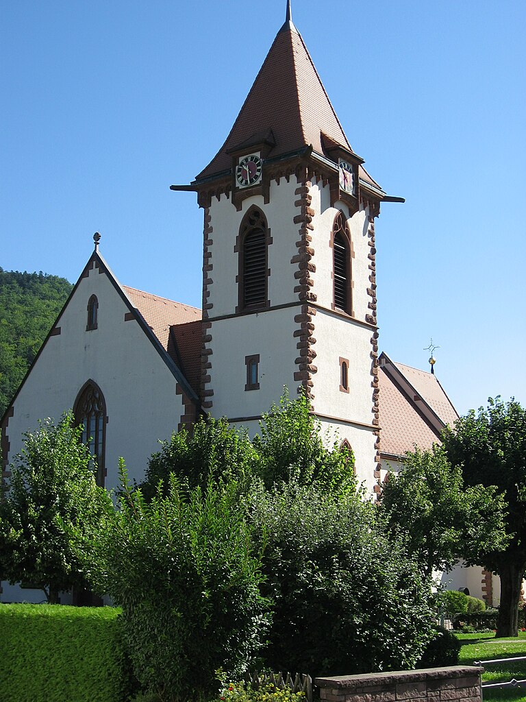

Buchenbach
- municipality in Baden-Württemberg, Germany
Buchenbach is a picturesque village located in the Black Forest region of Germany, known for its stunning natural beauty and a network of well-maintained hiking trails. Hiking in Buchenbach offers a variety of experiences, from gentle walks through lush forests to more challenging trails that provide breathtaking views of the surrounding landscape....
- Country:

- Postal Code: 79256
- Local Dialing Code: 07661
- Licence Plate Code: FR
- Coordinates: 47° 58' 0" N, 8° 1' 0" E


- GPS tracks (wikiloc): [Link]
- AboveSeaLevel: 590 м m
- Area: 38.99 sq km
- Population: 3116
- Web site: [Link]


Horben
- municipality in Baden-Württemberg, Germany
Horben is a picturesque village located in the Black Forest region of Germany, near Freiburg. This area is known for its stunning natural landscapes, dense forests, and charming trails, making it a great destination for hikers of all skill levels....
- Country:

- Postal Code: 79289
- Local Dialing Code: 0761
- Licence Plate Code: FR
- Coordinates: 47° 56' 0" N, 7° 52' 0" E


- GPS tracks (wikiloc): [Link]
- AboveSeaLevel: 495 м m
- Area: 8.75 sq km
- Population: 1128
- Web site: [Link]

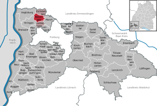
Bötzingen
- municipality in Baden-Württemberg, Germany
Bötzingen is a charming municipality located in the Breisgau region of Baden-Württemberg, Germany. Nestled at the edge of the Black Forest, it offers access to scenic landscapes and various hiking opportunities....
- Country:

- Postal Code: 79268
- Local Dialing Code: 07663
- Licence Plate Code: FR
- Coordinates: 48° 4' 35" N, 7° 43' 29" E


- GPS tracks (wikiloc): [Link]
- AboveSeaLevel: 192 м m
- Area: 13 sq km
- Population: 5316
- Web site: [Link]

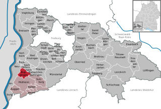
Buggingen
- municipality in Baden-Württemberg, Germany
Buggingen is a quaint village located in the state of Baden-Württemberg, Germany, near the Black Forest region. While it may not be one of the most famous hiking destinations, it offers a range of scenic trails and natural beauty that can appeal to outdoor enthusiasts....
- Country:

- Postal Code: 79426
- Local Dialing Code: 07634; 07631
- Licence Plate Code: FR
- Coordinates: 47° 50' 53" N, 7° 38' 13" E


- GPS tracks (wikiloc): [Link]
- AboveSeaLevel: 239 м m
- Area: 15.32 sq km
- Population: 3970
- Web site: [Link]


Gottenheim
- municipality in Baden-Württemberg, Germany
Gottenheim is a charming village located in the Baden-Württemberg region of Germany, near the borders of the Black Forest. Its scenic landscapes and proximity to various natural attractions make it a lovely spot for hiking enthusiasts. Here are some highlights for hiking in and around Gottenheim:...
- Country:

- Postal Code: 79288
- Local Dialing Code: 07665
- Licence Plate Code: FR
- Coordinates: 48° 3' 0" N, 7° 44' 0" E


- GPS tracks (wikiloc): [Link]
- AboveSeaLevel: 191 м m
- Area: 8.74 sq km
- Population: 2965
- Web site: [Link]

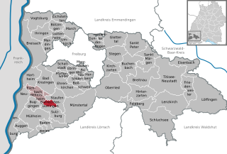
Ballrechten-Dottingen
- municipality in Baden-Württemberg, Germany
 Hiking in Ballrechten-Dottingen
Ballrechten-Dottingen is a charming village located in the foothills of the Black Forest in Baden-Württemberg, Germany. It's an excellent destination for hiking enthusiasts looking to explore scenic trails and the beauty of the surrounding countryside....
- Country:

- Postal Code: 79282
- Local Dialing Code: 07634
- Licence Plate Code: FR
- Coordinates: 47° 51' 32" N, 7° 41' 51" E


- GPS tracks (wikiloc): [Link]
- AboveSeaLevel: 332 м m
- Area: 6.62 sq km
- Population: 2328
- Web site: [Link]

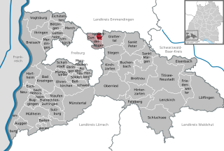
Heuweiler
- municipality in Baden-Württemberg, Germany
Heuweiler is a picturesque village located near Freiburg in the Black Forest region of Germany. Hiking in and around Heuweiler offers a mix of beautiful landscapes, dense forests, and scenic views of the surrounding countryside. Here are some highlights for hiking in this area:...
- Country:

- Postal Code: 79194
- Local Dialing Code: 07666
- Licence Plate Code: FR
- Coordinates: 48° 3' 0" N, 7° 54' 0" E


- GPS tracks (wikiloc): [Link]
- AboveSeaLevel: 258 м m
- Area: 4.03 sq km
- Population: 1113
- Web site: [Link]


Friedenweiler
- municipality in Baden-Württemberg, Germany
Friedenweiler is a charming village located in the Black Forest region of Germany, known for its beautiful landscapes, lush forests, and picturesque hiking trails. Here’s what you can expect when hiking in Friedenweiler:...
- Country:

- Postal Code: 79877
- Local Dialing Code: 07651; 07654
- Licence Plate Code: FR
- Coordinates: 47° 55' 3" N, 8° 15' 20" E


- GPS tracks (wikiloc): [Link]
- AboveSeaLevel: 900 м m
- Area: 27.08 sq km
- Population: 1905
- Web site: [Link]


Lenzkirch
- municipality in Baden-Württemberg, Germany
Lenzkirch, located in the Black Forest region of Germany, is an excellent destination for hikers and outdoor enthusiasts. The picturesque village offers a variety of hiking trails that cater to all skill levels, ranging from easy walks suitable for families to more challenging hikes for experienced hikers....
- Country:

- Postal Code: 79853
- Local Dialing Code: 07653
- Licence Plate Code: FR
- Coordinates: 47° 52' 6" N, 8° 12' 8" E


- GPS tracks (wikiloc): [Link]
- AboveSeaLevel: 810 м m
- Area: 57.90 sq km
- Population: 5062
- Web site: [Link]
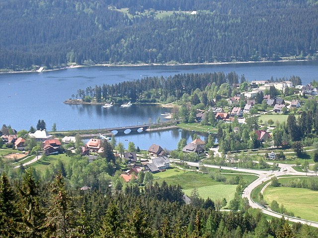

Schluchsee
- municipality in Baden-Württemberg, Germany
Schluchsee is a beautiful destination for hiking located in the Black Forest region of Baden-Württemberg, Germany. This area is renowned for its picturesque landscapes, dense forests, and numerous lakes. Here’s an overview of what you can expect when hiking around Schluchsee:...
- Country:

- Postal Code: 79859
- Local Dialing Code: 07656
- Licence Plate Code: FR
- Coordinates: 47° 49' 10" N, 8° 10' 51" E


- GPS tracks (wikiloc): [Link]
- AboveSeaLevel: 952 м m
- Area: 69.43 sq km
- Population: 2516
- Web site: [Link]


Glottertal
- municipality in Baden-Württemberg, Germany
Glottertal, located in the Black Forest region of Germany, is a wonderful destination for hiking enthusiasts. The area is characterized by its stunning natural beauty, rolling hills, dense forests, and charming villages. Here are some key points to consider if you're planning to hike in Glottertal:...
- Country:

- Postal Code: 79286
- Local Dialing Code: 07684
- Licence Plate Code: FR
- Coordinates: 48° 3' 0" N, 7° 56' 0" E


- GPS tracks (wikiloc): [Link]
- AboveSeaLevel: 350 м m
- Area: 30.76 sq km
- Population: 3153
- Web site: [Link]


Löffingen
- town in Baden-Württemberg, Germany
Löffingen, located in the Black Forest region of Germany, offers a variety of beautiful hiking opportunities amidst stunning natural scenery. Here are some key points to consider when planning a hiking trip in Löffingen:...
- Country:

- Postal Code: 79843
- Local Dialing Code: 07654
- Licence Plate Code: FR
- Coordinates: 47° 53' 2" N, 8° 20' 37" E


- GPS tracks (wikiloc): [Link]
- AboveSeaLevel: 800 м m
- Area: 88.03 sq km
- Population: 7517
- Web site: [Link]


Ebringen
- municipality in Baden-Württemberg, Germany
Ebringen is a charming village located in the Baden-Württemberg region of Germany, nestled on the edge of the Black Forest and just a few kilometers from Freiburg. This area is a great destination for hiking enthusiasts, offering various trails that showcase the beautiful landscape, rich flora, and picturesque views....
- Country:

- Postal Code: 79285
- Local Dialing Code: 07664
- Licence Plate Code: FR
- Coordinates: 47° 57' 28" N, 7° 46' 35" E


- GPS tracks (wikiloc): [Link]
- AboveSeaLevel: 268 м m
- Area: 8.18 sq km
- Population: 2785
- Web site: [Link]

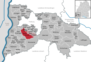
Ehrenkirchen
- municipality in Baden-Württemberg, Germany
Ehrenkirchen is a small town located in the district of Breisgau-Hochschwarzwald in Baden-Württemberg, Germany. It's surrounded by scenic landscapes perfect for hiking and outdoor activities....
- Country:

- Postal Code: 79238
- Local Dialing Code: 07633
- Licence Plate Code: FR
- Coordinates: 47° 54' 55" N, 7° 45' 7" E


- GPS tracks (wikiloc): [Link]
- AboveSeaLevel: 265 м m
- Area: 37.8 sq km
- Population: 7182
- Web site: [Link]


Umkirch
- municipality in Baden-Württemberg, Germany
Umkirch is a charming village located near Freiburg in the southwestern part of Germany, surrounded by the scenic landscapes of the Black Forest and the picturesque countryside of Baden-Württemberg. Hiking in and around Umkirch offers a variety of trails catering to different skill levels and interests....
- Country:

- Postal Code: 79224
- Local Dialing Code: 07665
- Licence Plate Code: FR
- Coordinates: 48° 1' 58" N, 7° 45' 49" E


- GPS tracks (wikiloc): [Link]
- AboveSeaLevel: 219 м m
- Area: 8.72 sq km
- Population: 5731
- Web site: [Link]
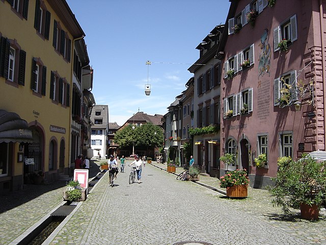

Staufen im Breisgau
- town in Baden-Württemberg, Germany
Staufen im Breisgau, located in the scenic Black Forest region of Germany, is a great destination for hiking enthusiasts. The area offers stunning landscapes, rolling hills, and numerous trails suitable for all levels of hikers....
- Country:

- Postal Code: 79219
- Local Dialing Code: 07633
- Licence Plate Code: FR
- Coordinates: 47° 52' 53" N, 7° 43' 53" E


- GPS tracks (wikiloc): [Link]
- AboveSeaLevel: 284 м m
- Area: 23.26 sq km
- Population: 7715
- Web site: [Link]


Kirchzarten
- municipality in Baden-Württemberg, Germany
Kirchzarten, located in the Breisgau region of Germany, is an excellent starting point for hiking enthusiasts. Nestled at the foot of the Black Forest, it offers a variety of trails that cater to different skill levels and preferences. Here are some highlights of hiking in and around Kirchzarten:...
- Country:

- Postal Code: 79199
- Local Dialing Code: 07661
- Licence Plate Code: FR
- Coordinates: 47° 58' 0" N, 7° 57' 0" E


- GPS tracks (wikiloc): [Link]
- AboveSeaLevel: 380 м m
- Area: 21.14 sq km
- Population: 9830
- Web site: [Link]
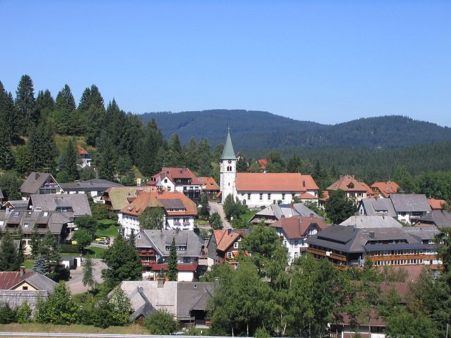

Feldberg
- municipality in Baden-Württemberg, Germany
Feldberg is a prominent mountain in the Black Forest region of Baden-Württemberg, Germany, and is known for its stunning landscapes, diverse flora and fauna, and excellent hiking opportunities. Here’s what you need to know about hiking in Feldberg:...
- Country:

- Postal Code: 79868
- Local Dialing Code: 07655; 07676
- Licence Plate Code: FR
- Coordinates: 47° 51' 22" N, 8° 6' 42" E


- GPS tracks (wikiloc): [Link]
- AboveSeaLevel: 1277 м m
- Area: 24.97 sq km
- Population: 1977
- Web site: [Link]


Eschbach
- municipality in Baden-Württemberg, Germany
Eschbach is a charming village located in the district of Breisgau-Hochschwarzwald in Baden-Württemberg, Germany. The area is renowned for its beautiful landscapes, wooded hills, and proximity to the Black Forest, making it an excellent destination for hiking enthusiasts....
- Country:

- Postal Code: 79427
- Local Dialing Code: 07634
- Licence Plate Code: FR
- Coordinates: 47° 53' 24" N, 7° 39' 18" E


- GPS tracks (wikiloc): [Link]
- AboveSeaLevel: 246 м m
- Area: 10.03 sq km
- Population: 2417
- Web site: [Link]


Breitnau
- municipality in Baden-Württemberg, Germany
Breitnau, located in the Black Forest region of Germany, offers stunning landscapes and a variety of hiking opportunities suitable for all skill levels. The area is known for its lush forests, rolling hills, and picturesque valleys, making it a perfect destination for nature lovers and outdoor enthusiasts....
- Country:

- Postal Code: 79874
- Local Dialing Code: 07652
- Licence Plate Code: FR
- Coordinates: 47° 56' 0" N, 8° 5' 0" E


- GPS tracks (wikiloc): [Link]
- AboveSeaLevel: 968 м m
- Area: 39.9 sq km
- Population: 1734
- Web site: [Link]


Gundelfingen
- municipality in Baden-Württemberg, Germany
Gundelfingen, located in the Baden-Württemberg region of Germany, is surrounded by beautiful landscapes that make it an appealing destination for hikers. The area features a mix of forests, hills, and rivers, providing a variety of trails for different skill levels....
- Country:

- Postal Code: 79194
- Local Dialing Code: 0761
- Licence Plate Code: FR
- Coordinates: 48° 2' 33" N, 7° 51' 57" E


- GPS tracks (wikiloc): [Link]
- AboveSeaLevel: 235 м m
- Area: 14.28 sq km
- Population: 11345
- Web site: [Link]


Stegen
- municipality in Baden-Württemberg, Germany
Stegen, located in the Black Forest region of Germany, offers a variety of beautiful hiking trails that cater to different skill levels and preferences. The area is characterized by stunning natural scenery, including dense forests, rolling hills, and picturesque views....
- Country:

- Postal Code: 79252
- Local Dialing Code: 07661
- Licence Plate Code: FR
- Coordinates: 47° 58' 58" N, 7° 57' 50" E


- GPS tracks (wikiloc): [Link]
- AboveSeaLevel: 408 м m
- Area: 26.32 sq km
- Population: 4440
- Web site: [Link]

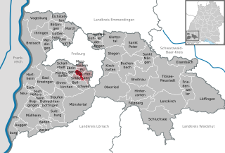
Wittnau
- municipality in Baden-Württemberg, Germany
Wittnau is a charming village located in the picturesque region of Baden-Württemberg, Germany. It's surrounded by natural beauty, making it an excellent destination for hiking enthusiasts. Here are some highlights and tips for hiking in Wittnau:...
- Country:

- Postal Code: 79299
- Local Dialing Code: 0761
- Licence Plate Code: FR
- Coordinates: 47° 56' 45" N, 7° 48' 53" E


- GPS tracks (wikiloc): [Link]
- AboveSeaLevel: 378 м m
- Area: 5.04 sq km
- Population: 1459
- Web site: [Link]

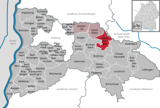
Sankt Märgen
- municipality in Baden-Württemberg, Germany
Sankt Märgen is a picturesque village located in the Black Forest region of Germany. It's a fantastic destination for hiking enthusiasts, offering a variety of trails that cater to different skill levels, making it suitable for both casual walkers and more experienced hikers....
- Country:

- Postal Code: 79274
- Local Dialing Code: 07669
- Licence Plate Code: FR
- Coordinates: 48° 0' 30" N, 8° 5' 37" E


- GPS tracks (wikiloc): [Link]
- AboveSeaLevel: 895 м m
- Area: 33.32 sq km
- Population: 1840
- Web site: [Link]


Ihringen
- municipality in Baden-Württemberg, Germany
Ihringen, located in the scenic Baden-Württemberg region of Germany, offers a charming landscape for hiking enthusiasts. Nestled on the edge of the Kaiserstuhl mountain range and close to the Basque region of France, it's known for its rolling hills, vineyards, and stunning views. Here are some highlights for hiking in Ihringen:...
- Country:

- Postal Code: 79241
- Local Dialing Code: 07668
- Licence Plate Code: FR
- Coordinates: 48° 2' 35" N, 7° 38' 51" E


- GPS tracks (wikiloc): [Link]
- AboveSeaLevel: 198 м m
- Area: 23 sq km
- Population: 5976
- Web site: [Link]
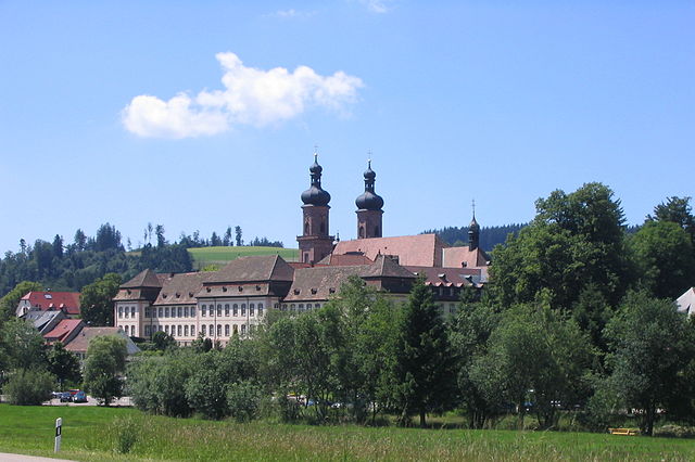

Sankt Peter
- municipality in Baden-Württemberg, Germany
Sankt Peter, located in the Black Forest region of Baden-Württemberg, Germany, is renowned for its beautiful landscapes, dense forests, and charming villages. The area offers a variety of hiking trails suitable for all skill levels, making it an excellent destination for hiking enthusiasts....
- Country:

- Postal Code: 79271
- Local Dialing Code: 07660
- Licence Plate Code: FR
- Coordinates: 48° 0' 59" N, 8° 1' 57" E


- GPS tracks (wikiloc): [Link]
- AboveSeaLevel: 716 м m
- Area: 35.93 sq km
- Population: 2560
- Web site: [Link]
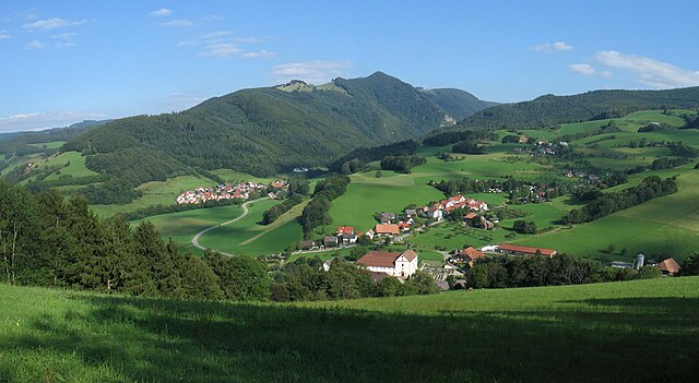

Oberried
- municipality in Baden-Württemberg, Germany
Oberried, located in the picturesque region of Baden-Württemberg, Germany, offers a range of beautiful hiking opportunities for both beginners and experienced hikers. Nestled near the edge of the Black Forest, this area is known for its stunning natural landscapes, dense forests, and serene trails....
- Country:

- Postal Code: 79254
- Local Dialing Code: 07661
- Licence Plate Code: FR
- Coordinates: 47° 55' 55" N, 7° 56' 50" E


- GPS tracks (wikiloc): [Link]
- AboveSeaLevel: 460 м m
- Area: 66.32 sq km
- Population: 2827
- Web site: [Link]
March
- municipality in Baden-Württemberg, Germany
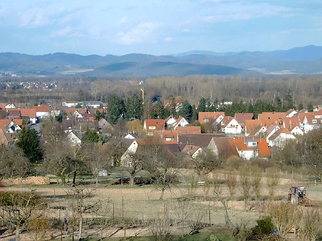
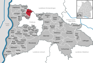
Hiking in Breisgau, located in the southwest of Germany, is a wonderful experience in March as the region begins to awaken from winter. Here are some key points to consider:...
- Country:

- Postal Code: 79232
- Local Dialing Code: 07665
- Licence Plate Code: FR
- Coordinates: 48° 3' 22" N, 7° 46' 55" E


- GPS tracks (wikiloc): [Link]
- AboveSeaLevel: 201 м m
- Area: 17.79 sq km
- Population: 8914
- Web site: [Link]


Schallstadt
- municipality in Baden-Württemberg, Germany
Schallstadt, located in the Baden-Württemberg region of Germany, is a charming small town situated near Freiburg and offers access to several beautiful hiking trails. The surrounding area is characterized by stunning landscapes, vineyards, and forests, making it an excellent destination for outdoor enthusiasts. Here are some highlights of hiking in and around Schallstadt:...
- Country:

- Postal Code: 79227
- Local Dialing Code: 07664
- Licence Plate Code: FR
- Coordinates: 47° 57' 29" N, 7° 45' 1" E


- GPS tracks (wikiloc): [Link]
- AboveSeaLevel: 223 м m
- Area: 19.56 sq km
- Population: 6053
- Web site: [Link]

Eichstetten am Kaiserstuhl
- municipality in Baden-Württemberg, Germany
 Hiking in Eichstetten am Kaiserstuhl
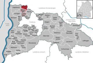
Eichstetten am Kaiserstuhl is a charming village located in the Kaiserstuhl region of Germany, known for its beautiful landscapes, vineyards, and hiking opportunities. Here are some highlights and tips for hiking in the area:...
- Country:

- Postal Code: 79356
- Local Dialing Code: 07663
- Licence Plate Code: FR
- Coordinates: 48° 5' 39" N, 7° 44' 40" E


- GPS tracks (wikiloc): [Link]
- AboveSeaLevel: 193 м m
- Area: 12.31 sq km
- Population: 3442
- Web site: [Link]


Merzhausen
- municipality in Baden-Württemberg, Germany
Merzhausen, a small town located near Freiburg im Breisgau in the Black Forest region of Germany, offers beautiful hiking opportunities, especially for nature enthusiasts and those looking to explore the scenic landscapes of southern Germany....
- Country:

- Postal Code: 79249
- Local Dialing Code: 0761
- Licence Plate Code: FR
- Coordinates: 47° 58' 0" N, 7° 50' 0" E


- GPS tracks (wikiloc): [Link]
- AboveSeaLevel: 351 м m
- Area: 2.76 sq km
- Population: 5111
- Web site: [Link]


Bollschweil
- municipality in Baden-Württemberg, Germany
Bollschweil is a small village located in the Southern Black Forest region of Germany, near Freiburg im Breisgau. It's a great area for hiking enthusiasts due to its picturesque landscapes, diverse terrain, and well-marked trails. Here are some highlights about hiking in and around Bollschweil:...
- Country:

- Postal Code: 79283
- Local Dialing Code: 07633
- Licence Plate Code: FR
- Coordinates: 47° 55' 14" N, 7° 47' 21" E


- GPS tracks (wikiloc): [Link]
- AboveSeaLevel: 328 м m
- Area: 16.43 sq km
- Population: 2272
- Web site: [Link]


Pfaffenweiler
- municipality in Baden-Württemberg, Germany
Pfaffenweiler, a charming village in the Baden-Württemberg region of Germany, offers an array of hiking opportunities that cater to various skill levels. The area is known for its picturesque landscapes, vineyards, and scenic paths that traverse the surrounding hills and forests....
- Country:

- Postal Code: 79292
- Local Dialing Code: 07664
- Licence Plate Code: FR
- Coordinates: 47° 56' 0" N, 7° 45' 0" E


- GPS tracks (wikiloc): [Link]
- AboveSeaLevel: 260 м m
- Area: 3.61 sq km
- Population: 2519
- Web site: [Link]


Sölden
- municipality in Baden-Württemberg, Germany
Sölden is a charming municipality located in the state of Baden-Württemberg, Germany. It is known for its beautiful landscapes, picturesque trails, and outdoor activities. While Sölden itself may not have the extensive hiking options found in larger mountains or national parks, the surrounding areas do provide an array of trails suitable for various skill levels....
- Country:

- Postal Code: 79294
- Local Dialing Code: 0761
- Licence Plate Code: FR
- Coordinates: 47° 55' 56" N, 7° 48' 42" E


- GPS tracks (wikiloc): [Link]
- AboveSeaLevel: 394 м m
- Area: 3.8 sq km
- Population: 1259
- Web site: [Link]
Shares border with regions:


Freiburg im Breisgau
- large city in Baden-Württemberg, Germany
 Hiking in Freiburg im Breisgau
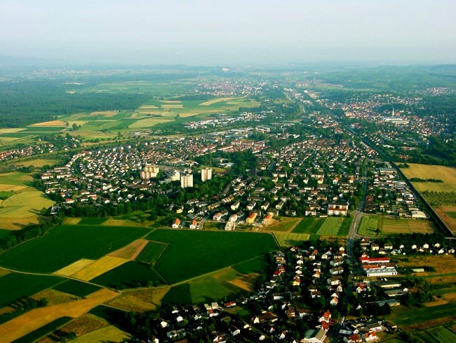
Freiburg im Breisgau, located in the southwest of Germany, is a wonderful base for hiking enthusiasts. Nestled at the edge of the Black Forest, Freiburg not only boasts a charming old town but also provides access to numerous hiking trails that vary in difficulty and scenery. Here are some highlights about hiking in the area:...
- Country:

- Postal Code: 79098–79117
- Local Dialing Code: 07665; 07664; 0761
- Licence Plate Code: FR
- Coordinates: 47° 59' 41" N, 7° 50' 59" E


- GPS tracks (wikiloc): [Link]
- AboveSeaLevel: 278 м m
- Area: 153.04 sq km
- Population: 227590
- Web site: [Link]
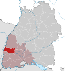
Emmendingen
- district of Baden-Württemberg, Germany
Emmendingen, located in the southwestern part of Germany in the state of Baden-Württemberg, offers beautiful hiking opportunities with its diverse landscapes, including rolling hills, forests, vineyards, and the scenic Black Forest nearby. Here are some highlights and tips for hiking in the Emmendingen district:...
- Country:

- Capital: Emmendingen
- Licence Plate Code: EM
- Coordinates: 48° 6' 0" N, 7° 48' 0" E


- GPS tracks (wikiloc): [Link]
- AboveSeaLevel: 352 м m
- Area: 679.90 sq km
- Population: 157399
- Web site: [Link]

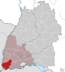
Lörrach
- district of Baden-Württemberg, Germany
Lörrach is a district located in southern Germany, near the borders with Switzerland and France. It is surrounded by the scenic beauty of the Black Forest and offers a variety of hiking opportunities for outdoor enthusiasts. Here’s some information about hiking in the Lörrach area:...
- Country:

- Capital: Lörrach
- Licence Plate Code: LÖ
- Coordinates: 47° 39' 0" N, 7° 42' 0" E


- GPS tracks (wikiloc): [Link]
- AboveSeaLevel: 621 м m
- Area: 806.81 sq km
- Population: 220606
- Web site: [Link]


Waldshut
- district of Baden-Württemberg, Germany
Waldshut is a beautiful district in the state of Baden-Württemberg, Germany, known for its stunning natural landscapes, which make it an excellent destination for hikers. The district is situated near the borders of Switzerland and provides a variety of hiking opportunities suitable for different skill levels. Here are some highlights and suggestions for hiking in Waldshut:...
- Country:

- Capital: Waldshut-Tiengen
- Licence Plate Code: WT
- Coordinates: 47° 37' 48" N, 8° 12' 0" E


- GPS tracks (wikiloc): [Link]
- AboveSeaLevel: 729 м m
- Area: 1131.19 sq km
- Population: 163699
- Web site: [Link]

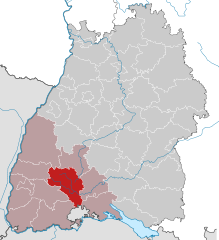
Schwarzwald-Baar
- district of Baden-Württemberg, Germany
The Schwarzwald-Baar-Kreis in Baden-Württemberg, Germany, offers a diverse range of hiking opportunities, with its stunning landscapes characterized by dense forests, rolling hills, and picturesque villages. Here are some highlights and tips for hiking in the Schwarzwald-Baar-Kreis:...
- Country:

- Capital: Villingen-Schwenningen
- Licence Plate Code: VS
- Coordinates: 48° 1' 0" N, 8° 26' 0" E


- GPS tracks (wikiloc): [Link]
- AboveSeaLevel: 749 м m
- Area: 1025.24 sq km
- Web site: [Link]

