Brousse-le-Château (Brousse-le-Château)

- commune in Aveyron, France
- Country:

- Postal Code: 12480
- Coordinates: 43° 59' 50" N, 2° 37' 30" E


- GPS tracks (wikiloc): [Link]
- Area: 15.54 sq km
- Population: 154
- Wikipedia en: wiki(en)
- Wikipedia: wiki(fr)
- Wikidata storage: Wikidata: Q473963
- Wikipedia Commons Category: [Link]
- Freebase ID: [/m/0dy8zj]
- GeoNames ID: Alt: [6447062]
- SIREN number: [211200381]
- BnF ID: [15247014d]
- PACTOLS thesaurus ID: [pcrtmXsKHJ0N1h]
- INSEE municipality code: 12038
Shares border with regions:


Broquiès
- commune in Aveyron, France
- Country:
- Postal Code: 12480
- Coordinates: 44° 0' 18" N, 2° 41' 45" E
- GPS tracks (wikiloc): [Link]
- Area: 37.99 sq km
- Population: 606
- Web site: [Link]
Connac
- commune in Aveyron, France
- Country:
- Postal Code: 12170
- Coordinates: 44° 1' 12" N, 2° 36' 7" E
- GPS tracks (wikiloc): [Link]
- Area: 10.69 sq km
- Population: 108
- Web site: [Link]
Lestrade-et-Thouels
- commune in Aveyron, France
- Country:
- Postal Code: 12430
- Coordinates: 44° 3' 33" N, 2° 39' 34" E
- GPS tracks (wikiloc): [Link]
- Area: 42.27 sq km
- Population: 479


Saint-Izaire
- commune in Aveyron, France
- Country:
- Postal Code: 12480
- Coordinates: 43° 58' 29" N, 2° 43' 14" E
- GPS tracks (wikiloc): [Link]
- Area: 34.48 sq km
- Population: 304

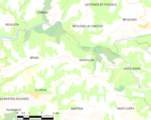
Montclar
- commune in Aveyron, France
- Country:
- Postal Code: 12550
- Coordinates: 43° 58' 3" N, 2° 38' 47" E
- GPS tracks (wikiloc): [Link]
- Area: 12.8 sq km
- Population: 169
- Web site: [Link]