Broquiès (Broquiès)

- commune in Aveyron, France
- Country:

- Postal Code: 12480
- Coordinates: 44° 0' 18" N, 2° 41' 45" E


- GPS tracks (wikiloc): [Link]
- Area: 37.99 sq km
- Population: 606
- Web site: http://www.broquies.fr
- Wikipedia en: wiki(en)
- Wikipedia: wiki(fr)
- Wikidata storage: Wikidata: Q1020505
- Wikipedia Commons Category: [Link]
- Freebase ID: [/m/03m930v]
- GeoNames ID: Alt: [6447061]
- SIREN number: [211200373]
- BnF ID: [152470132]
- PACTOLS thesaurus ID: [pcrtZdbsilq96R]
- INSEE municipality code: 12037
Shares border with regions:
Les Costes-Gozon
- commune in Aveyron, France
- Country:
- Postal Code: 12400
- Coordinates: 44° 1' 3" N, 2° 48' 8" E
- GPS tracks (wikiloc): [Link]
- Area: 20.33 sq km
- Population: 182
Lestrade-et-Thouels
- commune in Aveyron, France
- Country:
- Postal Code: 12430
- Coordinates: 44° 3' 33" N, 2° 39' 34" E
- GPS tracks (wikiloc): [Link]
- Area: 42.27 sq km
- Population: 479


Le Truel
- commune in Aveyron, France
- Country:
- Postal Code: 12430
- Coordinates: 44° 2' 58" N, 2° 45' 18" E
- GPS tracks (wikiloc): [Link]
- Area: 26.48 sq km
- Population: 344


Saint-Izaire
- commune in Aveyron, France
- Country:
- Postal Code: 12480
- Coordinates: 43° 58' 29" N, 2° 43' 14" E
- GPS tracks (wikiloc): [Link]
- Area: 34.48 sq km
- Population: 304
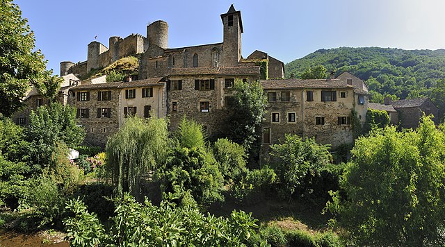

Brousse-le-Château
- commune in Aveyron, France
- Country:
- Postal Code: 12480
- Coordinates: 43° 59' 50" N, 2° 37' 30" E
- GPS tracks (wikiloc): [Link]
- Area: 15.54 sq km
- Population: 154
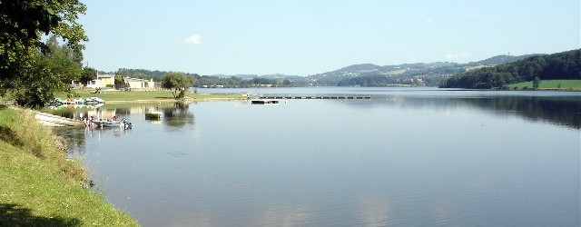

Villefranche-de-Panat
- commune in Aveyron, France
- Country:
- Postal Code: 12430
- Coordinates: 44° 5' 18" N, 2° 42' 17" E
- GPS tracks (wikiloc): [Link]
- Area: 29.13 sq km
- Population: 730
- Web site: [Link]