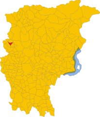
Brumano (Brumano)
.svg)
- Italian comune
 Hiking in Brumano
Brumano is a picturesque town located in the Lombardy region of Italy, nestled in the Bergamo Alps. It offers a variety of hiking opportunities that cater to different skill levels, making it a great destination for outdoor enthusiasts.
Hiking Trails
-
Sentiero dei Fiori: This is a beautiful trail known for its wildflowers and breathtaking views of the surrounding valleys and mountains. It’s relatively easy, making it suitable for families and beginners.
-
Trail to Monte Alben: For those looking for a more challenging hike, the trail to Monte Alben offers stunning panoramic views. The ascent is steeper, and the terrain can be rugged, so it's best suited for experienced hikers.
-
Valle Imagna: This area offers several hiking paths that wind through lush landscapes, quaint villages, and historical sites. The trails here can vary from easy walks to more strenuous hikes.
-
The Path of the Mills: This hike takes you through the historical remnants of old mills and agricultural sites, providing a mix of nature and history. It’s a moderate trail ideal for those who enjoy both aspects.
Considerations
- Best Time to Visit: The ideal times for hiking in Brumano are spring (April to June) and early autumn (September to October), when the weather is mild and the scenery is vibrant.
- Weather: Always check the weather forecast before heading out, as conditions can change rapidly in the mountains.
- Safety: Ensure you wear appropriate footwear, carry enough water, snacks, and a map or GPS device. Inform someone about your hiking plans for safety.
Local Amenities
Brumano offers several accommodations and dining options to help you recharge after a day on the trails. Local eateries typically serve traditional Bergamasque cuisine, which is a delightful way to experience the local culture.
Overall, hiking in Brumano provides a fantastic opportunity to explore the natural beauty and rich history of the Italian Alps. Happy hiking!
- Country:

- Postal Code: 24037
- Local Dialing Code: 035
- Licence Plate Code: BG
- Coordinates: 45° 51' 0" N, 9° 30' 0" E


- GPS tracks (wikiloc): [Link]
- AboveSeaLevel: 911 м m
- Area: 8.14 sq km
- Population: 119
- Web site: http://www.comune.brumano.bg.it/
- Wikipedia en: wiki(en)
- Wikipedia: wiki(it)
- Wikidata storage: Wikidata: Q100016
- Wikipedia Commons Gallery: [Link]
- Wikipedia Commons Category: [Link]
- Freebase ID: [/m/0gj8_f]
- GeoNames ID: Alt: [6540344]
- OSM relation ID: [46296]
- ISTAT ID: 016041
- Italian cadastre code: B217
Shares border with regions:


Fuipiano Valle Imagna
- Italian comune
Hiking in Fuipiano Valle Imagna
Fuipiano Valle Imagna is a picturesque area located in the Lombardy region of Italy, surrounded by the stunning natural beauty of the Italian Alps. This region is known for its serene landscapes, lush greenery, and traditional Italian villages, making it a wonderful destination for hikers of all skill levels....
- Country:
- Postal Code: 24030
- Local Dialing Code: 035
- Licence Plate Code: BG
- Coordinates: 45° 51' 0" N, 9° 32' 0" E
- GPS tracks (wikiloc): [Link]
- AboveSeaLevel: 1019 м m
- Area: 4.28 sq km
- Population: 211
- Web site: [Link]

Locatello
- Italian comune
Hiking in Locatello
Locatello, located in the province of Bergamo in northern Italy, offers a range of hiking opportunities, particularly for those who enjoy the beauty of the Italian Alps and surrounding landscapes. Here are some highlights and tips for hiking in Locatello:...
- Country:
- Postal Code: 24030
- Local Dialing Code: 035
- Licence Plate Code: BG
- Coordinates: 45° 50' 0" N, 9° 32' 0" E
- GPS tracks (wikiloc): [Link]
- AboveSeaLevel: 557 м m
- Area: 3.79 sq km
- Population: 810
- Web site: [Link]


Rota d'Imagna
- Italian comune
Hiking in Rota d'Imagna
Rota d'Imagna, located in the Bergamo region of northern Italy, offers beautiful hiking opportunities framed by stunning landscapes and rich natural beauty. The area is characterized by its rolling hills, valleys, and picturesque trails, making it a great destination for hikers of various skill levels....
- Country:
- Postal Code: 24037
- Local Dialing Code: 035
- Licence Plate Code: BG
- Coordinates: 45° 50' 0" N, 9° 31' 0" E
- GPS tracks (wikiloc): [Link]
- AboveSeaLevel: 690 м m
- Area: 6.03 sq km
- Population: 920
- Web site: [Link]


Vedeseta
- Italian comune
Hiking in Vedeseta
Vedeseta is a picturesque village located in the province of Bergamo in Lombardy, Italy, known for its stunning natural landscapes and hiking opportunities. The area is surrounded by the Italian Alps and offers various trails suitable for different skill levels, making it an attractive destination for hikers....
- Country:
- Postal Code: 24010
- Local Dialing Code: 0345
- Licence Plate Code: BG
- Coordinates: 45° 53' 27" N, 9° 32' 23" E
- GPS tracks (wikiloc): [Link]
- AboveSeaLevel: 820 м m
- Area: 19.29 sq km
- Population: 205
- Web site: [Link]
Erve
- Italian comune
Hiking in Erve
Erve is not as widely recognized as some other hiking destinations, but it can be a fantastic place for those looking for a quieter, more off-the-beaten-path experience. When hiking in Erve or any similar region, here are a few points to consider:...
- Country:
- Postal Code: 23805
- Local Dialing Code: 0341
- Licence Plate Code: LC
- Coordinates: 45° 49' 0" N, 9° 27' 0" E
- GPS tracks (wikiloc): [Link]
- AboveSeaLevel: 559 м m
- Area: 6.2 sq km
- Population: 713
- Web site: [Link]


Morterone
- Italian comune
Hiking in Morterone
Morterone, located in the Lombardy region of Italy, is a small mountain village nestled in the foothills of the Grigna massif. It's a fantastic destination for hikers looking to explore the natural beauty of the Italian Alps, offering a range of trails suitable for various skill levels....
- Country:
- Postal Code: 23811
- Local Dialing Code: 0341
- Licence Plate Code: LC
- Coordinates: 45° 52' 26" N, 9° 28' 58" E
- GPS tracks (wikiloc): [Link]
- AboveSeaLevel: 1070 м m
- Area: 13.71 sq km
- Population: 35
- Web site: [Link]


Lecco
- Italian comune
Hiking in Lecco
Lecco, located in the Lombardy region of northern Italy, is a fantastic destination for hiking enthusiasts. Nestled at the southeastern tip of Lake Como, it offers stunning natural landscapes, diverse trails, and breathtaking views of the surrounding mountains, including the Grigna and Resegone ranges....
- Country:
- Postal Code: 23900
- Local Dialing Code: 0341
- Licence Plate Code: LC
- Coordinates: 45° 51' 0" N, 9° 24' 0" E
- GPS tracks (wikiloc): [Link]
- AboveSeaLevel: 214 м m
- Area: 45.14 sq km
- Population: 48177
- Web site: [Link]