
Lecco (Lecco)
.svg)
- Italian comune
 Hiking in Lecco
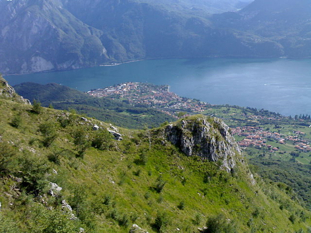
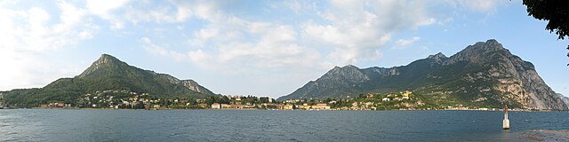
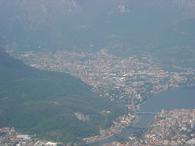
Lecco, located in the Lombardy region of northern Italy, is a fantastic destination for hiking enthusiasts. Nestled at the southeastern tip of Lake Como, it offers stunning natural landscapes, diverse trails, and breathtaking views of the surrounding mountains, including the Grigna and Resegone ranges.
Popular Hiking Trails in Lecco:
-
Piani d’Erna: This area can be accessed via a funicular from Lecco and offers several trails suitable for various skill levels. The panoramic views of Lake Como and the surrounding peaks are breathtaking.
-
Monte Barro: Part of a regional park, this mountain offers trails that range from easy walks to more challenging hikes. The summit provides a spectacular view of Lake Como and the surrounding countryside.
-
Grigna Settentrionale: This is a favorite for more experienced hikers. The trails here can be quite challenging, but they lead to rewarding vistas and beautiful alpine scenery. The ascent to the summit from the east can be strenuous but is worth the effort.
-
Sentiero del Viandante: This ancient pathway runs along the eastern shore of Lake Como and traverses through quaint villages and lush landscapes. It's a moderate hike, perfect for those who want to enjoy both nature and local culture.
-
Rifugio Azzoni and Monte Resegone: Starting from the town of Morterone or the Rifugio Azzoni, you can hike up to the summit of the Resegone, which resembles a serrated knife. The trail is rugged but offers panoramic views and the chance to spot local wildlife.
Tips for Hiking in Lecco:
-
Season Considerations: Spring and early autumn are ideal for hiking, as the weather is usually mild. Summer can get hot, and winter hiking requires gear for snow and icy conditions.
-
Stay Hydrated: Always carry enough water, especially on longer hikes. Some trails may not have water sources.
-
Trail Maps: It's wise to have a map or GPS device since trail markings can vary. Local tourist offices often provide maps and additional resources.
-
Proper Gear: Wear suitable hiking boots and clothing. The terrain can be rocky and uneven.
-
Respect Nature: Adhere to Leave No Trace principles to preserve the beauty of the area for future visitors.
Lecco offers a blend of natural beauty, outdoor adventure, and cultural experiences, making it an excellent choice for hiking enthusiasts of all levels. Whether you're looking for a casual lakeside stroll or a challenging mountain ascent, you’ll find something that suits your interest.
- Country:

- Postal Code: 23900
- Local Dialing Code: 0341
- Licence Plate Code: LC
- Coordinates: 45° 51' 0" N, 9° 24' 0" E


- GPS tracks (wikiloc): [Link]
- AboveSeaLevel: 214 м m
- Area: 45.14 sq km
- Population: 48177
- Web site: http://www.comune.lecco.it
- Wikipedia en: wiki(en)
- Wikipedia: wiki(it)
- Wikidata storage: Wikidata: Q6237
- Wikipedia Commons Gallery: [Link]
- Wikipedia Commons Category: [Link]
- Wikipedia Commons Maps Category: [Link]
- Freebase ID: [/m/01l24q]
- GeoNames ID: Alt: [6541997]
- VIAF ID: Alt: [263626055]
- OSM relation ID: [46229]
- GND ID: Alt: [4256535-2]
- archINFORM location ID: [11371]
- MusicBrainz area ID: [8887d0f8-1d69-47b4-b386-114ca8393dff]
- Quora topic ID: [Lecco-Italy]
- UN/LOCODE: [ITLCO]
- Encyclopædia Britannica Online ID: [place/Lecco-Italy]
- Great Russian Encyclopedia Online ID: [2138203]
- Digital Atlas of the Roman Empire ID: [17167]
- National Library of Israel ID: [000979200]
- Trismegistos Geo ID: [31547]
- Treccani ID: [lecco]
- ISTAT ID: 097042
- Italian cadastre code: E507
- LombardiaBeniCulturali toponym ID: 5000183
Shares border with regions:


Brumano
- Italian comune
Hiking in Brumano
Brumano is a picturesque town located in the Lombardy region of Italy, nestled in the Bergamo Alps. It offers a variety of hiking opportunities that cater to different skill levels, making it a great destination for outdoor enthusiasts....
- Country:
- Postal Code: 24037
- Local Dialing Code: 035
- Licence Plate Code: BG
- Coordinates: 45° 51' 0" N, 9° 30' 0" E
- GPS tracks (wikiloc): [Link]
- AboveSeaLevel: 911 м m
- Area: 8.14 sq km
- Population: 119
- Web site: [Link]

Abbadia Lariana
- Italian comune in the Province of Lecco
Hiking in Abbadia Lariana
Abbadia Lariana is a charming village located on the eastern shore of Lake Como in Italy, and it offers a variety of hiking opportunities ranging from easy walks to more challenging trails. The region is characterized by its stunning natural scenery, including lush forests, rugged mountains, and beautiful lake views....
- Country:
- Postal Code: 23821
- Local Dialing Code: 0341
- Licence Plate Code: LC
- Coordinates: 45° 54' 0" N, 9° 20' 0" E
- GPS tracks (wikiloc): [Link]
- AboveSeaLevel: 204 м m
- Area: 16.67 sq km
- Population: 3216
- Web site: [Link]

Malgrate
- Italian comune
Hiking in Malgrate
Malgrate is a picturesque town located in the Lombardy region of Italy, situated along the eastern shore of Lake Lecco, which is part of the larger Lake Como area. This region offers a variety of opportunities for hiking, with stunning views of the lake and surrounding mountains....
- Country:
- Postal Code: 23864
- Local Dialing Code: 0341
- Licence Plate Code: LC
- Coordinates: 45° 50' 56" N, 9° 22' 35" E
- GPS tracks (wikiloc): [Link]
- AboveSeaLevel: 231 м m
- Area: 1.9 sq km
- Population: 4271
- Web site: [Link]


Pescate
- Italian comune
Hiking in Pescate
Pescate, a small town located in the Lombardy region of Italy, offers a stunning backdrop for hiking enthusiasts due to its proximity to beautiful natural landscapes, including Lake Lecco and the surrounding mountains. Here are some highlights for those interested in hiking in the Pescate area:...
- Country:
- Postal Code: 23855
- Local Dialing Code: 0341
- Licence Plate Code: LC
- Coordinates: 45° 50' 0" N, 9° 24' 0" E
- GPS tracks (wikiloc): [Link]
- AboveSeaLevel: 214 м m
- Area: 2.1 sq km
- Population: 2231
- Web site: [Link]


Vercurago
- Italian comune
Hiking in Vercurago
Vercurago, located in the Lombardy region of Italy near Lake Lecco, offers a scenic backdrop for hiking enthusiasts. The area is characterized by its picturesque landscapes, including mountains, forests, and stunning views of the lake and surrounding hills....
- Country:
- Postal Code: 23808
- Local Dialing Code: 0341
- Licence Plate Code: LC
- Coordinates: 45° 49' 0" N, 9° 25' 0" E
- GPS tracks (wikiloc): [Link]
- AboveSeaLevel: 225 м m
- Area: 2.12 sq km
- Population: 2818
- Web site: [Link]
Ballabio
- Italian comune
Hiking in Ballabio
Ballabio, located in the Lombardy region of Italy, is a charming mountain village situated near the Lecco area and is an excellent destination for hiking enthusiasts. The surrounding mountains, particularly the Grigna range, offer a variety of trails suited for different skill levels, from easy walks to more challenging ascents....
- Country:
- Postal Code: 23811
- Local Dialing Code: 0341
- Licence Plate Code: LC
- Coordinates: 45° 54' 0" N, 9° 25' 0" E
- GPS tracks (wikiloc): [Link]
- AboveSeaLevel: 661 м m
- Area: 15.04 sq km
- Population: 4052
- Web site: [Link]
Erve
- Italian comune
Hiking in Erve
Erve is not as widely recognized as some other hiking destinations, but it can be a fantastic place for those looking for a quieter, more off-the-beaten-path experience. When hiking in Erve or any similar region, here are a few points to consider:...
- Country:
- Postal Code: 23805
- Local Dialing Code: 0341
- Licence Plate Code: LC
- Coordinates: 45° 49' 0" N, 9° 27' 0" E
- GPS tracks (wikiloc): [Link]
- AboveSeaLevel: 559 м m
- Area: 6.2 sq km
- Population: 713
- Web site: [Link]

Garlate
- Italian comune
Hiking in Garlate
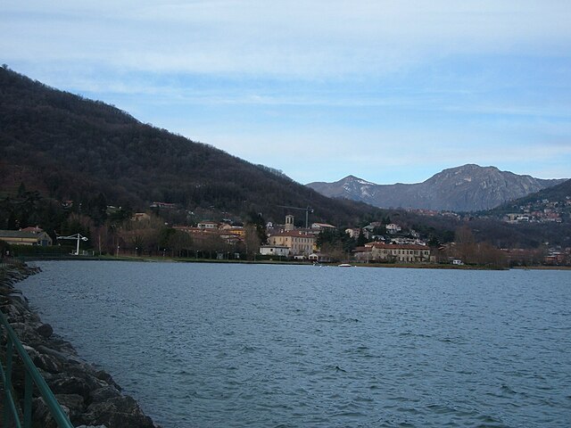
Garlate is a small town located in the province of Lecco in northern Italy, situated near the shores of Lake Garlate. The area offers beautiful scenery, making it a pleasant destination for hiking enthusiasts. Here are some highlights and tips for hiking in and around Garlate:...
- Country:
- Postal Code: 23852
- Local Dialing Code: 0341
- Licence Plate Code: LC
- Coordinates: 45° 48' 0" N, 9° 24' 0" E
- GPS tracks (wikiloc): [Link]
- AboveSeaLevel: 205 м m
- Area: 3.3 sq km
- Population: 2731
- Web site: [Link]

Valmadrera
- Italian comune
Hiking in Valmadrera
Valmadrera is a charming town located in the province of Lecco, in the Lombardy region of Italy. It is situated near the eastern shore of Lake Como and is surrounded by beautiful natural landscapes, making it a great destination for hiking enthusiasts. Here are some key highlights about hiking in Valmadrera:...
- Country:
- Postal Code: 23868
- Local Dialing Code: 0341
- Licence Plate Code: LC
- Coordinates: 45° 50' 47" N, 9° 21' 30" E
- GPS tracks (wikiloc): [Link]
- AboveSeaLevel: 234 м m
- Area: 12.6 sq km
- Population: 11601
- Web site: [Link]


Mandello del Lario
- Italian comune
Hiking in Mandello del Lario
Mandello del Lario, located on the eastern shore of Lake Como in Italy, offers stunning landscapes, rich history, and a variety of hiking opportunities that cater to different levels of experience. Here are some highlights of hiking in this beautiful region:...
- Country:
- Postal Code: 23826
- Local Dialing Code: 0341
- Licence Plate Code: LC
- Coordinates: 45° 55' 0" N, 9° 19' 0" E
- GPS tracks (wikiloc): [Link]
- AboveSeaLevel: 200 м m
- Area: 43.33 sq km
- Population: 10313
- Web site: [Link]


Morterone
- Italian comune
Hiking in Morterone
Morterone, located in the Lombardy region of Italy, is a small mountain village nestled in the foothills of the Grigna massif. It's a fantastic destination for hikers looking to explore the natural beauty of the Italian Alps, offering a range of trails suitable for various skill levels....
- Country:
- Postal Code: 23811
- Local Dialing Code: 0341
- Licence Plate Code: LC
- Coordinates: 45° 52' 26" N, 9° 28' 58" E
- GPS tracks (wikiloc): [Link]
- AboveSeaLevel: 1070 м m
- Area: 13.71 sq km
- Population: 35
- Web site: [Link]
Galbiate
- Italian comune
Hiking in Galbiate
Galbiate, located in the province of Lecco in Lombardy, Italy, is a delightful destination for hiking enthusiasts. Nestled close to Lake Como and surrounded by stunning natural landscapes, it offers various trails catering to different skill levels. Here are some key highlights of hiking in Galbiate:...
- Country:
- Postal Code: 23851
- Local Dialing Code: 0341
- Licence Plate Code: LC
- Coordinates: 45° 48' 0" N, 9° 23' 0" E
- GPS tracks (wikiloc): [Link]
- AboveSeaLevel: 371 м m
- Area: 15.64 sq km
- Population: 8545
- Web site: [Link]