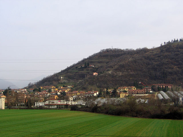
Brusaporto (Brusaporto)
.svg)
- Italian comune
 Hiking in Brusaporto
Brusaporto is a charming town located in the province of Bergamo in Northern Italy, surrounded by the beautiful landscapes of the Lombardy region. While Brusaporto itself may not be a major hiking destination, it is conveniently situated near the foothills of the Bergamo Alps, offering various hiking opportunities in the surrounding area.
Nearby Hiking Opportunities:
-
Parco dei Colli di Bergamo: Just a short drive from Brusaporto, this park features numerous trails that weave through rolling hills, woodlands, and stunning viewpoints overlooking Bergamo and the surrounding valleys. Trails range from easy walks to more challenging hikes, making it suitable for all levels of hikers.
-
Monte Misma: About a 30-minute drive from Brusaporto, Monte Misma offers several trails with stunning views of the surrounding mountains and valleys. It's a great spot for both hiking and enjoying the local flora and fauna.
-
Sentiero dei Tedeschi (The German Trail): This trail runs through the region, linking various historical sites and offering beautiful views along the way. It’s an excellent choice for history buffs as well as nature lovers.
-
Val Seriana: Further north of Brusaporto is the Val Seriana valley, filled with trails that vary in difficulty and provide access to beautiful mountain scenery. Trekking here can lead you to alpine lakes and quaint mountain villages.
Tips for Hiking in the Area:
- Weather: Weather can change quickly in the mountains, so it's wise to check conditions and dress in layers.
- Navigation: Consider carrying a detailed map or downloading a reliable hiking app to help navigate the trails.
- Safety: Always inform someone of your hiking plans and carry sufficient water and snacks. A first-aid kit is also a good idea.
- Local Guidance: If you're unfamiliar with the area, consider hiring a local guide for a more enriching experience.
Conclusion
While Brusaporto itself may not have dedicated hiking trails, its proximity to stunning natural landscapes and established hiking paths makes it a great base for outdoor enthusiasts. Be sure to explore the region's beautiful parks and mountains, and enjoy the breathtaking Italian scenery that surrounds this delightful town!
- Country:

- Postal Code: 24060
- Local Dialing Code: 035-68
- Licence Plate Code: BG
- Coordinates: 45° 40' 0" N, 9° 46' 0" E


- GPS tracks (wikiloc): [Link]
- AboveSeaLevel: 255 м m
- Area: 4.99 sq km
- Population: 5600
- Web site: http://www.comune.brusaporto.bg.it
- Wikipedia en: wiki(en)
- Wikipedia: wiki(it)
- Wikidata storage: Wikidata: Q100018
- Wikipedia Commons Gallery: [Link]
- Wikipedia Commons Category: [Link]
- Freebase ID: [/m/0gj90v]
- GeoNames ID: Alt: [6536533]
- OSM relation ID: [45712]
- UN/LOCODE: [ITBPT]
- ISTAT ID: 016042
- Italian cadastre code: B223
Shares border with regions:


Seriate
- Italian comune
Hiking in Seriate
Seriate is a town located in the Lombardy region of northern Italy, close to the city of Bergamo. While it may not be as widely recognized for hiking as some other locations in the Italian Alps, it does have access to several beautiful hiking trails and natural landscapes that outdoor enthusiasts can enjoy....
- Country:
- Postal Code: 24068
- Local Dialing Code: 035
- Licence Plate Code: BG
- Coordinates: 45° 41' 5" N, 9° 43' 4" E
- GPS tracks (wikiloc): [Link]
- AboveSeaLevel: 247 м m
- Area: 12.53 sq km
- Population: 25358
- Web site: [Link]

Albano Sant'Alessandro
- Italian comune
Hiking in Albano Sant'Alessandro
Albano Sant'Alessandro is a charming town located in the province of Bergamo, in the Lombardy region of northern Italy. It's situated in a picturesque area characterized by lush landscapes, hills, and proximity to the beautiful Orobie Alps, making it a fantastic destination for hiking enthusiasts....
- Country:
- Postal Code: 24061
- Local Dialing Code: 035
- Licence Plate Code: BG
- Coordinates: 45° 41' 9" N, 9° 46' 4" E
- GPS tracks (wikiloc): [Link]
- AboveSeaLevel: 243 м m
- Area: 5.12 sq km
- Population: 8244
- Web site: [Link]


Bagnatica
- Italian comune
Hiking in Bagnatica
Bagnatica is a small municipality located in the Lombardy region of Italy, near the province of Bergamo. While it may not be as well-known as some other hiking destinations in Italy, there are several opportunities for outdoor activities in and around this area....
- Country:
- Postal Code: 24060
- Local Dialing Code: 035
- Licence Plate Code: BG
- Coordinates: 45° 39' 43" N, 9° 46' 52" E
- GPS tracks (wikiloc): [Link]
- AboveSeaLevel: 220 м m
- Area: 6.55 sq km
- Population: 4317
- Web site: [Link]