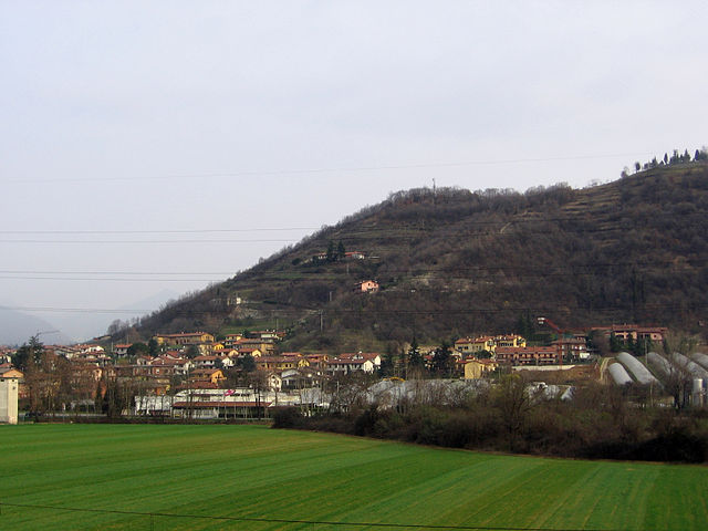
Bagnatica (Bagnatica)
.svg)
- Italian comune
 Hiking in Bagnatica
Bagnatica is a small municipality located in the Lombardy region of Italy, near the province of Bergamo. While it may not be as well-known as some other hiking destinations in Italy, there are several opportunities for outdoor activities in and around this area.
Hiking Opportunities in Bagnatica
-
Local Trails: The surrounding hills and countryside around Bagnatica offer various walking and hiking trails. Look for local pathways that connect to nearby villages and scenic viewpoints.
-
Parco Regionale dei Colli di Bergamo: Just a short distance away, this regional park offers numerous trails with stunning views of the Bergamo hills and the surrounding landscape. The park is known for its rich biodiversity, charming landscapes, and historical sites.
-
Ciclovia dell’Adda: If you enjoy cycling as well, this cycle path which follows the Adda River connects several towns near Bagnatica. It's an excellent way to explore the river region, and you can combine hiking with biking.
-
Nearby Peaks: If you're up for a bit more adventure, consider hiking in the nearby Orobie Alps. This mountain range is accessible from Bergamo and offers a variety of trails ranging from easy walks to challenging hikes.
Tips for Hiking in Bagnatica
-
Weather Check: Always check the local weather before heading out, as conditions can change rapidly.
-
Proper Gear: Wear comfortable hiking shoes and dress in layers to accommodate temperature changes throughout the day. Bring water and snacks, especially for longer hikes.
-
Local Maps: It’s useful to have local trail maps or a GPS device to navigate, as trail markers might not always be clearly visible.
-
Respect Nature: Stay on marked trails, dispose of waste properly, and respect wildlife and local flora.
-
Accompaniment: If you’re unfamiliar with the area, consider hiking with a local guide or an experienced hiker to enhance your experience.
Enjoy your hiking adventures in Bagnatica and the surrounding regions! The scenery and culture of Lombardy can add a unique touch to your outdoor experience.
- Country:

- Postal Code: 24060
- Local Dialing Code: 035
- Licence Plate Code: BG
- Coordinates: 45° 39' 43" N, 9° 46' 52" E


- GPS tracks (wikiloc): [Link]
- AboveSeaLevel: 220 м m
- Area: 6.55 sq km
- Population: 4317
- Web site: http://www.comunedibagnatica.it
- Wikipedia en: wiki(en)
- Wikipedia: wiki(it)
- Wikidata storage: Wikidata: Q99961
- Wikipedia Commons Gallery: [Link]
- Wikipedia Commons Category: [Link]
- Freebase ID: [/m/0gj8n6]
- GeoNames ID: Alt: [6543143]
- VIAF ID: Alt: [150258382]
- OSM relation ID: [45617]
- UN/LOCODE: [ITBNA]
- ISTAT ID: 016018
- Italian cadastre code: A557
Shares border with regions:


Brusaporto
- Italian comune
Hiking in Brusaporto
Brusaporto is a charming town located in the province of Bergamo in Northern Italy, surrounded by the beautiful landscapes of the Lombardy region. While Brusaporto itself may not be a major hiking destination, it is conveniently situated near the foothills of the Bergamo Alps, offering various hiking opportunities in the surrounding area....
- Country:
- Postal Code: 24060
- Local Dialing Code: 035-68
- Licence Plate Code: BG
- Coordinates: 45° 40' 0" N, 9° 46' 0" E
- GPS tracks (wikiloc): [Link]
- AboveSeaLevel: 255 м m
- Area: 4.99 sq km
- Population: 5600
- Web site: [Link]


Calcinate
- Italian comune
Hiking in Calcinate
Calcinate, located in the province of Bergamo in Italy, is not particularly known as a prime hiking destination, but it offers access to the scenic landscapes and trails in the surrounding regions of Lombardy. Here are some suggestions and information about hiking in and around Calcinate:...
- Country:
- Postal Code: 24050
- Local Dialing Code: 035
- Licence Plate Code: BG
- Coordinates: 45° 37' 16" N, 9° 48' 1" E
- GPS tracks (wikiloc): [Link]
- AboveSeaLevel: 186 м m
- Area: 15.08 sq km
- Population: 5985
- Web site: [Link]


Costa di Mezzate
- Italian comune
Hiking in Costa di Mezzate
Costa di Mezzate is a charming location in Italy, located in the province of Bergamo in Lombardy. It's a great spot for hiking, particularly for those who enjoy scenic trails and beautiful landscapes. Here are some details about hiking in Costa di Mezzate:...
- Country:
- Postal Code: 24060
- Local Dialing Code: 035
- Licence Plate Code: BG
- Coordinates: 45° 40' 0" N, 9° 48' 0" E
- GPS tracks (wikiloc): [Link]
- AboveSeaLevel: 218 м m
- Area: 5.22 sq km
- Population: 3374
- Web site: [Link]


Montello, Lombardy
- Italian comune
Hiking in Montello, Lombardy
Montello is a beautiful area in Lombardy, Italy, known for its picturesque landscapes, rich natural beauty, and various outdoor activities, including hiking. Here are some key points about hiking in Montello:...
- Country:
- Postal Code: 24060
- Local Dialing Code: 035
- Licence Plate Code: BG
- Coordinates: 45° 40' 0" N, 9° 48' 0" E
- GPS tracks (wikiloc): [Link]
- AboveSeaLevel: 229 м m
- Area: 1.82 sq km
- Population: 3263
- Web site: [Link]


Seriate
- Italian comune
Hiking in Seriate
Seriate is a town located in the Lombardy region of northern Italy, close to the city of Bergamo. While it may not be as widely recognized for hiking as some other locations in the Italian Alps, it does have access to several beautiful hiking trails and natural landscapes that outdoor enthusiasts can enjoy....
- Country:
- Postal Code: 24068
- Local Dialing Code: 035
- Licence Plate Code: BG
- Coordinates: 45° 41' 5" N, 9° 43' 4" E
- GPS tracks (wikiloc): [Link]
- AboveSeaLevel: 247 м m
- Area: 12.53 sq km
- Population: 25358
- Web site: [Link]

Albano Sant'Alessandro
- Italian comune
Hiking in Albano Sant'Alessandro
Albano Sant'Alessandro is a charming town located in the province of Bergamo, in the Lombardy region of northern Italy. It's situated in a picturesque area characterized by lush landscapes, hills, and proximity to the beautiful Orobie Alps, making it a fantastic destination for hiking enthusiasts....
- Country:
- Postal Code: 24061
- Local Dialing Code: 035
- Licence Plate Code: BG
- Coordinates: 45° 41' 9" N, 9° 46' 4" E
- GPS tracks (wikiloc): [Link]
- AboveSeaLevel: 243 м m
- Area: 5.12 sq km
- Population: 8244
- Web site: [Link]


Bolgare
- Italian comune
Hiking in Bolgare
Bolgare is a small town in the province of Bergamo, Lombardy, Italy. Nestled in a beautiful region that offers access to the stunning landscapes of the Italian Alps, Bolgare is a great starting point for various hiking adventures....
- Country:
- Postal Code: 24060
- Local Dialing Code: 035
- Licence Plate Code: BG
- Coordinates: 45° 38' 3" N, 9° 49' 1" E
- GPS tracks (wikiloc): [Link]
- AboveSeaLevel: 199 м m
- Area: 8.59 sq km
- Population: 6183
- Web site: [Link]