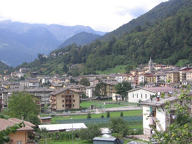
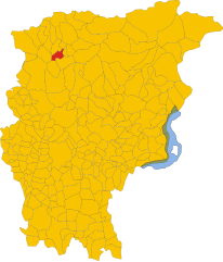
Camerata Cornello (Camerata Cornello)
.svg)
- Italian comune
 Hiking in Camerata Cornello
Camerata Cornello is a picturesque village located in the Italian Alps, specifically in the Lombardy region, within the province of Bergamo. It offers a variety of hiking opportunities with stunning natural landscapes, historical sites, and charming alpine scenery.
Hiking Trails
-
Sentiero dei Santi: This is a popular hiking trail that connects Camerata Cornello to the nearby villages. The path offers breathtaking views of the surrounding mountains and valleys. It’s a relatively easy hike, suitable for families and beginners.
-
Valle di Scalve: Beyond Camerata Cornello, the Scalve Valley features numerous trails that range from easy walks to challenging climbs. The area is known for its diverse flora and fauna, making it a great spot for nature lovers.
-
Monte Avaro: For those looking to challenge themselves, hiking up Monte Avaro provides a more demanding trek but rewards hikers with panoramic views of the surrounding valleys and peaks.
Points of Interest
-
Historical Sites: While hiking, you may come across historical landmarks, such as old mills, ruins, and traditional stone houses that tell the story of the region's culture and heritage.
-
Natural Attractions: The trails often lead you to beautiful spots for picnicking or resting, including waterfalls and scenic viewpoints.
Tips for Hiking in Camerata Cornello
-
Preparation: Always check the weather and trail conditions before heading out. Dress in layers, as the weather can change quickly in the mountains.
-
Gear: Wear sturdy hiking boots and bring plenty of water, snacks, and sun protection. A map or GPS device is also helpful in navigating the trails.
-
Local Insights: Consider speaking with local hiking guides or associations for the latest trail updates and recommendations, as well as for safety advice.
-
Respect Nature: Always follow Leave No Trace principles to preserve the natural beauty of the area for future hikers.
Hiking in Camerata Cornello is a wonderful way to experience the natural beauty of the Alps while enjoying the rich cultural heritage of Italy. Whether you're an experienced hiker or a beginner, there are trails for everyone to explore.
- Country:

- Postal Code: 24010
- Local Dialing Code: 0345
- Licence Plate Code: BG
- Coordinates: 45° 54' 0" N, 9° 39' 0" E


- GPS tracks (wikiloc): [Link]
- AboveSeaLevel: 570 м m
- Area: 12.94 sq km
- Population: 616
- Web site: http://www.comune.cameratacornello.bg.it
- Wikipedia en: wiki(en)
- Wikipedia: wiki(it)
- Wikidata storage: Wikidata: Q100133
- Wikipedia Commons Gallery: [Link]
- Wikipedia Commons Category: [Link]
- Freebase ID: [/m/0gj92_]
- GeoNames ID: Alt: [6539487]
- VIAF ID: Alt: [139747270]
- OSM relation ID: [46491]
- WOEID: [711795]
- ISTAT ID: 016048
- Italian cadastre code: B471
Shares border with regions:


Cassiglio
- Italian comune
Hiking in Cassiglio
Cassiglio is a picturesque village located in the province of Bergamo, in the Lombardy region of Italy. It lies in the heart of the Italian Alps, making it a fantastic destination for hiking enthusiasts. Here are some key points about hiking in and around Cassiglio:...
- Country:
- Postal Code: 24010
- Local Dialing Code: 0345
- Licence Plate Code: BG
- Coordinates: 45° 58' 0" N, 9° 36' 44" E
- GPS tracks (wikiloc): [Link]
- AboveSeaLevel: 602 м m
- Area: 13.68 sq km
- Population: 110
- Web site: [Link]


Lenna, Lombardy
- Italian comune
Hiking in Lenna, Lombardy
Lenna is a quaint village located in the Bergamo province of Lombardy, Italy. It is situated in a picturesque part of the Italian Alps, making it a great base for hiking enthusiasts. The area is characterized by stunning landscapes, rich flora and fauna, and a variety of trails that cater to different skill levels....
- Country:
- Postal Code: 24010
- Local Dialing Code: 0345
- Licence Plate Code: BG
- Coordinates: 45° 56' 36" N, 9° 40' 39" E
- GPS tracks (wikiloc): [Link]
- AboveSeaLevel: 465 м m
- Area: 12.74 sq km
- Population: 592
- Web site: [Link]
Piazza Brembana
- Italian comune
Hiking in Piazza Brembana
Piazza Brembana is a picturesque valley located in the Bergamo province of Lombardy, Italy. It's surrounded by the stunning Orobie Alps, making it an excellent destination for hiking enthusiasts. The area boasts a variety of trails, ranging from easy walks suitable for families to challenging hikes for more experienced trekkers....
- Country:
- Postal Code: 24014
- Local Dialing Code: 0345
- Licence Plate Code: BG
- Coordinates: 45° 56' 50" N, 9° 40' 30" E
- GPS tracks (wikiloc): [Link]
- AboveSeaLevel: 518 м m
- Area: 6.77 sq km
- Population: 1213
- Web site: [Link]


San Giovanni Bianco
- Italian comune
Hiking in San Giovanni Bianco
San Giovanni Bianco is a charming village located in the Lombardy region of Italy, surrounded by the breathtaking landscapes of the Orobic Alps. It offers a variety of hiking opportunities for both beginners and experienced hikers, thanks to its diverse terrain and well-marked trails....
- Country:
- Postal Code: 24015
- Local Dialing Code: 0345
- Licence Plate Code: BG
- Coordinates: 45° 52' 0" N, 9° 39' 0" E
- GPS tracks (wikiloc): [Link]
- AboveSeaLevel: 448 м m
- Area: 31.03 sq km
- Population: 4798
- Web site: [Link]


Taleggio, Lombardy
- Italian comune
Hiking in Taleggio, Lombardy
Taleggio is a picturesque valley located in the Bergamo province of Lombardy, Italy. It is renowned for its stunning landscapes, rich history, and traditional agriculture, including the famous Taleggio cheese. Hiking in this region offers a variety of trails, ranging from easy walks to more challenging routes, catering to different skill levels. Here are some highlights and tips for hiking in Taleggio:...
- Country:
- Postal Code: 24010
- Local Dialing Code: 0345
- Licence Plate Code: BG
- Coordinates: 45° 54' 0" N, 9° 34' 0" E
- GPS tracks (wikiloc): [Link]
- AboveSeaLevel: 758 м m
- Area: 46.59 sq km
- Population: 552
- Web site: [Link]