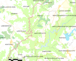
Campouriez (Campouriez)

- commune in Aveyron, France
- Country:

- Postal Code: 12140
- Coordinates: 44° 41' 22" N, 2° 36' 23" E


- GPS tracks (wikiloc): [Link]
- Area: 18.38 sq km
- Population: 359
- Web site: http://www.campouriez.fr
- Wikipedia en: wiki(en)
- Wikipedia: wiki(fr)
- Wikidata storage: Wikidata: Q1082398
- Wikipedia Commons Category: [Link]
- Freebase ID: [/m/03m934p]
- SIREN number: [211200480]
- BnF ID: [15247024q]
- INSEE municipality code: 12048
Shares border with regions:


Florentin-la-Capelle
- commune in Aveyron, France
- Country:
- Postal Code: 12140
- Coordinates: 44° 37' 49" N, 2° 37' 55" E
- GPS tracks (wikiloc): [Link]
- Area: 36.8 sq km
- Population: 283
- Web site: [Link]


Montézic
- commune in Aveyron, France
- Country:
- Postal Code: 12460
- Coordinates: 44° 42' 33" N, 2° 38' 22" E
- GPS tracks (wikiloc): [Link]
- Area: 18.87 sq km
- Population: 241


Saint-Amans-des-Cots
- commune in Aveyron, France
- Country:
- Postal Code: 12460
- Coordinates: 44° 41' 21" N, 2° 39' 34" E
- GPS tracks (wikiloc): [Link]
- Area: 41.51 sq km
- Population: 763

Saint-Hippolyte
- commune in Aveyron, France
- Country:
- Postal Code: 12140
- Coordinates: 44° 42' 40" N, 2° 35' 30" E
- GPS tracks (wikiloc): [Link]
- Area: 36.87 sq km
- Population: 451
- Web site: [Link]
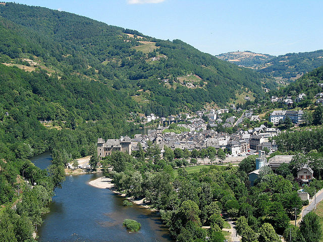
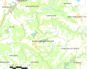
Entraygues-sur-Truyère
- commune in Aveyron, France
- Country:
- Postal Code: 12140
- Coordinates: 44° 38' 47" N, 2° 34' 1" E
- GPS tracks (wikiloc): [Link]
- Area: 30.15 sq km
- Population: 1038