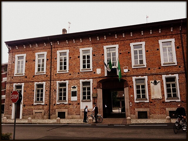
Canegrate (Canegrate)
.svg)
- comune in Province of Milan
 Hiking in Canegrate
Canegrate is a town in the Lombardy region of Italy, located near Milan. While it may not be as well-known for hiking as some of the more mountainous areas in the region, there are still opportunities for outdoor activities and walking trails in and around Canegrate.
Local Hiking Options
-
Parco dei Mulini: This park offers scenic walking paths along the waterways, showcasing the natural beauty of the surrounding area. It’s a great place for a leisurely hike.
-
Canegrate's Surroundings: The area around Canegrate has several rural trails that can be explored. These routes often connect small towns and offer a glimpse into the local countryside.
-
Nearby Nature Reserves: Consider visiting nearby nature reserves or parks. For example, the nearby Parco Nord Milano offers a variety of trails in a more wooded environment, suitable for hiking and enjoying nature.
-
Lakes and Rivers: The proximity to lakes such as Lake Maggiore or Lake Como (a bit further afield) provides additional hiking opportunities with beautiful lakeside views and trails.
Tips for Hiking in Canegrate
- Seasonal Considerations: Spring and fall are ideal for hiking, as the weather is typically mild. Summer can be hot, while winter may bring colder temperatures and rain.
- Local Maps: Bring a detailed map or use a hiking app to navigate the trails, as well as to find local points of interest.
- Stay Hydrated: Always carry enough water, especially on longer hikes or during warmer months.
- Respect Nature: Follow local guidelines regarding wildlife and waste disposal. Stay on designated trails to protect the environment.
Conclusion
While Canegrate itself may not be a hiking hotspot, it serves as a convenient base for exploring the lush landscapes of Lombardy. The combination of local parks and proximity to larger nature reserves makes it a worthwhile spot for outdoor enthusiasts. If you're looking for a more immersive experience, consider heading towards the mountains or lakes further from the town for more challenging hikes.
- Country:

- Postal Code: 20010
- Local Dialing Code: 0331
- Licence Plate Code: MI
- Coordinates: 45° 34' 0" N, 8° 56' 0" E


- GPS tracks (wikiloc): [Link]
- AboveSeaLevel: 196 м m
- Area: 5.25 sq km
- Population: 12574
- Web site: http://www.comune.canegrate.mi.it
- Wikipedia en: wiki(en)
- Wikipedia: wiki(it)
- Wikidata storage: Wikidata: Q581
- Wikipedia Commons Category: [Link]
- Freebase ID: [/m/0gj57b]
- GeoNames ID: Alt: [6536499]
- VIAF ID: Alt: [244766344]
- OSM relation ID: [45325]
- MusicBrainz area ID: [39a9dfe3-fd78-4320-a8d5-560a37868745]
- Quora topic ID: [Canegrate]
- TGN ID: [1043819]
- UN/LOCODE: [ITCAE]
- Gran Enciclopèdia Catalana ID: [0264525]
- Facebook Places ID: [111891932161106]
- Trismegistos Geo ID: [30800]
- ISTAT ID: 015046
- Italian cadastre code: B593
- LombardiaBeniCulturali toponym ID: 8000095
Shares border with regions:

Busto Garolfo
- Italian comune
Hiking in Busto Garolfo
Busto Garolfo is a small town located in the Lombardy region of Italy, just northwest of Milan. While it may not be as widely known for hiking as larger national parks or mountainous areas, there are still several opportunities for outdoor activities in and around the region. Here are some key points about hiking in Busto Garolfo:...
- Country:
- Postal Code: 20020
- Local Dialing Code: 0331
- Licence Plate Code: MI
- Coordinates: 45° 32' 52" N, 8° 53' 12" E
- GPS tracks (wikiloc): [Link]
- AboveSeaLevel: 180 м m
- Area: 12.99 sq km
- Population: 13850
- Web site: [Link]


Parabiago
- Italian comune
Hiking in Parabiago
Parabiago, a town in the Lombardy region of Italy, is surrounded by scenic landscapes that offer various opportunities for hiking and outdoor activities. While Parabiago itself is not a major hiking destination, it is well-positioned to access trails and natural areas in the nearby regions. Here are some insights about hiking in and around Parabiago:...
- Country:
- Postal Code: 20015
- Local Dialing Code: 0331
- Licence Plate Code: MI
- Coordinates: 45° 33' 30" N, 8° 56' 52" E
- GPS tracks (wikiloc): [Link]
- AboveSeaLevel: 184 м m
- Area: 14.29 sq km
- Population: 27747
- Web site: [Link]


Legnano
- Italian comune
Hiking in Legnano
Legnano, located in the Lombardy region of Italy, is surrounded by beautiful landscapes that offer various hiking opportunities. The area is rich in natural beauty, featuring rolling hills, valleys, and scenic views, as well as historical sites and charming towns....
- Country:
- Postal Code: 20025
- Local Dialing Code: 0331
- Licence Plate Code: MI
- Coordinates: 45° 35' 49" N, 8° 54' 32" E
- GPS tracks (wikiloc): [Link]
- AboveSeaLevel: 199 м m
- Area: 17.68 sq km
- Population: 60259
- Web site: [Link]


San Vittore Olona
- Italian comune
Hiking in San Vittore Olona
San Vittore Olona is a charming town in the Lombardy region of Italy, situated not far from Milan. While it may not be a well-known hiking destination, it offers some lovely outdoor experiences and access to the surrounding areas....
- Country:
- Postal Code: 20028
- Local Dialing Code: 0331
- Licence Plate Code: MI
- Coordinates: 45° 35' 0" N, 8° 56' 0" E
- GPS tracks (wikiloc): [Link]
- AboveSeaLevel: 197 м m
- Area: 3.49 sq km
- Population: 8425
- Web site: [Link]


San Giorgio su Legnano
- Italian comune
Hiking in San Giorgio su Legnano
San Giorgio su Legnano is a charming town located in the Lombardy region of Italy, just northwest of Milan. While it may not be as well-known for hiking as other Italian destinations, there are several outdoor activities and trails nearby that can be explored for a delightful hiking experience....
- Country:
- Postal Code: 20010
- Local Dialing Code: 0331
- Licence Plate Code: MI
- Coordinates: 45° 34' 0" N, 8° 55' 0" E
- GPS tracks (wikiloc): [Link]
- AboveSeaLevel: 198 м m
- Area: 2.17 sq km
- Population: 6794
- Web site: [Link]