canton of Herbault (canton d'Herbault)
- canton of France (until March 2015)
- Country:

- Capital: Herbault
- Coordinates: 47° 35' 22" N, 1° 10' 13" E


- GPS tracks (wikiloc): [Link]
- Wikidata storage: Wikidata: Q1547683
- INSEE canton code: [4106]
Includes regions:


Françay
- commune in Loir-et-Cher, France
- Country:
- Postal Code: 41190
- Coordinates: 47° 37' 4" N, 1° 7' 33" E
- GPS tracks (wikiloc): [Link]
- Area: 20.31 sq km
- Population: 281

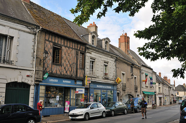
Chouzy-sur-Cisse
- former commune in Loir-et-Cher, France
- Country:
- Postal Code: 41150
- Coordinates: 47° 31' 31" N, 1° 14' 50" E
- GPS tracks (wikiloc): [Link]
- Area: 22.43 sq km
- Population: 2027
- Web site: [Link]
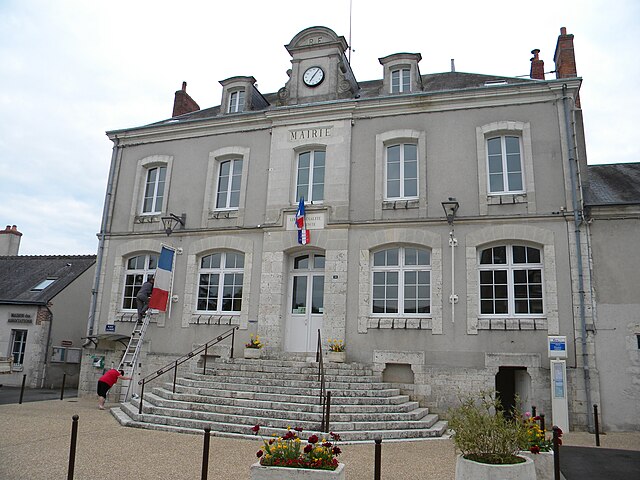
Herbault
- commune in Loir-et-Cher, France
- Country:
- Postal Code: 41190
- Coordinates: 47° 36' 17" N, 1° 8' 19" E
- GPS tracks (wikiloc): [Link]
- Area: 13.01 sq km
- Population: 1247

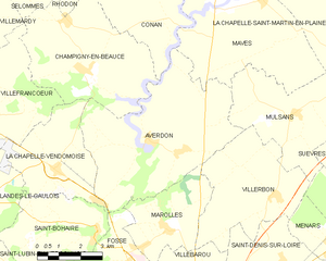
Averdon
- commune in Loir-et-Cher, France
- Country:
- Postal Code: 41330
- Coordinates: 47° 41' 4" N, 1° 17' 43" E
- GPS tracks (wikiloc): [Link]
- Area: 29.14 sq km
- Population: 706
Saint-Étienne-des-Guérets
- commune in Loir-et-Cher, France
- Country:
- Postal Code: 41190
- Coordinates: 47° 35' 57" N, 1° 3' 51" E
- GPS tracks (wikiloc): [Link]
- Area: 11.72 sq km
- Population: 95

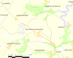
La Chapelle-Vendômoise
- commune in Loir-et-Cher, France
- Country:
- Postal Code: 41330
- Coordinates: 47° 40' 15" N, 1° 14' 21" E
- GPS tracks (wikiloc): [Link]
- Area: 13.07 sq km
- Population: 744


Villefrancœur
- commune in Loir-et-Cher, France
- Country:
- Postal Code: 41330
- Coordinates: 47° 41' 37" N, 1° 13' 9" E
- GPS tracks (wikiloc): [Link]
- Area: 18.08 sq km
- Population: 425
- Web site: [Link]
Seillac
- former commune in Loir-et-Cher, France
- Country:
- Postal Code: 41150
- Coordinates: 47° 32' 42" N, 1° 9' 26" E
- GPS tracks (wikiloc): [Link]
- Area: 9.58 sq km
- Population: 107

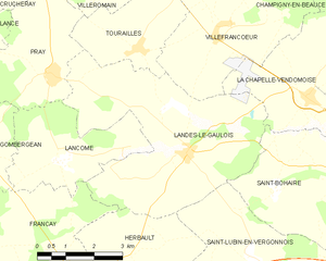
Landes-le-Gaulois
- commune in Loir-et-Cher, France
- Country:
- Postal Code: 41190
- Coordinates: 47° 39' 10" N, 1° 10' 59" E
- GPS tracks (wikiloc): [Link]
- Area: 24.15 sq km
- Population: 739
- Web site: [Link]


Veuves
- former commune in Loir-et-Cher, France
- Country:
- Postal Code: 41150
- Coordinates: 47° 28' 17" N, 1° 7' 29" E
- GPS tracks (wikiloc): [Link]
- Area: 8.07 sq km
- Population: 215


Monteaux
- commune in Loir-et-Cher, France
- Country:
- Postal Code: 41150
- Coordinates: 47° 29' 9" N, 1° 6' 48" E
- GPS tracks (wikiloc): [Link]
- Area: 6.27 sq km
- Population: 790
Saint-Cyr-du-Gault
- commune in Loir-et-Cher, France
- Country:
- Postal Code: 41190
- Coordinates: 47° 37' 16" N, 1° 1' 48" E
- GPS tracks (wikiloc): [Link]
- Area: 26.06 sq km
- Population: 176

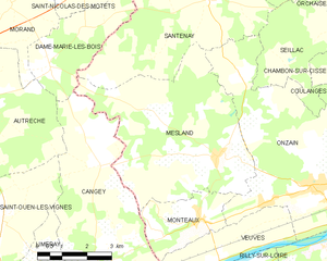
Mesland
- commune in Loir-et-Cher, France
- Country:
- Postal Code: 41150
- Coordinates: 47° 30' 35" N, 1° 7' 21" E
- GPS tracks (wikiloc): [Link]
- Area: 26.38 sq km
- Population: 570
Orchaise
- former commune in Loir-et-Cher, France
- Country:
- Postal Code: 41190
- Coordinates: 47° 35' 24" N, 1° 11' 56" E
- GPS tracks (wikiloc): [Link]
- Area: 20.03 sq km
- Population: 976
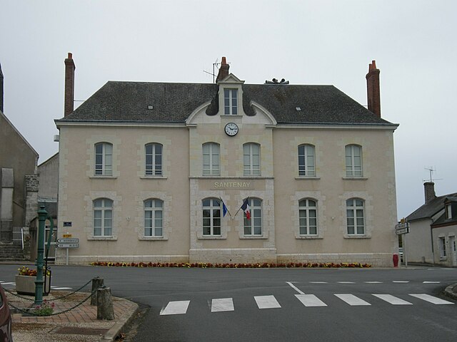

Santenay
- commune in Loir-et-Cher, France
- Country:
- Postal Code: 41190
- Coordinates: 47° 34' 0" N, 1° 6' 59" E
- GPS tracks (wikiloc): [Link]
- Area: 30.28 sq km
- Population: 297


Molineuf
- former commune in Loir-et-Cher, France
- Country:
- Postal Code: 41190
- Coordinates: 47° 34' 43" N, 1° 12' 56" E
- GPS tracks (wikiloc): [Link]
- Area: 11.02 sq km
- Population: 774


Champigny-en-Beauce
- commune in Loir-et-Cher, France
- Country:
- Postal Code: 41330
- Coordinates: 47° 42' 43" N, 1° 15' 21" E
- GPS tracks (wikiloc): [Link]
- Area: 22.31 sq km
- Population: 585


Lancôme
- commune in Loir-et-Cher, France
- Country:
- Postal Code: 41190
- Coordinates: 47° 38' 56" N, 1° 7' 24" E
- GPS tracks (wikiloc): [Link]
- Area: 9.89 sq km
- Population: 124


Coulanges
- former commune in Loir-et-Cher, France
- Country:
- Postal Code: 41150
- Coordinates: 47° 32' 35" N, 1° 13' 23" E
- GPS tracks (wikiloc): [Link]
- Area: 8.35 sq km
- Population: 328

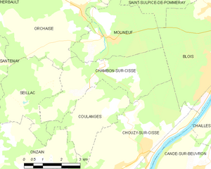
Chambon-sur-Cisse
- former commune in Loir-et-Cher, France
- Country:
- Postal Code: 41190
- Coordinates: 47° 33' 45" N, 1° 12' 57" E
- GPS tracks (wikiloc): [Link]
- Area: 12.71 sq km
- Population: 671

Onzain
- former commune in Loir-et-Cher, France
- Country:
- Postal Code: 41150
- Coordinates: 47° 29' 59" N, 1° 10' 27" E
- GPS tracks (wikiloc): [Link]
- Area: 29.89 sq km
- Population: 3395