canton of Chartres-Sud-Est (canton de Chartres-Sud-Est)
- canton of France (until March 2015)
- Country:

- Capital: Chartres
- Coordinates: 48° 24' 30" N, 1° 34' 56" E


- GPS tracks (wikiloc): [Link]
- Wikidata storage: Wikidata: Q1475677
- INSEE canton code: [2825]
Includes regions:


Berchères-les-Pierres
- commune in Eure-et-Loir, France
- Country:
- Postal Code: 28630
- Coordinates: 48° 23' 6" N, 1° 33' 13" E
- GPS tracks (wikiloc): [Link]
- Area: 19.83 sq km
- Population: 997
- Web site: [Link]

Le Coudray
- commune in Eure-et-Loir, France
- Country:
- Postal Code: 28630
- Coordinates: 48° 25' 49" N, 1° 29' 27" E
- GPS tracks (wikiloc): [Link]
- AboveSeaLevel: 147 м m
- Area: 5.52 sq km
- Population: 4220
- Web site: [Link]


Nogent-le-Phaye
- commune in Eure-et-Loir, France
- Country:
- Postal Code: 28630
- Coordinates: 48° 26' 49" N, 1° 34' 35" E
- GPS tracks (wikiloc): [Link]
- Area: 15.01 sq km
- Population: 1378

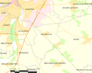
Gellainville
- commune in Eure-et-Loir, France
- Country:
- Postal Code: 28630
- Coordinates: 48° 24' 58" N, 1° 32' 0" E
- GPS tracks (wikiloc): [Link]
- Area: 12.01 sq km
- Population: 685
- Web site: [Link]


Prunay-le-Gillon
- commune in Eure-et-Loir, France
- Country:
- Postal Code: 28360
- Coordinates: 48° 21' 55" N, 1° 38' 7" E
- GPS tracks (wikiloc): [Link]
- Area: 25.36 sq km
- Population: 1069
- Web site: [Link]

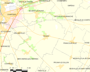
Sours
- commune in Eure-et-Loir, France
- Country:
- Postal Code: 28630
- Coordinates: 48° 24' 36" N, 1° 35' 50" E
- GPS tracks (wikiloc): [Link]
- Area: 33.15 sq km
- Population: 1927