canton of Huningue (canton de Huningue)
- canton of France (until March 2015)
Canton de Huningue, located in the Alsace region of France, is a picturesque area that offers a variety of hiking opportunities. Nestled near the borders of Germany and Switzerland, this region is characterized by a mix of natural landscapes, charming villages, and cultural landmarks. Here’s what you need to know about hiking in this area:
Landscape and Trails
-
Scenic Routes: The hiking trails around Canton de Huningue feature a diverse landscape including forests, rivers, and wetlands. The proximity to the Rhine River provides beautiful views and opportunities for birdwatching.
-
Natural Reserves: The nearby Petite Camargue Alsacienne Nature Reserve is a highlight for hikers. It has well-marked trails that enable visitors to explore its rich biodiversity, including various bird species and other wildlife.
-
Historical Sites: Many trails pass through or near historical sites, such as the Fort of Huningue or the old town centers of Huningue and surrounding villages. Incorporating these sites into your hike can add cultural depth to your adventure.
Trail Difficulty and Duration
- Variety of Trails: The region offers a mix of trails suited for different skill levels, from easy walks suitable for families to more challenging hikes for experienced trekkers.
- Length: Trails can range from short circuits of a few kilometers to longer hikes that take several hours to complete. Be sure to check maps and guidebooks for specific distances.
Tips for Hiking in Canton de Huningue
-
Maps and Signage: Trail markers are generally clear, but it’s always a good idea to carry a map or a hiking app for navigation.
-
Local Conditions: Check the local weather before heading out, as conditions can change rapidly, especially near rivers.
-
Gear: Wear appropriate hiking shoes and consider bringing trekking poles, especially for uneven terrain. A hydration system and snacks are essential for longer hikes.
-
Respect Nature: Always follow Leave No Trace principles. Stay on marked trails to preserve the local flora and fauna.
-
Cultural Etiquette: If passing through villages, be respectful of local customs and the privacy of residents.
Additional Activities
If you have time beyond hiking, consider exploring local attractions such as:
- The regional wines of Alsace: visit nearby vineyards for tasting experiences.
- Cycling routes alongside the Rhine are also popular and provide another way to enjoy the landscape.
Hiking in Canton de Huningue offers a delightful blend of natural beauty, outdoor activity, and cultural exploration, making it a great destination for both casual walkers and avid hikers. Enjoy your adventure!
- Country:

- Capital: Huningue
- Coordinates: 47° 36' 0" N, 7° 35' 0" E


- GPS tracks (wikiloc): [Link]
- Wikidata storage: Wikidata: Q1398621
- INSEE canton code: [6811]
Includes regions:

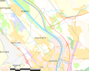
Village-Neuf
- commune in Haut-Rhin, France
Village-Neuf, located in the Alsace region of France near the border with Germany and Switzerland, offers a charming setting for hiking enthusiasts. The area boasts a mix of natural landscapes, including forests, rivers, and fields, making it an excellent destination for outdoor activities....
- Country:

- Postal Code: 68128
- Coordinates: 47° 36' 24" N, 7° 34' 10" E


- GPS tracks (wikiloc): [Link]
- Area: 6.83 sq km
- Population: 4111
- Web site: [Link]


Knœringue
- commune in Haut-Rhin, France
Knœringue is a picturesque village located in the Alsace region of France, near the border with Germany and Switzerland. It serves as a launching point for various hiking opportunities in the surrounding areas, particularly in the Vosges mountains and the Jura region....
- Country:

- Postal Code: 68220
- Coordinates: 47° 33' 49" N, 7° 24' 10" E


- GPS tracks (wikiloc): [Link]
- Area: 4.68 sq km
- Population: 381


Leymen
- commune in Haut-Rhin, France
Leymen is a charming village located in the Alsace region of northeastern France, near the Swiss border. It provides a wonderful base for hiking enthusiasts, as it is surrounded by picturesque landscapes and diverse trails suitable for various skill levels. Here are some highlights for hiking in and around Leymen:...
- Country:

- Postal Code: 68220
- Coordinates: 47° 29' 41" N, 7° 29' 0" E


- GPS tracks (wikiloc): [Link]
- Area: 11.64 sq km
- Population: 1198


Liebenswiller
- commune in Haut-Rhin, France
Liebenswiller is a charming village located in the Alsace region of northeastern France, near the borders of Switzerland and Germany. The area is surrounded by beautiful landscapes, making it a great spot for hiking enthusiasts. Here’s what you can expect when hiking in and around Liebenswiller:...
- Country:

- Postal Code: 68220
- Coordinates: 47° 29' 54" N, 7° 27' 18" E


- GPS tracks (wikiloc): [Link]
- Area: 3.87 sq km
- Population: 207

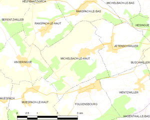
Michelbach-le-Haut
- commune in Haut-Rhin, France
Michelbach-le-Haut is a charming village located in the Alsace region of France, surrounded by scenic landscapes that are ideal for hiking enthusiasts. The area offers a variety of trails that cater to different skill levels, making it a great destination for both novice hikers and experienced trekkers....
- Country:

- Postal Code: 68220
- Coordinates: 47° 33' 59" N, 7° 26' 38" E


- GPS tracks (wikiloc): [Link]
- Area: 7.38 sq km
- Population: 621


Michelbach-le-Bas
- commune in Haut-Rhin, France
Michelbach-le-Bas is a picturesque village located in the Alsace region of France, known for its beautiful landscapes and proximity to the Vosges Mountains. Hiking in this area offers a variety of trails, ranging from easy walks to more challenging hikes, all set against stunning natural backdrops....
- Country:

- Postal Code: 68730
- Coordinates: 47° 35' 35" N, 7° 27' 53" E


- GPS tracks (wikiloc): [Link]
- Area: 4.94 sq km
- Population: 706
- Web site: [Link]


Ranspach-le-Bas
- commune in Haut-Rhin, France
Ranspach-le-Bas is a charming village located in the Alsace region of France, near the Vosges mountains, making it a great spot for hiking enthusiasts. The area is characterized by its beautiful natural landscapes, picturesque valleys, and well-maintained trails that cater to various skill levels....
- Country:

- Postal Code: 68730
- Coordinates: 47° 35' 15" N, 7° 26' 44" E


- GPS tracks (wikiloc): [Link]
- Area: 4.43 sq km
- Population: 650
- Web site: [Link]

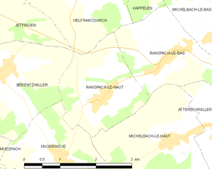
Ranspach-le-Haut
- commune in Haut-Rhin, France
Ranspach-le-Haut, located in the Haut-Rhin department of France, offers a scenic environment for hiking enthusiasts. Nestled near the borders of Switzerland and Germany, this charming village is surrounded by lush forests, rolling hills, and beautiful landscapes that provide an array of hiking opportunities....
- Country:

- Postal Code: 68220
- Coordinates: 47° 34' 40" N, 7° 25' 15" E


- GPS tracks (wikiloc): [Link]
- Area: 4.39 sq km
- Population: 621

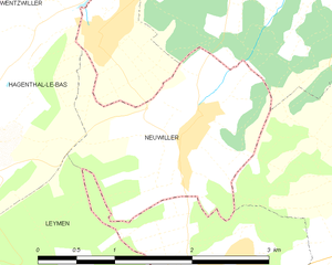
Neuwiller
- commune in Haut-Rhin, France
Neuwiller is a charming village located in the Bas-Rhin department of France, in the Alsace region. While it may not be as widely known as some other hiking destinations, it offers beautiful landscapes and a peaceful atmosphere ideal for outdoor enthusiasts....
- Country:

- Postal Code: 68220
- Coordinates: 47° 31' 28" N, 7° 30' 58" E


- GPS tracks (wikiloc): [Link]
- Area: 3.72 sq km
- Population: 473


Hagenthal-le-Bas
- commune in Haut-Rhin, France
Hagenthal-le-Bas is a charming village located in the Alsace region of France, close to the Swiss border. The area offers a range of hiking opportunities, showcasing the beautiful landscapes of the Alsace countryside....
- Country:

- Postal Code: 68220
- Coordinates: 47° 31' 29" N, 7° 28' 39" E


- GPS tracks (wikiloc): [Link]
- Area: 6.2 sq km
- Population: 1231


Attenschwiller
- commune in Haut-Rhin, France
Attenschwiller is a small village located in the Alsace region of France, near the Swiss border. This area is known for its beautiful landscapes and natural beauty, making it a great destination for hiking enthusiasts....
- Country:

- Postal Code: 68220
- Coordinates: 47° 34' 0" N, 7° 27' 51" E


- GPS tracks (wikiloc): [Link]
- Area: 5.11 sq km
- Population: 944
- Web site: [Link]

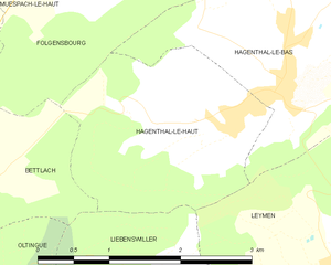
Hagenthal-le-Haut
- commune in Haut-Rhin, France
Hagenthal-le-Haut is a charming village located in the Alsace region of France, near the border with Switzerland. It offers a variety of hiking opportunities for enthusiasts looking to explore the beautiful landscapes of the area. Here are some aspects to consider when hiking in and around Hagenthal-le-Haut:...
- Country:

- Postal Code: 68220
- Coordinates: 47° 31' 10" N, 7° 28' 4" E


- GPS tracks (wikiloc): [Link]
- Area: 4.92 sq km
- Population: 641


Hégenheim
- commune in Haut-Rhin, France
Hégenheim, a small commune in the Alsace region of France, offers a charming environment for hiking enthusiasts, especially those interested in exploring the natural beauty of the border area between France and Switzerland. While the village itself is relatively small, it serves as a gateway to various hiking opportunities in the nearby landscapes....
- Country:

- Postal Code: 68220
- Coordinates: 47° 33' 43" N, 7° 31' 32" E


- GPS tracks (wikiloc): [Link]
- Area: 6.7 sq km
- Population: 3435
- Web site: [Link]


Buschwiller
- commune in Haut-Rhin, France
Buschwiller is a small village in France, located near the border with Switzerland, and nestled in the picturesque Alsace region. While it might not be as well-known as some of the larger hiking destinations, it has its own charm and offers beautiful landscapes for outdoor enthusiasts....
- Country:

- Postal Code: 68220
- Coordinates: 47° 33' 30" N, 7° 30' 27" E


- GPS tracks (wikiloc): [Link]
- Area: 4.16 sq km
- Population: 1018


Folgensbourg
- commune in Haut-Rhin, France
Folgensbourg, located in the Alsace region of France near the border with Switzerland, offers a charming setting for hiking enthusiasts. The area is characterized by its lush landscapes, rolling hills, and views of the Rhine Valley, making it a picturesque destination for outdoor activities....
- Country:

- Postal Code: 68220
- Coordinates: 47° 33' 1" N, 7° 26' 42" E


- GPS tracks (wikiloc): [Link]
- Area: 6.72 sq km
- Population: 902


Hésingue
- commune in Haut-Rhin, France
Hésingue, a quaint village in the Alsace region of France near the border with Switzerland and Germany, offers a charming hiking experience. The area is characterized by its picturesque landscapes, featuring lush greenery and varied terrains that are perfect for outdoor enthusiasts....
- Country:

- Postal Code: 68220
- Coordinates: 47° 34' 34" N, 7° 31' 19" E


- GPS tracks (wikiloc): [Link]
- Area: 9.14 sq km
- Population: 2660
- Web site: [Link]


Blotzheim
- commune in Haut-Rhin, France
Blotzheim, located in the Alsace region of France near the Swiss border, might not be as commonly recognized as a hiking destination compared to larger nearby areas like the Vosges mountains or the Jura range. However, it offers pleasant walking and hiking opportunities, especially for those looking for more gentle and scenic routes....
- Country:

- Postal Code: 68730
- Coordinates: 47° 36' 6" N, 7° 29' 43" E


- GPS tracks (wikiloc): [Link]
- Area: 14.6 sq km
- Population: 4466
- Web site: [Link]


Wentzwiller
- commune in Haut-Rhin, France
Wentzwiller is a small village located in the Alsace region of France, near the borders of Switzerland and Germany. This area offers a picturesque landscape and is ideal for hiking enthusiasts, providing a mix of forest trails, vineyards, and panoramic views of the surrounding countryside and the nearby Jura mountains....
- Country:

- Postal Code: 68220
- Coordinates: 47° 33' 1" N, 7° 28' 47" E


- GPS tracks (wikiloc): [Link]
- Area: 4.71 sq km
- Population: 733

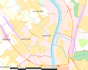
Huningue
- commune in Haut-Rhin, France
Huningue, located in the Alsace region of France, near the borders of Switzerland and Germany, offers a unique blend of natural beauty and cultural experiences. While Huningue itself is a small town, it provides access to several hiking opportunities in the surrounding areas....
- Country:

- Postal Code: 68330
- Coordinates: 47° 35' 29" N, 7° 34' 59" E


- GPS tracks (wikiloc): [Link]
- Area: 2.86 sq km
- Population: 7143
- Web site: [Link]
