Hagenthal-le-Haut (Hagenthal-le-Haut)
- commune in Haut-Rhin, France
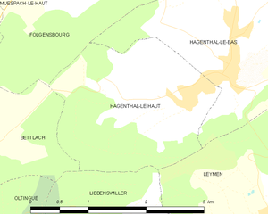
Hagenthal-le-Haut is a charming village located in the Alsace region of France, near the border with Switzerland. It offers a variety of hiking opportunities for enthusiasts looking to explore the beautiful landscapes of the area. Here are some aspects to consider when hiking in and around Hagenthal-le-Haut:
Trails and Scenery
- Diverse Terrain: The area features a mix of rolling hills, forests, and vineyards, providing scenic routes for all levels of hikers.
- Local Trails: There are several marked hiking trails that loop around the village, often connecting to neighboring towns and natural areas. Make sure to check local maps for specific trail options.
- Nature Highlights: Look out for the local flora and fauna. You might come across diverse wildlife and a variety of plant species typical of the Alsatian countryside.
Tips for Hiking in Hagenthal-le-Haut
- Wear Appropriate Gear: Suitable hiking shoes and clothing are essential, especially if you plan to explore more rugged trails.
- Maps and Navigation: It's advisable to carry a map or a GPS device, as some trails may not be well-marked. You can often find downloadable maps from local hiking clubs or websites.
- Stay Hydrated and Snack Ready: Bring enough water and snacks, particularly if you plan on hiking for several hours.
Community and Culture
- Local Events: Check for any local events or guided hikes that may be happening during your visit. Community groups often organize hikes that can enrich your experience.
- Cultural Sites: Take the time to appreciate the local architecture and culture in Hagenthal-le-Haut. Combining a hike with a visit to historic sites can enhance your experience.
Seasonal Considerations
- Spring and Summer: These seasons are ideal for hiking due to favorable weather and blooming nature.
- Fall: The autumn foliage can provide picturesque views along the trails.
- Winter: Be cautious of snow and ice on trails; some paths may become less accessible.
Safety Precautions
- Always let someone know your hiking plans.
- Enjoy hiking during daylight hours, and carry a flashlight if you're unsure about timing.
- Familiarize yourself with the local wildlife and any potential hazards.
Exploring Hagenthal-le-Haut on foot is a wonderful way to enjoy the natural beauty and local culture, so prepare well and savor your adventure!
- Country:

- Postal Code: 68220
- Coordinates: 47° 31' 10" N, 7° 28' 4" E


- GPS tracks (wikiloc): [Link]
- Area: 4.92 sq km
- Population: 641
- Wikipedia en: wiki(en)
- Wikipedia: wiki(fr)
- Wikidata storage: Wikidata: Q325102
- Wikipedia Commons Category: [Link]
- Freebase ID: [/m/03nssnn]
- Freebase ID: [/m/03nssnn]
- GeoNames ID: Alt: [6441453]
- GeoNames ID: Alt: [6441453]
- SIREN number: [216801217]
- SIREN number: [216801217]
- BnF ID: [15271823r]
- BnF ID: [15271823r]
- VIAF ID: Alt: [234845373]
- VIAF ID: Alt: [234845373]
- INSEE municipality code: 68121
- INSEE municipality code: 68121
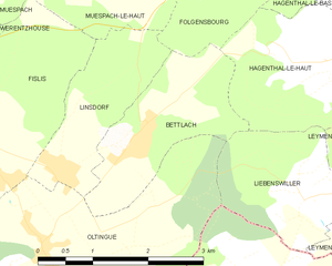
Shares border with regions:


Leymen
- commune in Haut-Rhin, France
Leymen is a charming village located in the Alsace region of northeastern France, near the Swiss border. It provides a wonderful base for hiking enthusiasts, as it is surrounded by picturesque landscapes and diverse trails suitable for various skill levels. Here are some highlights for hiking in and around Leymen:...
- Country:

- Postal Code: 68220
- Coordinates: 47° 29' 41" N, 7° 29' 0" E


- GPS tracks (wikiloc): [Link]
- Area: 11.64 sq km
- Population: 1198


Liebenswiller
- commune in Haut-Rhin, France
Liebenswiller is a charming village located in the Alsace region of northeastern France, near the borders of Switzerland and Germany. The area is surrounded by beautiful landscapes, making it a great spot for hiking enthusiasts. Here’s what you can expect when hiking in and around Liebenswiller:...
- Country:

- Postal Code: 68220
- Coordinates: 47° 29' 54" N, 7° 27' 18" E


- GPS tracks (wikiloc): [Link]
- Area: 3.87 sq km
- Population: 207


Hagenthal-le-Bas
- commune in Haut-Rhin, France
Hagenthal-le-Bas is a charming village located in the Alsace region of France, close to the Swiss border. The area offers a range of hiking opportunities, showcasing the beautiful landscapes of the Alsace countryside....
- Country:

- Postal Code: 68220
- Coordinates: 47° 31' 29" N, 7° 28' 39" E


- GPS tracks (wikiloc): [Link]
- Area: 6.2 sq km
- Population: 1231


Bettlach
- commune in Haut-Rhin, France
Bettlach is a charming commune located in the Haut-Rhin department in the Grand Est region of France. While it may be a smaller and less known area compared to some larger hiking destinations, the surrounding region offers beautiful landscapes, scenic views, and a variety of outdoor activities....
- Country:

- Postal Code: 68480
- Coordinates: 47° 30' 32" N, 7° 24' 51" E


- GPS tracks (wikiloc): [Link]
- Area: 4.09 sq km
- Population: 308


Folgensbourg
- commune in Haut-Rhin, France
Folgensbourg, located in the Alsace region of France near the border with Switzerland, offers a charming setting for hiking enthusiasts. The area is characterized by its lush landscapes, rolling hills, and views of the Rhine Valley, making it a picturesque destination for outdoor activities....
- Country:

- Postal Code: 68220
- Coordinates: 47° 33' 1" N, 7° 26' 42" E


- GPS tracks (wikiloc): [Link]
- Area: 6.72 sq km
- Population: 902

