canton of La Machine (canton de La Machine)
- canton of France (until March 2015)
- Country:

- Capital: La Machine
- Coordinates: 46° 52' 28" N, 3° 24' 4" E


- GPS tracks (wikiloc): [Link]
- Wikidata storage: Wikidata: Q1600088
- INSEE canton code: [5827]
Includes regions:

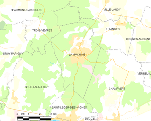
La Machine
- commune in Nièvre, France
- Country:
- Postal Code: 58260
- Coordinates: 46° 53' 21" N, 3° 27' 58" E
- GPS tracks (wikiloc): [Link]
- Area: 17.95 sq km
- Population: 3392
Druy-Parigny
- commune in Nièvre, France
- Country:
- Postal Code: 58160
- Coordinates: 46° 52' 8" N, 3° 21' 59" E
- GPS tracks (wikiloc): [Link]
- Area: 25.12 sq km
- Population: 337
Thianges
- commune in Nièvre, France
- Country:
- Postal Code: 58260
- Coordinates: 46° 54' 39" N, 3° 29' 58" E
- GPS tracks (wikiloc): [Link]
- Area: 12.8 sq km
- Population: 168


Saint-Léger-des-Vignes
- commune in Nièvre, France
- Country:
- Postal Code: 58300
- Coordinates: 46° 50' 24" N, 3° 27' 17" E
- GPS tracks (wikiloc): [Link]
- Area: 9.18 sq km
- Population: 1927
- Web site: [Link]

Saint-Ouen-sur-Loire
- commune in Nièvre, France
- Country:
- Postal Code: 58160
- Coordinates: 46° 53' 30" N, 3° 18' 10" E
- GPS tracks (wikiloc): [Link]
- AboveSeaLevel: 187 м m
- Area: 23.71 sq km
- Population: 562

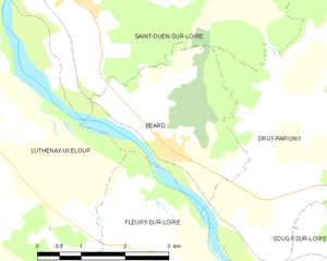
Béard
- commune in Nièvre, France
- Country:
- Postal Code: 58160
- Coordinates: 46° 51' 45" N, 3° 19' 39" E
- GPS tracks (wikiloc): [Link]
- Area: 7.71 sq km
- Population: 171


Sougy-sur-Loire
- commune in Nièvre, France
- Country:
- Postal Code: 58300
- Coordinates: 46° 51' 23" N, 3° 23' 26" E
- GPS tracks (wikiloc): [Link]
- Area: 32.92 sq km
- Population: 663