Saint-Léger-des-Vignes (Saint-Léger-des-Vignes)

- commune in Nièvre, France
- Country:

- Postal Code: 58300
- Coordinates: 46° 50' 24" N, 3° 27' 17" E


- GPS tracks (wikiloc): [Link]
- Area: 9.18 sq km
- Population: 1927
- Web site: http://www.saintlegerdesvignes.fr
- Wikipedia en: wiki(en)
- Wikipedia: wiki(fr)
- Wikidata storage: Wikidata: Q37171
- Wikipedia Commons Category: [Link]
- Freebase ID: [/m/03qffn2]
- GeoNames ID: Alt: [6438079]
- SIREN number: [215802505]
- BnF ID: [152665159]
- PACTOLS thesaurus ID: [pcrtdkFSmqz5Ta]
- INSEE municipality code: 58250
Shares border with regions:

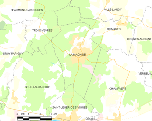
La Machine
- commune in Nièvre, France
- Country:
- Postal Code: 58260
- Coordinates: 46° 53' 21" N, 3° 27' 58" E
- GPS tracks (wikiloc): [Link]
- Area: 17.95 sq km
- Population: 3392

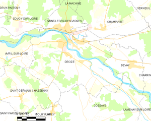
Decize
- commune in Nièvre, France
- Country:
- Postal Code: 58300
- Coordinates: 46° 49' 45" N, 3° 27' 41" E
- GPS tracks (wikiloc): [Link]
- Area: 48.22 sq km
- Population: 5623
- Web site: [Link]


Sougy-sur-Loire
- commune in Nièvre, France
- Country:
- Postal Code: 58300
- Coordinates: 46° 51' 23" N, 3° 23' 26" E
- GPS tracks (wikiloc): [Link]
- Area: 32.92 sq km
- Population: 663


Champvert
- commune in Nièvre, France
- Country:
- Postal Code: 58300
- Coordinates: 46° 50' 26" N, 3° 30' 41" E
- GPS tracks (wikiloc): [Link]
- Area: 46.12 sq km
- Population: 824