canton of Montbazens (canton de Montbazens)
- canton of France
- Country:

- Capital: Montbazens
- Coordinates: 44° 28' 39" N, 2° 13' 47" E


- GPS tracks (wikiloc): [Link]
- Wikidata storage: Wikidata: Q1726297
- Library of Congress authority ID: Alt: [no99042936]
- INSEE canton code: [1218]
Includes regions:


Brandonnet
- commune in Aveyron, France
- Country:
- Postal Code: 12350
- Coordinates: 44° 23' 16" N, 2° 8' 7" E
- GPS tracks (wikiloc): [Link]
- Area: 12.22 sq km
- Population: 321


Compolibat
- commune in Aveyron, France
- Country:
- Postal Code: 12350
- Coordinates: 44° 22' 39" N, 2° 11' 42" E
- GPS tracks (wikiloc): [Link]
- Area: 17.04 sq km
- Population: 355


Montbazens
- commune in Aveyron, France
- Country:
- Postal Code: 12220
- Coordinates: 44° 28' 36" N, 2° 13' 44" E
- GPS tracks (wikiloc): [Link]
- Area: 17.48 sq km
- Population: 1401
- Web site: [Link]


Galgan
- commune in Aveyron, France
- Country:
- Postal Code: 12220
- Coordinates: 44° 30' 10" N, 2° 10' 44" E
- GPS tracks (wikiloc): [Link]
- Area: 20.37 sq km
- Population: 359
Drulhe
- commune in Aveyron, France
- Country:
- Postal Code: 12350
- Coordinates: 44° 27' 44" N, 2° 7' 45" E
- GPS tracks (wikiloc): [Link]
- Area: 18.03 sq km
- Population: 445

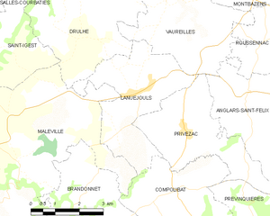
Lanuéjouls
- commune in Aveyron, France
- Country:
- Postal Code: 12350
- Coordinates: 44° 25' 30" N, 2° 9' 37" E
- GPS tracks (wikiloc): [Link]
- AboveSeaLevel: 500 м m
- Area: 12 sq km
- Population: 729

Maleville
- commune in Aveyron, France
- Country:
- Postal Code: 12350
- Coordinates: 44° 23' 50" N, 2° 6' 7" E
- GPS tracks (wikiloc): [Link]
- Area: 36.35 sq km
- Population: 979


Vaureilles
- commune in Aveyron, France
- Country:
- Postal Code: 12220
- Coordinates: 44° 27' 11" N, 2° 11' 53" E
- GPS tracks (wikiloc): [Link]
- Area: 14.24 sq km
- Population: 520


Valzergues
- commune in Aveyron, France
- Country:
- Postal Code: 12220
- Coordinates: 44° 29' 57" N, 2° 13' 17" E
- GPS tracks (wikiloc): [Link]
- Area: 6.49 sq km
- Population: 217

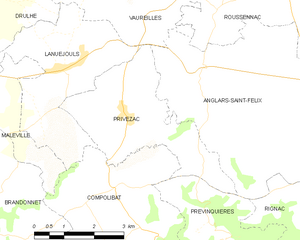
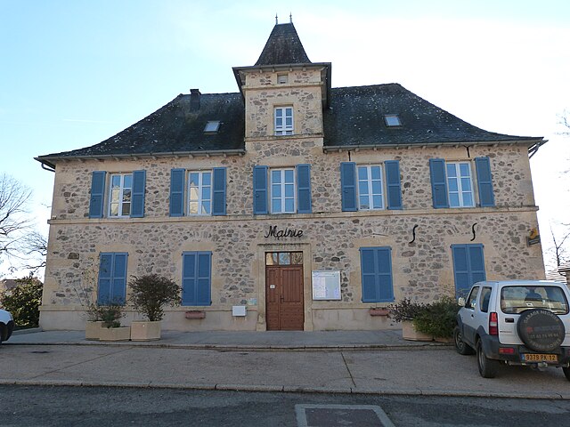
Privezac
- commune in Aveyron, France
- Country:
- Postal Code: 12350
- Coordinates: 44° 24' 44" N, 2° 11' 15" E
- GPS tracks (wikiloc): [Link]
- Area: 11.09 sq km
- Population: 342


Roussennac
- commune in Aveyron, France
- Country:
- Postal Code: 12220
- Coordinates: 44° 27' 15" N, 2° 15' 9" E
- GPS tracks (wikiloc): [Link]
- Area: 17.27 sq km
- Population: 606
- Web site: [Link]


Lugan
- commune in Aveyron, France
- Country:
- Postal Code: 12220
- Coordinates: 44° 28' 58" N, 2° 15' 32" E
- GPS tracks (wikiloc): [Link]
- AboveSeaLevel: 500 м m
- Area: 12.61 sq km
- Population: 339

Peyrusse-le-Roc
- commune in Aveyron, France
- Country:
- Postal Code: 12220
- Coordinates: 44° 29' 45" N, 2° 8' 26" E
- GPS tracks (wikiloc): [Link]
- Area: 13.81 sq km
- Population: 229