canton of Montfaucon-en-Velay (canton de Montfaucon-en-Velay)
- canton of France (until March 2015)
- Country:

- Capital: Montfaucon-en-Velay
- Coordinates: 45° 11' 8" N, 4° 18' 53" E


- GPS tracks (wikiloc): [Link]
- Wikidata storage: Wikidata: Q248160
- INSEE canton code: [4315]
Includes regions:

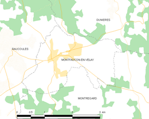
Montfaucon-en-Velay
- commune in Haute-Loire, France
- Country:
- Postal Code: 43290
- Coordinates: 45° 11' 6" N, 4° 18' 49" E
- GPS tracks (wikiloc): [Link]
- AboveSeaLevel: 914 м m
- Area: 4.99 sq km
- Population: 1257
Raucoules
- commune in Haute-Loire, France
- Country:
- Postal Code: 43290
- Coordinates: 45° 11' 15" N, 4° 17' 42" E
- GPS tracks (wikiloc): [Link]
- Area: 21.01 sq km
- Population: 911


Saint-Bonnet-le-Froid
- commune in Haute-Loire, France
- Country:
- Postal Code: 43290
- Coordinates: 45° 8' 33" N, 4° 26' 7" E
- GPS tracks (wikiloc): [Link]
- Area: 13.09 sq km
- Population: 261


Montregard
- commune in Haute-Loire, France
- Country:
- Postal Code: 43290
- Coordinates: 45° 9' 31" N, 4° 20' 48" E
- GPS tracks (wikiloc): [Link]
- Area: 39.93 sq km
- Population: 607

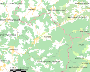
Riotord
- commune in Haute-Loire, France
- Country:
- Postal Code: 43220
- Coordinates: 45° 13' 54" N, 4° 24' 7" E
- GPS tracks (wikiloc): [Link]
- Area: 51.88 sq km
- Population: 1179


Dunières
- commune in Haute-Loire, France
- Country:
- Postal Code: 43220
- Coordinates: 45° 12' 56" N, 4° 20' 41" E
- GPS tracks (wikiloc): [Link]
- Area: 34.75 sq km
- Population: 2856
- Web site: [Link]
Saint-Julien-Molhesabate
- commune in Haute-Loire, France
- Country:
- Postal Code: 43220
- Coordinates: 45° 11' 10" N, 4° 25' 35" E
- GPS tracks (wikiloc): [Link]
- Area: 27.5 sq km
- Population: 173