canton of Montmirail (canton de Montmirail)
- canton of France (until March 2015)
- Country:

- Capital: Montmirail
- Coordinates: 48° 6' 0" N, 0° 48' 0" E


- GPS tracks (wikiloc): [Link]
- Wikidata storage: Wikidata: Q545373
- INSEE canton code: [7225]
Includes regions:


Courgenard
- commune in Sarthe, France
- Country:
- Postal Code: 72320
- Coordinates: 48° 9' 6" N, 0° 44' 12" E
- GPS tracks (wikiloc): [Link]
- Area: 11.32 sq km
- Population: 494

Champrond
- commune in Sarthe, France
- Country:
- Postal Code: 72320
- Coordinates: 48° 4' 39" N, 0° 44' 44" E
- GPS tracks (wikiloc): [Link]
- Area: 5.98 sq km
- Population: 69


Saint-Ulphace
- commune in Sarthe, France
- Country:
- Postal Code: 72320
- Coordinates: 48° 9' 30" N, 0° 48' 59" E
- GPS tracks (wikiloc): [Link]
- Area: 15.98 sq km
- Population: 231


Melleray
- commune in Sarthe, France
- Country:
- Postal Code: 72320
- Coordinates: 48° 5' 56" N, 0° 48' 1" E
- GPS tracks (wikiloc): [Link]
- Area: 25.9 sq km
- Population: 451


Saint-Maixent
- commune in Sarthe, France
- Country:
- Postal Code: 72320
- Coordinates: 48° 5' 22" N, 0° 39' 6" E
- GPS tracks (wikiloc): [Link]
- Area: 22.48 sq km
- Population: 721

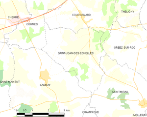
Saint-Jean-des-Échelles
- commune in Sarthe, France
- Country:
- Postal Code: 72320
- Coordinates: 48° 7' 48" N, 0° 42' 48" E
- GPS tracks (wikiloc): [Link]
- Area: 10.64 sq km
- Population: 254


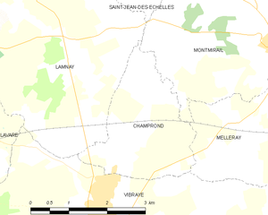
Lamnay
- commune in Sarthe, France
- Country:
- Postal Code: 72320
- Coordinates: 48° 6' 58" N, 0° 42' 15" E
- GPS tracks (wikiloc): [Link]
- Area: 22.09 sq km
- Population: 962

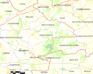
Gréez-sur-Roc
- commune in Sarthe, France
- Country:
- Postal Code: 72320
- Coordinates: 48° 8' 14" N, 0° 47' 41" E
- GPS tracks (wikiloc): [Link]
- Area: 25.38 sq km
- Population: 339


Montmirail
- commune in Sarthe, France
- Country:
- Postal Code: 72320
- Coordinates: 48° 6' 10" N, 0° 47' 26" E
- GPS tracks (wikiloc): [Link]
- Area: 12.53 sq km
- Population: 418