Gréez-sur-Roc (Gréez-sur-Roc)

- commune in Sarthe, France
- Country:

- Postal Code: 72320
- Coordinates: 48° 8' 14" N, 0° 47' 41" E


- GPS tracks (wikiloc): [Link]
- Area: 25.38 sq km
- Population: 339
- Wikipedia en: wiki(en)
- Wikipedia: wiki(fr)
- Wikidata storage: Wikidata: Q782117
- Wikipedia Commons Category: [Link]
- Freebase ID: [/m/03qk_3j]
- GeoNames ID: Alt: [3014760]
- SIREN number: [217201441]
- BnF ID: [15273699x]
- PACTOLS thesaurus ID: [pcrt5USasMWiE2]
- INSEE municipality code: 72144
Shares border with regions:


Chapelle-Guillaume
- commune in Eure-et-Loir, France
- Country:
- Postal Code: 28330
- Coordinates: 48° 6' 47" N, 0° 54' 18" E
- GPS tracks (wikiloc): [Link]
- Area: 19.86 sq km
- Population: 189


Courgenard
- commune in Sarthe, France
- Country:
- Postal Code: 72320
- Coordinates: 48° 9' 6" N, 0° 44' 12" E
- GPS tracks (wikiloc): [Link]
- Area: 11.32 sq km
- Population: 494


Saint-Ulphace
- commune in Sarthe, France
- Country:
- Postal Code: 72320
- Coordinates: 48° 9' 30" N, 0° 48' 59" E
- GPS tracks (wikiloc): [Link]
- Area: 15.98 sq km
- Population: 231
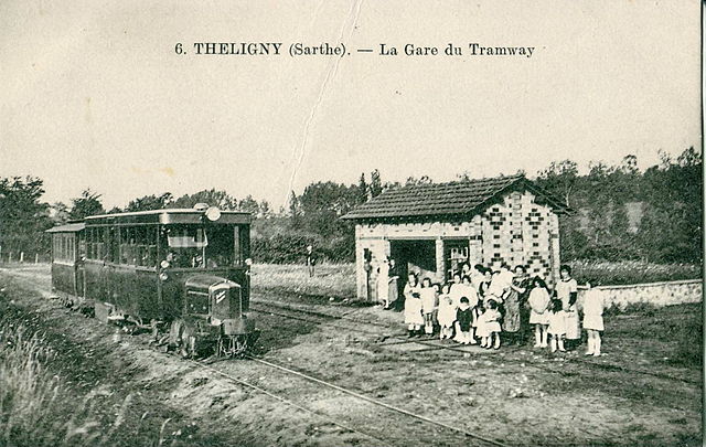

Théligny
- commune in Sarthe, France
- Country:
- Postal Code: 72320
- Coordinates: 48° 10' 31" N, 0° 47' 59" E
- GPS tracks (wikiloc): [Link]
- Area: 14.31 sq km
- Population: 219


Melleray
- commune in Sarthe, France
- Country:
- Postal Code: 72320
- Coordinates: 48° 5' 56" N, 0° 48' 1" E
- GPS tracks (wikiloc): [Link]
- Area: 25.9 sq km
- Population: 451

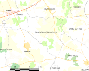
Saint-Jean-des-Échelles
- commune in Sarthe, France
- Country:
- Postal Code: 72320
- Coordinates: 48° 7' 48" N, 0° 42' 48" E
- GPS tracks (wikiloc): [Link]
- Area: 10.64 sq km
- Population: 254

La Bazoche-Gouet
- commune in Eure-et-Loir, France
- Country:
- Postal Code: 28330
- Coordinates: 48° 8' 19" N, 0° 58' 50" E
- GPS tracks (wikiloc): [Link]
- Area: 37.44 sq km
- Population: 1236


Montmirail
- commune in Sarthe, France
- Country:
- Postal Code: 72320
- Coordinates: 48° 6' 10" N, 0° 47' 26" E
- GPS tracks (wikiloc): [Link]
- Area: 12.53 sq km
- Population: 418