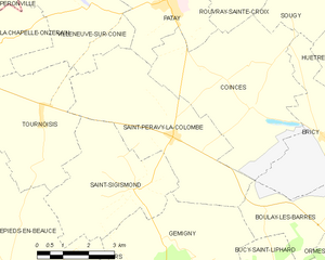
canton of Patay (canton de Patay)
- canton of France (until March 2015)
- Country:

- Capital: Patay
- Coordinates: 48° 0' 16" N, 1° 41' 36" E


- GPS tracks (wikiloc): [Link]
- Wikidata storage: Wikidata: Q509182
- INSEE canton code: [4528]
Includes regions:
La Chapelle-Onzerain
- commune in Loiret, France
- Country:
- Postal Code: 45310
- Coordinates: 48° 2' 0" N, 1° 36' 43" E
- GPS tracks (wikiloc): [Link]
- Area: 7.06 sq km
- Population: 122
Bricy
- commune in Loiret, France
- Country:
- Postal Code: 45310
- Coordinates: 47° 59' 55" N, 1° 46' 53" E
- GPS tracks (wikiloc): [Link]
- Area: 12.66 sq km
- Population: 559
- Web site: [Link]
Boulay-les-Barres
- commune in Loiret, France
- Country:
- Postal Code: 45140
- Coordinates: 47° 58' 49" N, 1° 47' 1" E
- GPS tracks (wikiloc): [Link]
- Area: 12.45 sq km
- Population: 946


Gémigny
- commune in Loiret, France
- Country:
- Postal Code: 45310
- Coordinates: 47° 57' 50" N, 1° 41' 42" E
- GPS tracks (wikiloc): [Link]
- Area: 14.17 sq km
- Population: 211


Villamblain
- commune in Loiret, France
- Country:
- Postal Code: 45310
- Coordinates: 48° 0' 36" N, 1° 33' 8" E
- GPS tracks (wikiloc): [Link]
- Area: 25.95 sq km
- Population: 280


Tournoisis
- commune in Loiret, France
- Country:
- Postal Code: 45310
- Coordinates: 48° 0' 20" N, 1° 37' 49" E
- GPS tracks (wikiloc): [Link]
- Area: 14.94 sq km
- Population: 408

Saint-Péravy-la-Colombe
- commune in Loiret, France
- Country:
- Postal Code: 45310
- Coordinates: 48° 0' 1" N, 1° 41' 59" E
- GPS tracks (wikiloc): [Link]
- Area: 18.96 sq km
- Population: 742
- Web site: [Link]


Saint-Sigismond
- commune in Loiret, France
- Country:
- Postal Code: 45310
- Coordinates: 47° 58' 52" N, 1° 40' 49" E
- GPS tracks (wikiloc): [Link]
- Area: 14.93 sq km
- Population: 271
Villeneuve-sur-Conie
- commune in Loiret, France
- Country:
- Postal Code: 45310
- Coordinates: 48° 2' 41" N, 1° 39' 3" E
- GPS tracks (wikiloc): [Link]
- Area: 17.97 sq km
- Population: 211

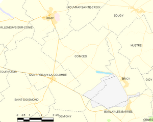
Coinces
- commune in Loiret, France
- Country:
- Postal Code: 45310
- Coordinates: 48° 0' 37" N, 1° 44' 25" E
- GPS tracks (wikiloc): [Link]
- Area: 21.63 sq km
- Population: 582
- Web site: [Link]


Bucy-Saint-Liphard
- commune in Loiret, France
- Country:
- Postal Code: 45140
- Coordinates: 47° 56' 9" N, 1° 45' 54" E
- GPS tracks (wikiloc): [Link]
- Area: 17.84 sq km
- Population: 200


Patay
- commune in Loiret, France
- Country:
- Postal Code: 45310
- Coordinates: 48° 2' 53" N, 1° 41' 44" E
- GPS tracks (wikiloc): [Link]
- Area: 13.8 sq km
- Population: 2133
- Web site: [Link]
Rouvray-Sainte-Croix
- commune in Loiret, France
- Country:
- Postal Code: 45310
- Coordinates: 48° 3' 33" N, 1° 43' 56" E
- GPS tracks (wikiloc): [Link]
- Area: 9.47 sq km
- Population: 145