canton of Rives (canton de Rives)
- canton of France
Canton de Rives, located in the Auvergne-Rhône-Alpes region of France, is known for its picturesque landscapes, rolling hills, and beautiful natural scenery, making it a fantastic destination for hiking enthusiasts. Here are some key points to consider:
Trails and Routes
- Variety of Trails: The Canton de Rives offers a range of trails suitable for various skill levels, from easy walks to more challenging hikes.
- Marked Paths: Many trails are well-marked and maintained, ensuring an enjoyable experience for hikers. Look for signage that indicates the level of difficulty and estimated time.
- Scenic Views: Hikes often provide stunning views of the surrounding countryside, including valleys, forests, and sometimes glimpses of nearby mountains.
Natural Features
- Diverse Flora and Fauna: The region is home to a variety of plant and animal life, making it an excellent spot for nature lovers and wildlife watchers.
- Lakes and Rivers: Hiking around the areas near lakes or rivers can be particularly rewarding, offering opportunities for additional activities like fishing or swimming.
Recommendations
- Local Guides: Consider hiring a local guide for specialized hikes or to learn more about the region's natural and cultural history.
- Safety Precautions: Always remain aware of your surroundings, carry enough water, wear appropriate footwear, and inform someone of your hiking plans.
- Weather Awareness: Check the weather forecast before your hike, as conditions can change rapidly in mountainous areas.
Best Times to Hike
Spring and autumn are ideal times for hiking in Canton de Rives due to milder temperatures and fewer crowds. Summer can be warm, while winter may bring snow, so be prepared and check trail conditions if hiking in colder months.
Additional Activities
Aside from hiking, the Canton de Rives area may also offer opportunities for cycling, horseback riding, and exploring local villages, which can enhance your overall experience.
In summary, Canton de Rives is a beautiful destination with diverse hiking opportunities for all skill levels. Make sure to plan accordingly, and enjoy the natural beauty this region has to offer!
- Country:

- Capital: Rives
- Coordinates: 45° 20' 55" N, 5° 31' 7" E


- GPS tracks (wikiloc): [Link]
- Wikidata storage: Wikidata: Q1726967
- INSEE canton code: [3823]
Includes regions:
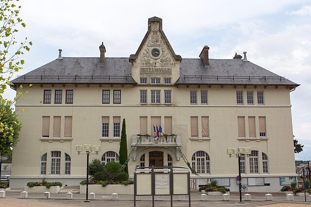

Rives
- commune in Isère, France
Rives, located in the Isère department of the Auvergne-Rhône-Alpes region in southeastern France, offers a range of outdoor activities, including hiking. The area is characterized by its picturesque landscapes, mountainous terrain, and proximity to the French Alps, making it a great starting point for various hiking adventures....
- Country:

- Postal Code: 38140
- Coordinates: 45° 21' 3" N, 5° 30' 8" E


- GPS tracks (wikiloc): [Link]
- Area: 10.93 sq km
- Population: 6242
- Web site: [Link]


Charnècles
- commune in Isère, France
Charnècles is a charming village located in the Isère department of the Auvergne-Rhône-Alpes region in France. It offers a scenic backdrop for hiking enthusiasts, with various trails that showcase the area's natural beauty and rich landscapes....
- Country:

- Postal Code: 38140
- Coordinates: 45° 20' 36" N, 5° 31' 40" E


- GPS tracks (wikiloc): [Link]
- Area: 5.23 sq km
- Population: 1505
- Web site: [Link]


Vourey
- commune in Isère, France
Vourey is a charming village located in the Auvergne-Rhône-Alpes region of France, surrounded by picturesque landscapes ideal for hiking enthusiasts. The area offers a variety of trails that cater to different skill levels, from easy walks through scenic meadows to more challenging hikes that lead into the nearby hills and forests....
- Country:

- Postal Code: 38210
- Coordinates: 45° 19' 15" N, 5° 31' 12" E


- GPS tracks (wikiloc): [Link]
- Area: 6.88 sq km
- Population: 1711
- Web site: [Link]


Saint-Jean-de-Moirans
- commune in Isère, France
 Hiking in Saint-Jean-de-Moirans
Saint-Jean-de-Moirans is located in the Auvergne-Rhône-Alpes region of France, nestled at the foot of the Chartreuse Mountains. This picturesque area offers a variety of hiking opportunities that cater to different skill levels, from leisurely walks to more challenging treks....
- Country:

- Postal Code: 38430
- Coordinates: 45° 20' 28" N, 5° 34' 56" E


- GPS tracks (wikiloc): [Link]
- Area: 6.43 sq km
- Population: 3427
- Web site: [Link]

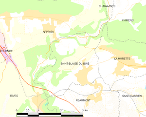
Saint-Blaise-du-Buis
- commune in Isère, France
 Hiking in Saint-Blaise-du-Buis
Saint-Blaise-du-Buis, located in the Isère department in southeastern France, is a great destination for hiking enthusiasts who appreciate nature and stunning landscapes. This area is characterized by its beautiful scenery, rolling hills, and a mix of forested areas and open fields, making it a picturesque spot for outdoor activities....
- Country:

- Postal Code: 38140
- Coordinates: 45° 22' 37" N, 5° 31' 6" E


- GPS tracks (wikiloc): [Link]
- Area: 5.44 sq km
- Population: 1028
- Web site: [Link]
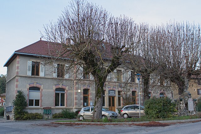

Réaumont
- commune in Isère, France
Réaumont is a picturesque village located in the Isère department of the Auvergne-Rhône-Alpes region in southeastern France. It's surrounded by beautiful landscapes, making it an ideal destination for hiking enthusiasts. Here’s what you need to know when considering a hike in Réaumont:...
- Country:

- Postal Code: 38140
- Coordinates: 45° 22' 11" N, 5° 31' 33" E


- GPS tracks (wikiloc): [Link]
- Area: 4.95 sq km
- Population: 1037
- Web site: [Link]

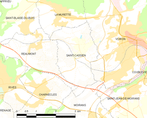
Saint-Cassien
- commune in Isère, France
Saint-Cassien, located in the Isère department of France, is a tranquil and beautiful area that offers a variety of hiking opportunities. Nestled in the scenic foothills of the French Alps, it features diverse landscapes, including forests, rivers, and stunning mountain vistas....
- Country:

- Postal Code: 38500
- Coordinates: 45° 21' 36" N, 5° 33' 12" E


- GPS tracks (wikiloc): [Link]
- Area: 5.67 sq km
- Population: 1143
- Web site: [Link]


Moirans
- commune in Isère, France
Moirans, located in the Auvergne-Rhône-Alpes region of France, is surrounded by beautiful landscapes that are perfect for hiking enthusiasts. Here are some key points to consider if you're planning a hiking trip in this area:...
- Country:

- Postal Code: 38430
- Coordinates: 45° 19' 30" N, 5° 33' 52" E


- GPS tracks (wikiloc): [Link]
- Area: 20.06 sq km
- Population: 8022
- Web site: [Link]
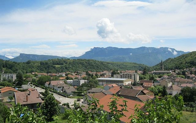

Renage
- commune in Isère, France
Renage is a picturesque village located in the Isère department in the Auvergne-Rhône-Alpes region of southeastern France. Surrounded by stunning natural landscapes, it's an excellent base for various hiking adventures....
- Country:

- Postal Code: 38140
- Coordinates: 45° 20' 0" N, 5° 29' 7" E


- GPS tracks (wikiloc): [Link]
- Area: 5.1 sq km
- Population: 3557
- Web site: [Link]


Beaucroissant
- commune in Isère, France
Beaucroissant, located in the Isère department in the Auvergne-Rhône-Alpes region of France, offers a charming setting for hiking enthusiasts. The area is characterized by beautiful landscapes, rolling hills, and proximity to the Alps, making it a great base for exploring both gentle and more challenging trails....
- Country:

- Postal Code: 38140
- Coordinates: 45° 20' 26" N, 5° 28' 13" E


- GPS tracks (wikiloc): [Link]
- Area: 11.18 sq km
- Population: 1621
- Web site: [Link]


Izeaux
- commune in Isère, France
Izeaux is a small commune located in the Isère department in the Auvergne-Rhône-Alpes region of southeastern France. Nestled in the foothills of the Alps, it offers a variety of hiking opportunities for both beginners and experienced hikers....
- Country:

- Postal Code: 38140
- Coordinates: 45° 20' 4" N, 5° 25' 27" E


- GPS tracks (wikiloc): [Link]
- Area: 15.54 sq km
- Population: 2154
- Web site: [Link]


La Murette
- commune in Isère, France
La Murette is a small village located in the French Alps, specifically within the Isère department. It's nestled in a picturesque landscape offering a variety of hiking opportunities that cater to different skill levels....
- Country:

- Postal Code: 38140
- Coordinates: 45° 22' 52" N, 5° 32' 23" E


- GPS tracks (wikiloc): [Link]
- Area: 4.22 sq km
- Population: 1931