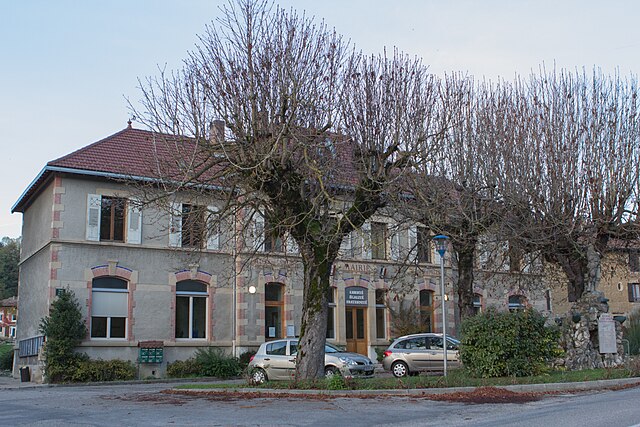
Saint-Cassien (Saint-Cassien)

- commune in Isère, France
 Hiking in Saint-Cassien
Saint-Cassien, located in the Isère department of France, is a tranquil and beautiful area that offers a variety of hiking opportunities. Nestled in the scenic foothills of the French Alps, it features diverse landscapes, including forests, rivers, and stunning mountain vistas.
Hiking Trails
- Local Trails: There are several well-marked trails in the region, suitable for different skill levels. Whether you're looking for an easy stroll or a more challenging hike, you can find routes that match your preference.
- GR Hiking Routes: The region may also be near GR (Grande Randonnée) trails, which are long-distance paths traversing various terrains in France. These trails can offer multi-day hiking experiences if you're up for it.
Key Points of Interest
- Natural Beauty: Expect to encounter rich flora and fauna, with opportunities for bird watching and spotting wildlife along the trails.
- Panoramic Views: Some trails lead to elevated viewpoints offering breathtaking panoramas of the Alps and surrounding valleys, making for excellent photography spots.
- Lakes and Rivers: Hiking trails may meander alongside the tranquil waters of local lakes or rivers, providing serene resting spots.
Hiking Tips
- Seasonal Considerations: Summer and early fall are generally the best times to hike, as snow in the winter can limit access to certain trails. Always check trail conditions before heading out.
- Preparation: Make sure to wear appropriate footwear, carry enough water, and bring snacks to keep your energy up while hiking.
- Navigation: Even though trails are marked, having a hiking map or a GPS device can be helpful, especially for the more remote paths.
Safety
- Always inform someone of your hiking plans.
- Be aware of the weather conditions and prepare accordingly.
- If venturing into more remote trails, it’s advisable to have knowledge of basic first aid and carry a first aid kit.
Conclusion
Hiking in Saint-Cassien offers a serene and picturesque environment, perfect for nature lovers and adventure seekers alike. Be sure to take the time to enjoy the exquisite natural beauty while respecting the local environment.
- Country:

- Postal Code: 38500
- Coordinates: 45° 21' 36" N, 5° 33' 12" E


- GPS tracks (wikiloc): [Link]
- Area: 5.67 sq km
- Population: 1143
- Web site: http://www.saint-cassien.fr
- Wikipedia en: wiki(en)
- Wikipedia: wiki(fr)
- Wikidata storage: Wikidata: Q1094333
- Wikipedia Commons Category: [Link]
- Freebase ID: [/m/03nw7pj]
- GeoNames ID: Alt: [2981241]
- SIREN number: [213803737]
- BnF ID: [15258183z]
- VIAF ID: Alt: [248343797]
- INSEE municipality code: 38373
Shares border with regions:

Réaumont
- commune in Isère, France
Hiking in Réaumont
Réaumont is a picturesque village located in the Isère department of the Auvergne-Rhône-Alpes region in southeastern France. It's surrounded by beautiful landscapes, making it an ideal destination for hiking enthusiasts. Here’s what you need to know when considering a hike in Réaumont:...
- Country:
- Postal Code: 38140
- Coordinates: 45° 22' 11" N, 5° 31' 33" E
- GPS tracks (wikiloc): [Link]
- Area: 4.95 sq km
- Population: 1037
- Web site: [Link]


Moirans
- commune in Isère, France
Hiking in Moirans
Moirans, located in the Auvergne-Rhône-Alpes region of France, is surrounded by beautiful landscapes that are perfect for hiking enthusiasts. Here are some key points to consider if you're planning a hiking trip in this area:...
- Country:
- Postal Code: 38430
- Coordinates: 45° 19' 30" N, 5° 33' 52" E
- GPS tracks (wikiloc): [Link]
- Area: 20.06 sq km
- Population: 8022
- Web site: [Link]


Voiron
- commune in Isère, France
Hiking in Voiron
Voiron, located in the Isère department in the Auvergne-Rhône-Alpes region of France, is surrounded by beautiful natural landscapes, making it an excellent destination for hiking enthusiasts. Here are some highlights about hiking around Voiron:...
- Country:
- Postal Code: 38500
- Coordinates: 45° 21' 48" N, 5° 35' 24" E
- GPS tracks (wikiloc): [Link]
- Area: 21.9 sq km
- Population: 20529
- Web site: [Link]


La Murette
- commune in Isère, France
Hiking in La Murette
La Murette is a small village located in the French Alps, specifically within the Isère department. It's nestled in a picturesque landscape offering a variety of hiking opportunities that cater to different skill levels....
- Country:
- Postal Code: 38140
- Coordinates: 45° 22' 52" N, 5° 32' 23" E
- GPS tracks (wikiloc): [Link]
- Area: 4.22 sq km
- Population: 1931