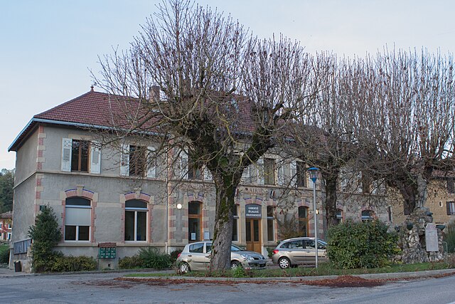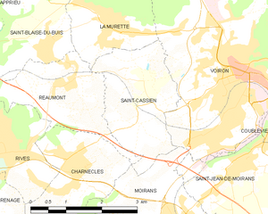
Moirans (Moirans)
- commune in Isère, France
Moirans, located in the Auvergne-Rhône-Alpes region of France, is surrounded by beautiful landscapes that are perfect for hiking enthusiasts. Here are some key points to consider if you're planning a hiking trip in this area:
Scenic Trails
-
Local Trails: Moirans offers various local hiking trails that range in difficulty from easy to moderate. Many trails wind through lush forests, rolling hills, and picturesque farmland.
-
Vercors Regional Natural Park: Just a short drive from Moirans, this park has stunning trails with breathtaking views of the surrounding mountains and valleys. The area is known for its limestone cliffs, diverse wildlife, and unique geological formations.
-
Isère River Valley: Hikes along the river provide a more relaxed experience with opportunities for bird watching and enjoying the tranquil scenery.
Hiking Tips
-
Maps and Signage: Many trails are well-marked, but it's wise to carry a detailed map or download GPS trails using hiking apps.
-
Weather Considerations: The weather can change quickly in mountainous areas, so check forecasts and be prepared for varying conditions. Layered clothing is recommended.
-
Safety: Always inform someone of your hiking plans and expected return time. Carry necessary supplies such as water, snacks, a first-aid kit, and a cellphone.
Best Time to Hike
- Spring and Fall: These seasons offer pleasant weather for hiking, with spring wildflowers and autumn foliage creating beautiful backdrops.
- Summer: Can be hot, so it's best to plan hikes for the cooler parts of the day.
Additional Activities
In addition to hiking, the region offers opportunities for cycling, rock climbing, and exploring local culture in nearby towns. Make sure to also try local cuisine and enjoy the regional specialties.
Conclusion
Moirans is a fantastic starting point for exploring the diverse hiking options in the Auvergne-Rhône-Alpes region. Whether you're a seasoned hiker or a beginner, you'll find trails that fit your skill level and provide stunning natural beauty. Enjoy your adventure!
- Country:

- Postal Code: 38430
- Coordinates: 45° 19' 30" N, 5° 33' 52" E


- GPS tracks (wikiloc): [Link]
- Area: 20.06 sq km
- Population: 8022
- Web site: http://www.ville-moirans.fr
- Wikipedia en: wiki(en)
- Wikipedia: wiki(fr)
- Wikidata storage: Wikidata: Q1154587
- Wikipedia Commons Gallery: [Link]
- Wikipedia Commons Category: [Link]
- Freebase ID: [/m/02w95lj]
- GeoNames ID: Alt: [6454074]
- SIREN number: [213802390]
- BnF ID: [152580512]
- VIAF ID: Alt: [245075067]
- INSEE municipality code: 38239
Shares border with regions:


Charnècles
- commune in Isère, France
Charnècles is a charming village located in the Isère department of the Auvergne-Rhône-Alpes region in France. It offers a scenic backdrop for hiking enthusiasts, with various trails that showcase the area's natural beauty and rich landscapes....
- Country:

- Postal Code: 38140
- Coordinates: 45° 20' 36" N, 5° 31' 40" E


- GPS tracks (wikiloc): [Link]
- Area: 5.23 sq km
- Population: 1505
- Web site: [Link]


Vourey
- commune in Isère, France
Vourey is a charming village located in the Auvergne-Rhône-Alpes region of France, surrounded by picturesque landscapes ideal for hiking enthusiasts. The area offers a variety of trails that cater to different skill levels, from easy walks through scenic meadows to more challenging hikes that lead into the nearby hills and forests....
- Country:

- Postal Code: 38210
- Coordinates: 45° 19' 15" N, 5° 31' 12" E


- GPS tracks (wikiloc): [Link]
- Area: 6.88 sq km
- Population: 1711
- Web site: [Link]


Saint-Jean-de-Moirans
- commune in Isère, France
 Hiking in Saint-Jean-de-Moirans
Saint-Jean-de-Moirans is located in the Auvergne-Rhône-Alpes region of France, nestled at the foot of the Chartreuse Mountains. This picturesque area offers a variety of hiking opportunities that cater to different skill levels, from leisurely walks to more challenging treks....
- Country:

- Postal Code: 38430
- Coordinates: 45° 20' 28" N, 5° 34' 56" E


- GPS tracks (wikiloc): [Link]
- Area: 6.43 sq km
- Population: 3427
- Web site: [Link]


Saint-Quentin-sur-Isère
- commune in Isère, France
 Hiking in Saint-Quentin-sur-Isère
Saint-Quentin-sur-Isère, located in the Isère department of France, is surrounded by beautiful landscapes that are perfect for hiking enthusiasts. The region features a mix of rolling hills, forests, and views of the nearby Alps, making it a great destination for hiking....
- Country:

- Postal Code: 38210
- Coordinates: 45° 16' 45" N, 5° 32' 32" E


- GPS tracks (wikiloc): [Link]
- Area: 19.45 sq km
- Population: 1396
- Web site: [Link]


Réaumont
- commune in Isère, France
Réaumont is a picturesque village located in the Isère department of the Auvergne-Rhône-Alpes region in southeastern France. It's surrounded by beautiful landscapes, making it an ideal destination for hiking enthusiasts. Here’s what you need to know when considering a hike in Réaumont:...
- Country:

- Postal Code: 38140
- Coordinates: 45° 22' 11" N, 5° 31' 33" E


- GPS tracks (wikiloc): [Link]
- Area: 4.95 sq km
- Population: 1037
- Web site: [Link]


Saint-Cassien
- commune in Isère, France
Saint-Cassien, located in the Isère department of France, is a tranquil and beautiful area that offers a variety of hiking opportunities. Nestled in the scenic foothills of the French Alps, it features diverse landscapes, including forests, rivers, and stunning mountain vistas....
- Country:

- Postal Code: 38500
- Coordinates: 45° 21' 36" N, 5° 33' 12" E


- GPS tracks (wikiloc): [Link]
- Area: 5.67 sq km
- Population: 1143
- Web site: [Link]


Voiron
- commune in Isère, France
Voiron, located in the Isère department in the Auvergne-Rhône-Alpes region of France, is surrounded by beautiful natural landscapes, making it an excellent destination for hiking enthusiasts. Here are some highlights about hiking around Voiron:...
- Country:

- Postal Code: 38500
- Coordinates: 45° 21' 48" N, 5° 35' 24" E


- GPS tracks (wikiloc): [Link]
- Area: 21.9 sq km
- Population: 20529
- Web site: [Link]


Voreppe
- commune in Isère, France
Voreppe, located in the Isère department of southeastern France, is a picturesque area that offers various hiking opportunities amid stunning natural landscapes. The proximity to the Chartreuse and Vercors mountain ranges makes it an ideal base for outdoor enthusiasts....
- Country:

- Postal Code: 38340
- Coordinates: 45° 17' 52" N, 5° 38' 13" E


- GPS tracks (wikiloc): [Link]
- Area: 28.65 sq km
- Population: 9441
- Web site: [Link]
