canton of Roybon (canton de Roybon)
- canton of France
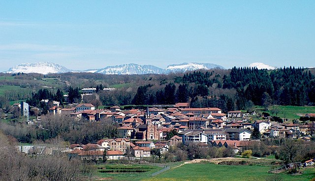
Canton de Roybon, located in the Isère department of the Auvergne-Rhône-Alpes region in southeastern France, offers a variety of hiking opportunities for outdoor enthusiasts. This area is characterized by its stunning landscapes, including forests, hills, and valleys, making it ideal for hikers of all skill levels.
Hiking Trails
-
Varied Terrain: The region features a mix of gentle trails suitable for families and challenging paths for experienced hikers. You can find routes that take you along rivers, through woodlands, and up to panoramic viewpoints.
-
Local Trails: Look into well-marked local trails such as those in the Vercors Regional Natural Park, which borders the Canton. The park offers breathtaking views and a chance to see local flora and fauna.
-
Seasonal Hiking: Each season provides a unique experience. Spring and summer offer lush greenery, while autumn showcases vibrant foliage. Winter hiking and snowshoeing may also be possible in this region.
Preparing for Your Hike
- Maps and Guides: It’s a good idea to have a detailed map or guidebook. Many local tourist offices can provide useful materials.
- Equipment: Ensure you have proper hiking boots, weather-appropriate clothing, water, and snacks. If you plan to hike in winter, consider bringing snowshoes or poles.
- Safety: Always inform someone about your hiking plans, especially if you're going on less trafficked trails. Mobile reception can be spotty in remote areas.
Points of Interest
While hiking, you can also take time to enjoy:
- Local Wildlife: The region is home to diverse wildlife, including deer and various bird species.
- Cultural Sites: Visit nearby villages to appreciate local architecture and perhaps enjoy traditional cuisine.
Hiking Clubs and Guides
Joining a local hiking club or hiring a guide can enrich your experience, offering insights into the natural environment and cultural heritage of the area.
In summary, hiking in Canton de Roybon provides a fulfilling experience amidst nature's beauty, with options catering to different levels of hikers. Whether you're looking for a leisurely walk or a challenging trek, you’ll find something that meets your needs. Always remember to follow local guidelines and respect nature during your adventures!
- Country:

- Capital: Roybon
- Coordinates: 45° 17' 58" N, 5° 10' 20" E


- GPS tracks (wikiloc): [Link]
- Wikidata storage: Wikidata: Q1668474
- Library of Congress authority ID: Alt: [n82098750]
- INSEE canton code: [3825]
Includes regions:


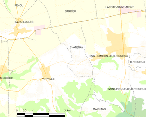
Châtenay
- commune in Isère, France
Châtenay is a charming commune located in the Isère department of the Auvergne-Rhône-Alpes region in southeastern France. While it may not be as well-known for hiking as some of the larger national parks or mountain ranges in the area, it offers several opportunities for outdoor activities, including hiking....
- Country:

- Postal Code: 38980
- Coordinates: 45° 19' 14" N, 5° 13' 45" E


- GPS tracks (wikiloc): [Link]
- Area: 4.62 sq km
- Population: 442


Thodure
- commune in Isère, France
Thodure is a picturesque village located in the southern part of India, specifically in the state of Tamil Nadu. It is known for its serene landscapes, lush greenery, and accessible trails that attract both amateur and seasoned hikers. Here are some key points to consider for hiking in Thodure:...
- Country:

- Postal Code: 38260
- Coordinates: 45° 19' 0" N, 5° 10' 7" E


- GPS tracks (wikiloc): [Link]
- Area: 14.43 sq km
- Population: 745


Saint-Clair-sur-Galaure
- commune in Isère, France
 Hiking in Saint-Clair-sur-Galaure
Saint-Clair-sur-Galaure, a picturesque village in the Drôme department of southeastern France, offers a delightful environment for hiking enthusiasts. The region is characterized by its rolling hills, lush landscapes, and scenic views of the surrounding countryside....
- Country:

- Postal Code: 38940
- Coordinates: 45° 15' 37" N, 5° 8' 40" E


- GPS tracks (wikiloc): [Link]
- Area: 15.3 sq km
- Population: 280

Montfalcon
- commune in Isère, France
Montfalcon is a scenic area that offers various hiking opportunities, particularly for those who appreciate nature and outdoor activities. While specific trails and conditions can change, here are some general insights into hiking in Montfalcon:...
- Country:

- Postal Code: 38940
- Coordinates: 45° 15' 16" N, 5° 10' 18" E


- GPS tracks (wikiloc): [Link]
- Area: 5.82 sq km
- Population: 123


Marcilloles
- commune in Isère, France
Marcilloles is a charming village located in the scenic region of Auvergne-Rhône-Alpes in France. It's well-known for its stunning natural surroundings, making it an excellent destination for hiking enthusiasts. Here’s what you can expect when hiking in this area:...
- Country:

- Postal Code: 38260
- Coordinates: 45° 20' 24" N, 5° 11' 2" E


- GPS tracks (wikiloc): [Link]
- Area: 9.5 sq km
- Population: 1056
- Web site: [Link]


Marnans
- commune in Isère, France
Marnans, a picturesque area known for its stunning landscapes, offers a variety of hiking opportunities suitable for different skill levels. Whether you are a beginner or an experienced hiker, the region has something for everyone....
- Country:

- Postal Code: 38980
- Coordinates: 45° 17' 41" N, 5° 14' 14" E


- GPS tracks (wikiloc): [Link]
- Area: 6.6 sq km
- Population: 152


Lentiol
- commune in Isère, France
Lentiol, a beautiful area in the French Alps, is a fantastic destination for hiking enthusiasts. Here are a few key points about hiking in Lentiol:...
- Country:

- Postal Code: 38270
- Coordinates: 45° 17' 57" N, 5° 6' 48" E


- GPS tracks (wikiloc): [Link]
- Area: 7.6 sq km
- Population: 217


Marcollin
- commune in Isère, France
Marcollin is a charming commune in the Isère department of southeastern France, nestled at the foothills of the Alps. While it may not be as widely recognized as other hiking destinations, it offers beautiful landscapes, scenic views, and a variety of trails that cater to different skill levels....
- Country:

- Postal Code: 38270
- Coordinates: 45° 18' 20" N, 5° 5' 16" E


- GPS tracks (wikiloc): [Link]
- Area: 10.69 sq km
- Population: 661
- Web site: [Link]


Beaufort
- commune in Isère, France
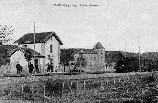
Beaufort, located in the Isère department of the Auvergne-Rhône-Alpes region in southeastern France, is a charming area known for its stunning alpine scenery and diverse hiking opportunities. Here are some highlights about hiking in this region:...
- Country:

- Postal Code: 38270
- Coordinates: 45° 19' 35" N, 5° 7' 19" E


- GPS tracks (wikiloc): [Link]
- AboveSeaLevel: 280 м m
- Area: 8.69 sq km
- Population: 564


Viriville
- commune in Isère, France
Viriville is a charming village located in the Isère department of France, nestled in the breathtaking backdrop of the French Alps. Hiking in this region offers an incredible experience, with its stunning landscapes, diverse flora and fauna, and a variety of trails suitable for different skill levels....
- Country:

- Postal Code: 38980
- Coordinates: 45° 18' 57" N, 5° 12' 15" E


- GPS tracks (wikiloc): [Link]
- Area: 30.46 sq km
- Population: 1634
- Web site: [Link]


Roybon
- commune in Isère, France
Roybon, located in the Auvergne-Rhône-Alpes region of France, offers several hiking opportunities for outdoor enthusiasts. The area is characterized by its beautiful landscapes, ranging from forests to rolling hills, making it ideal for both novice and experienced hikers....
- Country:

- Postal Code: 38940
- Coordinates: 45° 15' 31" N, 5° 14' 39" E


- GPS tracks (wikiloc): [Link]
- Area: 67.31 sq km
- Population: 1229
- Web site: [Link]