canton of Villenauxe-la-Grande (canton de Villenauxe-la-Grande)
- canton of France
- Country:

- Capital: Villenauxe-la-Grande
- Coordinates: 48° 35' 23" N, 3° 33' 14" E


- GPS tracks (wikiloc): [Link]
- Wikidata storage: Wikidata: Q1727896
- INSEE canton code: [1026]
Includes regions:


Plessis-Barbuise
- commune in Aube, France
- Country:
- Postal Code: 10400
- Coordinates: 48° 34' 36" N, 3° 35' 7" E
- GPS tracks (wikiloc): [Link]
- Area: 5.5 sq km
- Population: 189


Villenauxe-la-Grande
- commune in Aube, France
- Country:
- Postal Code: 10370
- Coordinates: 48° 35' 28" N, 3° 33' 27" E
- GPS tracks (wikiloc): [Link]
- AboveSeaLevel: 80 м m
- Area: 18.05 sq km
- Population: 2734
- Web site: [Link]


Périgny-la-Rose
- commune in Aube, France
- Country:
- Postal Code: 10400
- Coordinates: 48° 32' 59" N, 3° 37' 32" E
- GPS tracks (wikiloc): [Link]
- Area: 6.86 sq km
- Population: 133


La Villeneuve-au-Châtelot
- commune in Aube, France
- Country:
- Postal Code: 10400
- Coordinates: 48° 33' 1" N, 3° 36' 43" E
- GPS tracks (wikiloc): [Link]
- AboveSeaLevel: 71 м m
- Area: 6.17 sq km
- Population: 143


La Saulsotte
- commune in Aube, France
- Country:
- Postal Code: 10400
- Coordinates: 48° 32' 33" N, 3° 30' 6" E
- GPS tracks (wikiloc): [Link]
- Area: 18.93 sq km
- Population: 696


Montpothier
- commune in Aube, France
- Country:
- Postal Code: 10400
- Coordinates: 48° 34' 21" N, 3° 31' 7" E
- GPS tracks (wikiloc): [Link]
- Area: 7.72 sq km
- Population: 340

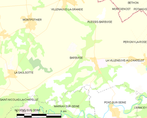
Barbuise
- commune in Aube, France
- Country:
- Postal Code: 10400
- Coordinates: 48° 33' 30" N, 3° 34' 37" E
- GPS tracks (wikiloc): [Link]
- Area: 18.09 sq km
- Population: 433