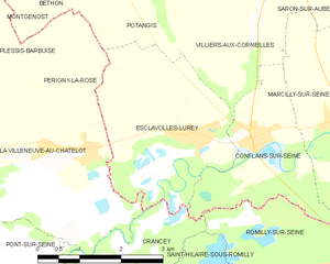
Périgny-la-Rose (Périgny-la-Rose)
- commune in Aube, France
- Country:

- Postal Code: 10400
- Coordinates: 48° 32' 59" N, 3° 37' 32" E


- GPS tracks (wikiloc): [Link]
- Area: 6.86 sq km
- Population: 133
- Wikipedia en: wiki(en)
- Wikipedia: wiki(fr)
- Wikidata storage: Wikidata: Q1376179
- Wikipedia Commons Category: [Link]
- Freebase ID: [/m/03m8ty4]
- GeoNames ID: Alt: [6426507]
- SIREN number: [211002761]
- BnF ID: [15246376j]
- PACTOLS thesaurus ID: [pcrtze2SDl8w9G]
- INSEE municipality code: 10284
Shares border with regions:


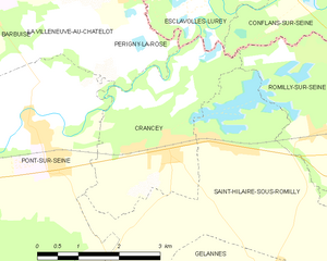
Crancey
- commune in Aube, France
- Country:

- Postal Code: 10100
- Coordinates: 48° 31' 0" N, 3° 38' 19" E


- GPS tracks (wikiloc): [Link]
- Area: 8.81 sq km
- Population: 739


Potangis
- commune in Marne, France
- Country:

- Postal Code: 51260
- Coordinates: 48° 35' 15" N, 3° 38' 39" E


- GPS tracks (wikiloc): [Link]
- Area: 8.87 sq km
- Population: 121


Montgenost
- commune in Marne, France
- Country:

- Postal Code: 51260
- Coordinates: 48° 35' 50" N, 3° 35' 41" E


- GPS tracks (wikiloc): [Link]
- Area: 8.4 sq km
- Population: 160


La Villeneuve-au-Châtelot
- commune in Aube, France
- Country:

- Postal Code: 10400
- Coordinates: 48° 33' 1" N, 3° 36' 43" E


- GPS tracks (wikiloc): [Link]
- AboveSeaLevel: 71 м m
- Area: 6.17 sq km
- Population: 143


Esclavolles-Lurey
- commune in Marne, France
- Country:

- Postal Code: 51260
- Coordinates: 48° 33' 8" N, 3° 39' 28" E


- GPS tracks (wikiloc): [Link]
- Area: 9.47 sq km
- Population: 596


Pont-sur-Seine
- commune in Aube, France
- Country:

- Postal Code: 10400
- Coordinates: 48° 31' 8" N, 3° 35' 41" E


- GPS tracks (wikiloc): [Link]
- Area: 16.15 sq km
- Population: 1147
- Web site: [Link]
