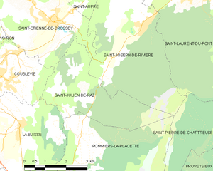
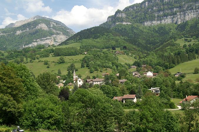
canton of Voiron (canton de Voiron)
- canton of France
Canton de Voiron is a beautiful region in the Isère department in the Auvergne-Rhône-Alpes region of southeastern France. It's known for its stunning natural landscapes, including rolling hills, forests, and nearby mountain ranges, making it a great destination for hiking enthusiasts.
Key Features of Hiking in Canton de Voiron:
-
Diverse Trails: The area offers a variety of hiking trails suitable for all levels, from beginner to experienced hikers. Trails range from easy walks in the valley to challenging routes that climb into the surrounding mountains.
-
Natural Beauty: Hikers can enjoy breathtaking views of the Chartreuse Mountains and the Vercors Massif. The changing seasons bring different palettes of colors, with vibrant wildflowers in spring and stunning autumn foliage.
-
Lac de Paladru: Close to the Canton de Voiron, Lac de Paladru is a popular spot for hiking and water activities. The lake's perimeter offers lovely trails, and the area is perfect for picnics and relaxing by the water.
-
Historical Sites: Hiking in the region can also lead you past various historical sites, including charming villages, chapels, and ruins, giving you a glimpse into the local culture and history.
-
Protected Areas: The surrounding natural parks, such as the Chartreuse Regional Natural Park, provide well-marked trails and opportunities to see a variety of wildlife.
-
Local Cuisine: After a day of hiking, enjoying local cuisine can enhance your experience. Many small towns in the Canton de Voiron have restaurants and markets where you can sample regional dishes and cheeses.
Recommended Hikes:
- The Tour du Pays Voironnais: A multi-day trek that showcases the region's natural beauty and cultural heritage.
- Sentier des Moulins: A scenic trail that leads you through picturesque landscapes with views of old mills and water features.
- Mont Granier: For experienced hikers, the hike to Mont Granier offers a challenging ascent with rewarding panoramic views.
Tips for Hiking in Canton de Voiron:
- Check the Weather: Always check local weather forecasts, as conditions can change rapidly in mountainous areas.
- Stay Hydrated: Carry enough water, especially on longer hikes.
- Trail Conditions: Before heading out, check trail conditions and maps, as some paths may be closed during certain times of the year.
- Gear Up: Wear appropriate footwear and gear, especially if you plan to tackle more rugged or steep trails.
Overall, hiking in Canton de Voiron offers a diverse experience combining beautiful landscapes, cultural exploration, and a sense of adventure!
- Country:

- Capital: Voiron
- Coordinates: 45° 21' 45" N, 5° 37' 35" E


- GPS tracks (wikiloc): [Link]
- Population: 46447
- Wikidata storage: Wikidata: Q1391840
- INSEE canton code: [3829]
Includes regions:


Saint-Étienne-de-Crossey
- commune in Isère, France
 Hiking in Saint-Étienne-de-Crossey
Saint-Étienne-de-Crossey is a charming commune located in the Isère department of the Auvergne-Rhône-Alpes region in southeastern France. It is surrounded by stunning natural landscapes, making it a great destination for hiking enthusiasts. Here are some highlights and tips for hiking in this area:...
- Country:

- Postal Code: 38960
- Coordinates: 45° 22' 45" N, 5° 38' 44" E


- GPS tracks (wikiloc): [Link]
- Area: 12.84 sq km
- Population: 2550
- Web site: [Link]


Saint-Nicolas-de-Macherin
- commune in Isère, France
 Hiking in Saint-Nicolas-de-Macherin
Saint-Nicolas-de-Macherin is a charming village located in the Auvergne-Rhône-Alpes region of France. While it may not be as well-known as some larger hiking destinations, it offers plenty of opportunities for outdoor enthusiasts to explore natural beauty, scenic landscapes, and local wildlife....
- Country:

- Postal Code: 38500
- Coordinates: 45° 23' 54" N, 5° 36' 24" E


- GPS tracks (wikiloc): [Link]
- Area: 10.6 sq km
- Population: 913
- Web site: [Link]


Saint-Julien-de-Raz
- former commune in Isère, France
Saint-Julien-de-Raz is a charming commune in the Vaucluse department of the Provence-Alpes-Côte d'Azur region in southeastern France. Although it's not widely known as a major hiking destination, it offers access to beautiful natural surroundings that are ideal for those interested in exploring the great outdoors....
- Country:

- Postal Code: 38134
- Coordinates: 45° 20' 59" N, 5° 39' 42" E


- GPS tracks (wikiloc): [Link]
- AboveSeaLevel: 630 м m
- Area: 10.81 sq km
- Population: 429
- Web site: [Link]


Pommiers-la-Placette
- former commune in Isère, France
 Hiking in Pommiers-la-Placette
Pommiers-la-Placette is a charming village located in the picturesque Grenoble region of France, nestled in the heart of the French Alps. This area is known for its breathtaking landscapes, offering a plethora of hiking opportunities for outdoor enthusiasts of all skill levels....
- Country:

- Postal Code: 38340
- Coordinates: 45° 19' 3" N, 5° 39' 26" E


- GPS tracks (wikiloc): [Link]
- Area: 16.92 sq km
- Population: 554
- Web site: [Link]


Coublevie
- commune in Isère, France
Coublevie is a charming village located in the Auvergne-Rhône-Alpes region of France, set near the foothills of the Alps. This region offers a variety of hiking opportunities for outdoor enthusiasts. Here are some key points to consider when hiking in and around Coublevie:...
- Country:

- Postal Code: 38500
- Coordinates: 45° 21' 20" N, 5° 37' 0" E


- GPS tracks (wikiloc): [Link]
- Area: 7.05 sq km
- Population: 4680
- Web site: [Link]


La Buisse
- commune in Isère, France
La Buisse is a charming village located in the Isère department of the Auvergne-Rhône-Alpes region in France. It serves as a great starting point for hiking enthusiasts looking to explore the natural beauty of the area, particularly the nearby Vercors Regional Natural Park and the Chartreuse Mountains....
- Country:

- Postal Code: 38500
- Coordinates: 45° 20' 6" N, 5° 37' 18" E


- GPS tracks (wikiloc): [Link]
- Area: 11.53 sq km
- Population: 3144
- Web site: [Link]


Saint-Aupre
- commune in Isère, France
Saint-Aupre is a charming commune located in the Isère department in the Auvergne-Rhône-Alpes region of France. It's surrounded by stunning natural landscapes, making it an excellent destination for hiking enthusiasts....
- Country:

- Postal Code: 38960
- Coordinates: 45° 23' 58" N, 5° 40' 14" E


- GPS tracks (wikiloc): [Link]
- Area: 11.93 sq km
- Population: 1123
- Web site: [Link]


Voiron
- commune in Isère, France
Voiron, located in the Isère department in the Auvergne-Rhône-Alpes region of France, is surrounded by beautiful natural landscapes, making it an excellent destination for hiking enthusiasts. Here are some highlights about hiking around Voiron:...
- Country:

- Postal Code: 38500
- Coordinates: 45° 21' 48" N, 5° 35' 24" E


- GPS tracks (wikiloc): [Link]
- Area: 21.9 sq km
- Population: 20529
- Web site: [Link]


Chirens
- commune in Isère, France
Chirens is a charming village located in the Isère department in the Auvergne-Rhône-Alpes region of southeastern France. It’s surrounded by beautiful natural landscapes, making it a great destination for hiking enthusiasts. Here are some highlights for hiking in and around Chirens:...
- Country:

- Postal Code: 38850
- Coordinates: 45° 24' 50" N, 5° 33' 21" E


- GPS tracks (wikiloc): [Link]
- AboveSeaLevel: 876 м m
- Area: 17.53 sq km
- Population: 2342
- Web site: [Link]


Voreppe
- commune in Isère, France
Voreppe, located in the Isère department of southeastern France, is a picturesque area that offers various hiking opportunities amid stunning natural landscapes. The proximity to the Chartreuse and Vercors mountain ranges makes it an ideal base for outdoor enthusiasts....
- Country:

- Postal Code: 38340
- Coordinates: 45° 17' 52" N, 5° 38' 13" E


- GPS tracks (wikiloc): [Link]
- Area: 28.65 sq km
- Population: 9441
- Web site: [Link]
