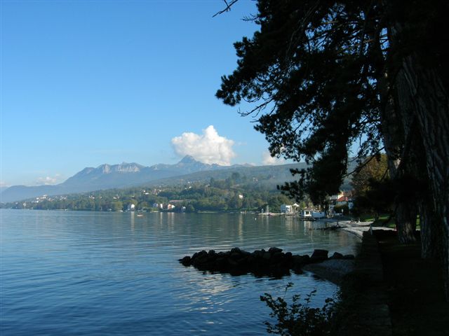
canton of Évian-les-Bains (canton d'Évian-les-Bains)

- canton of France
 Hiking in canton of Évian-les-Bains
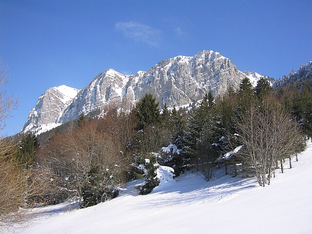
Hiking in the Canton of Évian-les-Bains, located in the Haute-Savoie region of France near Lake Geneva, offers a blend of stunning natural beauty, scenic trails, and cultural experiences. Here are some highlights and tips for hiking in this area:
Scenic Trails
-
Les Crêts de la Châtelaine: This trail provides panoramic views of Lake Geneva and the surrounding mountains. It's a moderately challenging hike that allows hikers to experience the local flora and fauna.
-
Sentier des Cimes: A more challenging route that takes you through beautiful alpine meadows and offers breathtaking vistas. This trail is well-marked and suitable for experienced hikers.
-
Le Bréda: A family-friendly hike that follows the river Bréda and offers opportunities for swimming in summer months. It's an easy trail that's great for all ages.
Nature and Wildlife
- The region boasts diverse ecosystems, including forests, alpine meadows, and lakeside habitats. Keep an eye out for local wildlife, including deer, chamois, and various bird species.
- The area is also known for its rich plant life, particularly during spring and summer when wildflowers are in bloom.
Practical Information
- Weather: The weather can change rapidly in the mountains, so it’s essential to check forecasts and be prepared with appropriate clothing and gear.
- Trail Conditions: Summer and early autumn are ideal for hiking, but if you plan to hike in spring or late autumn, be prepared for muddy or slippery trails due to melting snow or rain.
- Local Amenities: Évian-les-Bains has several facilities, including visitor centers, restaurants, and accommodation options, making it easy to plan your trip.
Cultural Highlights
- After a day of hiking, consider visiting Évian-les-Bains itself, known for its famous mineral water and beautiful lakeside promenades. The town's Art Nouveau architecture and spa facilities also offer a relaxing post-hike experience.
Safety Tips
- Always carry a map or GPS device, as some trails may not be well-marked.
- Stay hydrated, especially in warmer months, and carry snacks for energy.
- Inform someone of your hiking plan, especially if venturing on less populated trails.
Hiking in the Canton of Évian-les-Bains combines physical activity with the serenity of nature, making it a wonderful destination for outdoor enthusiasts. Enjoy your adventures!
- Country:

- Capital: Évian-les-Bains
- Coordinates: 46° 22' 49" N, 6° 38' 44" E


- GPS tracks (wikiloc): [Link]
- Population: 48491
- Wikipedia en: wiki(en)
- Wikipedia: wiki(fr)
- Wikidata storage: Wikidata: Q1728049
Includes regions:
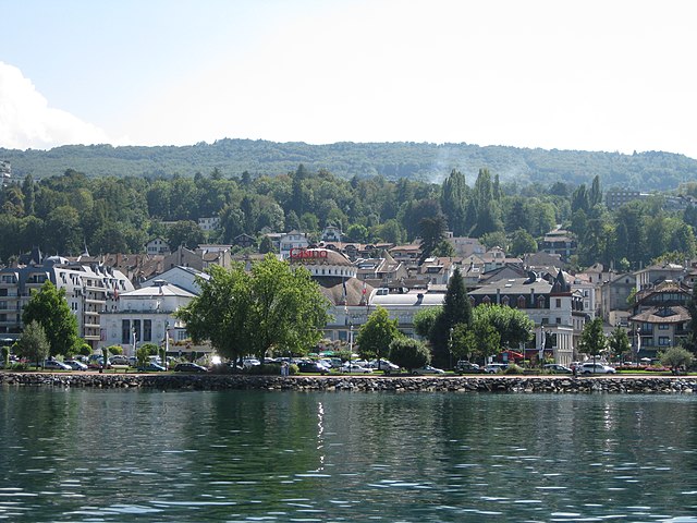

Évian-les-Bains
- commune in Haute-Savoie, France
Hiking in Évian-les-Bains
Évian-les-Bains, located on the shores of Lake Geneva in the Haute-Savoie region of France, is not only renowned for its healing thermal waters and stunning lakeside views but also offers a variety of hiking opportunities. Here are some highlights and tips for hiking in and around Évian-les-Bains:...
- Country:
- Postal Code: 74500
- Coordinates: 46° 24' 2" N, 6° 35' 24" E
- GPS tracks (wikiloc): [Link]
- Area: 4.29 sq km
- Population: 8968
- Web site: [Link]

Bernex
- commune in Haute-Savoie, France
Hiking in Bernex
Bernex is a picturesque village located in the Haute-Savoie region of the Rhône-Alpes in southeastern France. It is nestled near the French Alps, making it an excellent destination for hiking enthusiasts. Here’s an overview of what you can expect when hiking in and around Bernex:...
- Country:
- Postal Code: 74500
- Coordinates: 46° 21' 41" N, 6° 40' 30" E
- GPS tracks (wikiloc): [Link]
- Area: 22.31 sq km
- Population: 1266
- Web site: [Link]


Meillerie
- commune in Haute-Savoie, France
Hiking in Meillerie
Meillerie, a charming village located on the shores of Lake Geneva in the Haute-Savoie region of France, offers a variety of hiking opportunities that cater to different skill levels and preferences. The area is known for its stunning views of the lake and the surrounding mountains, making it a picturesque destination for outdoor enthusiasts....
- Country:
- Postal Code: 74500
- Coordinates: 46° 24' 26" N, 6° 43' 11" E
- GPS tracks (wikiloc): [Link]
- Area: 3.91 sq km
- Population: 328
- Web site: [Link]


Lugrin
- commune in Haute-Savoie, France
Hiking in Lugrin
Lugrin is a picturesque village located on the shores of Lake Geneva in the Haute-Savoie region of France, near the border with Switzerland. It offers stunning views of the lake and the surrounding Alps, making it an appealing destination for hiking enthusiasts. Here are some highlights to consider for a hiking adventure in and around Lugrin:...
- Country:
- Postal Code: 74500
- Coordinates: 46° 24' 9" N, 6° 39' 55" E
- GPS tracks (wikiloc): [Link]
- Area: 13.22 sq km
- Population: 2386
- Web site: [Link]


Féternes
- commune in Haute-Savoie, France
Hiking in Féternes
Féternes is a charming town situated in the Haute-Savoie region of France, near Lake Geneva. The surrounding area is perfect for hiking enthusiasts, offering a mix of stunning landscapes, diverse trails, and beautiful mountain views....
- Country:
- Postal Code: 74500
- Coordinates: 46° 21' 12" N, 6° 33' 47" E
- GPS tracks (wikiloc): [Link]
- Area: 14.31 sq km
- Population: 1393
- Web site: [Link]


Novel
- commune in Haute-Savoie, France
Hiking in Novel
Novel, located in the Haute-Savoie region of France, offers a picturesque setting for hiking enthusiasts. Nestled near the foothills of the French Alps and overlooking Lake Geneva, the region is characterized by beautiful landscapes, lush forests, and charming alpine meadows....
- Country:
- Postal Code: 74500
- Coordinates: 46° 22' 8" N, 6° 47' 15" E
- GPS tracks (wikiloc): [Link]
- Area: 9.75 sq km
- Population: 46
- Web site: [Link]

Publier
- commune in Haute-Savoie, France
Hiking in Publier
Publier, located in the Haute-Savoie region of France, near the shores of Lake Geneva, offers a variety of hiking opportunities that cater to all levels of hikers. The area is characterized by stunning landscapes, including mountains, forests, and beautiful views of the lake....
- Country:
- Postal Code: 74500
- Coordinates: 46° 23' 16" N, 6° 32' 39" E
- GPS tracks (wikiloc): [Link]
- Area: 8.92 sq km
- Population: 6912
- Web site: [Link]


Maxilly-sur-Léman
- commune in Haute-Savoie, France
Hiking in Maxilly-sur-Léman
Maxilly-sur-Léman is a charming commune located near Lake Geneva in the Haute-Savoie region of France. While it's not as widely known as some major hiking destinations, it offers a variety of picturesque trails for hikers of all levels. Here are some highlights about hiking in and around Maxilly-sur-Léman:...
- Country:
- Postal Code: 74500
- Coordinates: 46° 23' 58" N, 6° 37' 59" E
- GPS tracks (wikiloc): [Link]
- Area: 4.07 sq km
- Population: 1315
- Web site: [Link]


Vinzier
- commune in Haute-Savoie, France
Hiking in Vinzier
Vinzier is a picturesque village located in the Haute-Savoie region of France, close to the shores of Lake Geneva. The surrounding landscape offers stunning views of the Alps and a variety of hiking opportunities suitable for different skill levels....
- Country:
- Postal Code: 74500
- Coordinates: 46° 21' 0" N, 6° 37' 9" E
- GPS tracks (wikiloc): [Link]
- Area: 6.51 sq km
- Population: 785
- Web site: [Link]


Champanges
- commune in Haute-Savoie, France
Hiking in Champanges
Hiking in Champanges, a charming municipality located in the Haute-Savoie region of the French Alps, offers an array of stunning landscapes, charming villages, and panoramic views of the surrounding mountains, including Mont Blanc. Here are some highlights and considerations for hiking in this area:...
- Country:
- Postal Code: 74500
- Coordinates: 46° 22' 16" N, 6° 33' 11" E
- GPS tracks (wikiloc): [Link]
- Area: 3.71 sq km
- Population: 942
- Web site: [Link]

Neuvecelle
- commune in Haute-Savoie, France
Hiking in Neuvecelle
Neuvecelle is a picturesque village located near Lake Geneva in the Haute-Savoie region of France. Offering stunning views of the lake and the surrounding mountains, it is a wonderful place for hiking enthusiasts. Here are some key points about hiking in and around Neuvecelle:...
- Country:
- Postal Code: 74500
- Coordinates: 46° 23' 42" N, 6° 36' 45" E
- GPS tracks (wikiloc): [Link]
- Area: 4 sq km
- Population: 2991
- Web site: [Link]


Saint-Gingolph
- commune in Haute-Savoie, France
Hiking in Saint-Gingolph
Saint-Gingolph, located on the shores of Lake Geneva in Haute-Savoie, France, offers a unique blend of scenic beauty and hiking opportunities. Here’s an overview of what you can expect when hiking in this area:...
- Country:
- Postal Code: 74500
- Coordinates: 46° 23' 32" N, 6° 48' 7" E
- GPS tracks (wikiloc): [Link]
- Area: 7.33 sq km
- Population: 818
- Web site: [Link]


Saint-Paul-en-Chablais
- commune in Haute-Savoie, France
Hiking in Saint-Paul-en-Chablais
Saint-Paul-en-Chablais is a picturesque village located in the Haute-Savoie region of France, near the shores of Lake Geneva. This area is well-suited for hiking enthusiasts, offering a variety of trails that cater to different skill levels and preferences. Here’s an overview of what you can expect while hiking in and around Saint-Paul-en-Chablais:...
- Country:
- Postal Code: 74500
- Coordinates: 46° 22' 43" N, 6° 37' 49" E
- GPS tracks (wikiloc): [Link]
- Area: 14.45 sq km
- Population: 2340
- Web site: [Link]

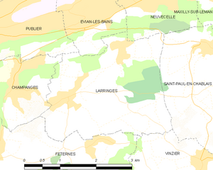
Larringes
- commune in Haute-Savoie, France
Hiking in Larringes
Larringes is a charming village located in the Haute-Savoie region of France, near the shores of Lake Geneva. It offers several opportunities for hiking, with picturesque views of the surrounding mountains and the lake....
- Country:
- Postal Code: 74500
- Coordinates: 46° 22' 7" N, 6° 34' 22" E
- GPS tracks (wikiloc): [Link]
- Area: 8.07 sq km
- Population: 1351
- Web site: [Link]

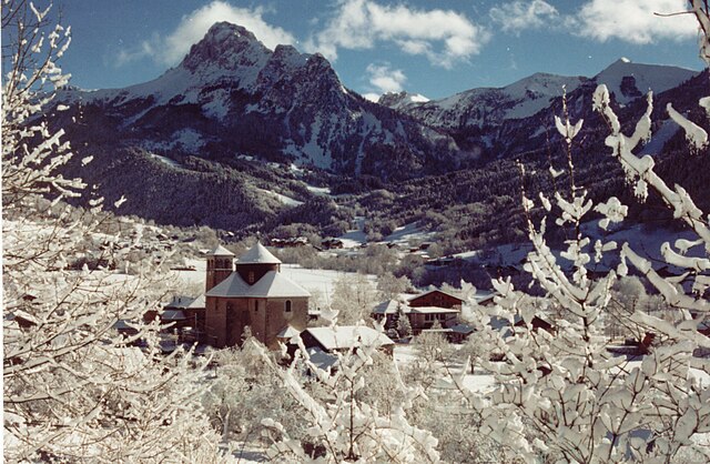
Thollon-les-Mémises
- commune in Haute-Savoie, France
Hiking in Thollon-les-Mémises
Thollon-les-Mémises, nestled in the French Alps near Lake Geneva, is a fantastic destination for hiking enthusiasts. The area is known for its stunning views and diverse trails that cater to various skill levels....
- Country:
- Postal Code: 74500
- Coordinates: 46° 23' 18" N, 6° 41' 56" E
- GPS tracks (wikiloc): [Link]
- Area: 13.78 sq km
- Population: 760
- Web site: [Link]