.JPG)
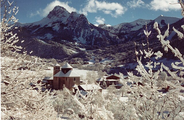
Saint-Paul-en-Chablais (Saint-Paul-en-Chablais)

- commune in Haute-Savoie, France
 Hiking in Saint-Paul-en-Chablais
Saint-Paul-en-Chablais is a picturesque village located in the Haute-Savoie region of France, near the shores of Lake Geneva. This area is well-suited for hiking enthusiasts, offering a variety of trails that cater to different skill levels and preferences. Here’s an overview of what you can expect while hiking in and around Saint-Paul-en-Chablais:
Scenic Trails
- Lake Geneva Trails: Many trails offer stunning views of Lake Geneva, with opportunities for lakeside walks and nature observation.
- Mountains and Forests: The surrounding mountains, including the Dent d'Oche and other peaks in the Chablais Alps, provide higher elevation trails that challenge more experienced hikers.
- Natural Parks: The nearby regional natural parks, such as the Parc naturel régional des Hauts de Chartreuse, feature well-marked paths and rich biodiversity.
Types of Hikes
- Easy Walks: There are gentle, flat paths suitable for families or those looking for leisurely strolls, often leading to beautiful viewpoints or picnic spots.
- Moderate Hikes: These trails generally have some elevation gain and may traverse through forests, offering a more immersive experience in nature.
- Challenging Hikes: For experienced hikers, there are steeper and more rugged trails that provide a sense of adventure and reward with breathtaking views.
Prepare for Your Hike
- Gear: Wear good hiking boots with proper grip, bring a map or GPS device, and pack plenty of water, snacks, and a first-aid kit.
- Weather: Check the weather forecast before heading out, as conditions can change rapidly in the mountains.
- Respect Nature: Stick to marked trails to minimize your impact on the environment and preserve the area's natural beauty.
Nearby Attractions
- Château de Ripaille: This historic castle located near Thonon-les-Bains is worth a visit and provides additional hiking opportunities in the region.
- Thermal Spas: After a long day of hiking, you may want to relax in one of the thermal spas located nearby, such as in Évian-les-Bains.
Local Tips
- It’s advisable to start early in the day to avoid crowds and have ample time to enjoy your hike.
- Consider visiting during the off-peak seasons (spring or fall) for a quieter experience and vibrant natural scenery.
Saint-Paul-en-Chablais is a wonderful place to explore the beauty of the French Alps, combining outdoor adventure with the charm of a small village. Enjoy your hikes!
- Country:

- Postal Code: 74500
- Coordinates: 46° 22' 43" N, 6° 37' 49" E


- GPS tracks (wikiloc): [Link]
- Area: 14.45 sq km
- Population: 2340
- Web site: http://www.saintpaulenchablais.fr
- Wikipedia en: wiki(en)
- Wikipedia: wiki(fr)
- Wikidata storage: Wikidata: Q848683
- Wikipedia Commons Gallery: [Link]
- Wikipedia Commons Category: [Link]
- Freebase ID: [/m/03ntxlk]
- GeoNames ID: Alt: [2977664]
- SIREN number: [217402494]
- BnF ID: [152745031]
- INSEE municipality code: 74249
Shares border with regions:

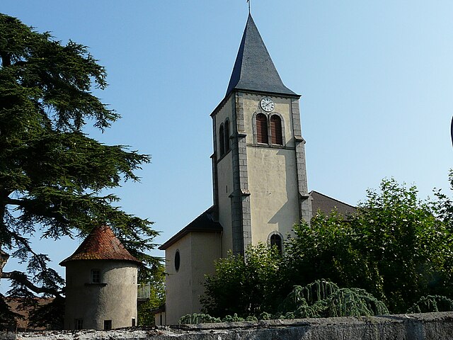
Bernex
- commune in Haute-Savoie, France
Hiking in Bernex
Bernex is a picturesque village located in the Haute-Savoie region of the Rhône-Alpes in southeastern France. It is nestled near the French Alps, making it an excellent destination for hiking enthusiasts. Here’s an overview of what you can expect when hiking in and around Bernex:...
- Country:
- Postal Code: 74500
- Coordinates: 46° 21' 41" N, 6° 40' 30" E
- GPS tracks (wikiloc): [Link]
- Area: 22.31 sq km
- Population: 1266
- Web site: [Link]


Lugrin
- commune in Haute-Savoie, France
Hiking in Lugrin
Lugrin is a picturesque village located on the shores of Lake Geneva in the Haute-Savoie region of France, near the border with Switzerland. It offers stunning views of the lake and the surrounding Alps, making it an appealing destination for hiking enthusiasts. Here are some highlights to consider for a hiking adventure in and around Lugrin:...
- Country:
- Postal Code: 74500
- Coordinates: 46° 24' 9" N, 6° 39' 55" E
- GPS tracks (wikiloc): [Link]
- Area: 13.22 sq km
- Population: 2386
- Web site: [Link]


Maxilly-sur-Léman
- commune in Haute-Savoie, France
Hiking in Maxilly-sur-Léman
Maxilly-sur-Léman is a charming commune located near Lake Geneva in the Haute-Savoie region of France. While it's not as widely known as some major hiking destinations, it offers a variety of picturesque trails for hikers of all levels. Here are some highlights about hiking in and around Maxilly-sur-Léman:...
- Country:
- Postal Code: 74500
- Coordinates: 46° 23' 58" N, 6° 37' 59" E
- GPS tracks (wikiloc): [Link]
- Area: 4.07 sq km
- Population: 1315
- Web site: [Link]


Vinzier
- commune in Haute-Savoie, France
Hiking in Vinzier
Vinzier is a picturesque village located in the Haute-Savoie region of France, close to the shores of Lake Geneva. The surrounding landscape offers stunning views of the Alps and a variety of hiking opportunities suitable for different skill levels....
- Country:
- Postal Code: 74500
- Coordinates: 46° 21' 0" N, 6° 37' 9" E
- GPS tracks (wikiloc): [Link]
- Area: 6.51 sq km
- Population: 785
- Web site: [Link]

Neuvecelle
- commune in Haute-Savoie, France
Hiking in Neuvecelle
Neuvecelle is a picturesque village located near Lake Geneva in the Haute-Savoie region of France. Offering stunning views of the lake and the surrounding mountains, it is a wonderful place for hiking enthusiasts. Here are some key points about hiking in and around Neuvecelle:...
- Country:
- Postal Code: 74500
- Coordinates: 46° 23' 42" N, 6° 36' 45" E
- GPS tracks (wikiloc): [Link]
- Area: 4 sq km
- Population: 2991
- Web site: [Link]

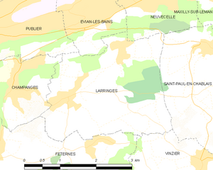
Larringes
- commune in Haute-Savoie, France
Hiking in Larringes
Larringes is a charming village located in the Haute-Savoie region of France, near the shores of Lake Geneva. It offers several opportunities for hiking, with picturesque views of the surrounding mountains and the lake....
- Country:
- Postal Code: 74500
- Coordinates: 46° 22' 7" N, 6° 34' 22" E
- GPS tracks (wikiloc): [Link]
- Area: 8.07 sq km
- Population: 1351
- Web site: [Link]