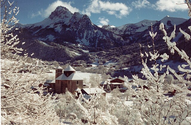
Lugrin (Lugrin)

- commune in Haute-Savoie, France
 Hiking in Lugrin
Lugrin is a picturesque village located on the shores of Lake Geneva in the Haute-Savoie region of France, near the border with Switzerland. It offers stunning views of the lake and the surrounding Alps, making it an appealing destination for hiking enthusiasts. Here are some highlights to consider for a hiking adventure in and around Lugrin:
Scenic Trails
-
Lugrin Nature Walks: There are several trails that start in Lugrin itself, taking you through lush forests and along beautiful shores of Lake Geneva. The trails are generally well-marked and vary in difficulty, making them accessible for different skill levels.
-
Mont Benand: This is a popular hike that provides breathtaking panoramic views of the lake and mountains. The trail typically leads you through charming alpine pastures and offers opportunities for wildlife spotting.
-
Sentier des Coudes: For a more challenging experience, consider the Sentier des Coudes trail that offers rugged paths and steeper inclines, rewarding hikers with spectacular views.
Flora and Fauna
While hiking, you can enjoy the rich biodiversity of the region. Keep an eye out for various species of birds, wildflowers, and perhaps even some of the local fauna, such as deer or foxes.
Seasonal Considerations
- Spring and Summer: Ideal times for hiking, with trail conditions generally good and wildflowers blooming. Make sure to stay hydrated, especially as temperatures can rise.
- Fall: A beautiful season to hike, with vibrant autumn colors. However, be prepared for cooler temperatures.
- Winter: Some trails may be suitable for snowshoeing or winter hiking, but check local conditions and ensure you’re equipped for winter hiking.
Local Amenities
Lugrin has facilities such as cafés and small shops for supplies. After a day of hiking, you can enjoy local cuisine and relax while soaking in the stunning lake views.
Safety Tips
- Always check the weather forecast before heading out.
- Carry a map or a GPS device, as some areas may have limited cell service.
- Wear appropriate hiking gear, including sturdy boots and weather-appropriate clothing.
- Inform someone of your hiking plans if you're going out on your own.
In summary, Lugrin offers a variety of hiking opportunities that cater to different skill levels, all while providing stunning views and a chance to immerse yourself in nature. Enjoy your hiking adventure!
- Country:

- Postal Code: 74500
- Coordinates: 46° 24' 9" N, 6° 39' 55" E


- GPS tracks (wikiloc): [Link]
- Area: 13.22 sq km
- Population: 2386
- Web site: http://www.mairie-lugrin.fr/
- Wikipedia en: wiki(en)
- Wikipedia: wiki(fr)
- Wikidata storage: Wikidata: Q639596
- Wikipedia Commons Category: [Link]
- Freebase ID: [/m/03ntyv2]
- GeoNames ID: Alt: [2997158]
- SIREN number: [217401546]
- BnF ID: [15274412q]
- VIAF ID: Alt: [241241956]
- GND ID: Alt: [7501704-0]
- MusicBrainz area ID: [09bf7221-f2d2-4c70-a41b-0e340a44928d]
- INSEE municipality code: 74154
Shares border with regions:

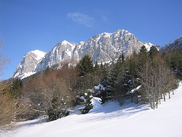
Bernex
- commune in Haute-Savoie, France
Hiking in Bernex
Bernex is a picturesque village located in the Haute-Savoie region of the Rhône-Alpes in southeastern France. It is nestled near the French Alps, making it an excellent destination for hiking enthusiasts. Here’s an overview of what you can expect when hiking in and around Bernex:...
- Country:
- Postal Code: 74500
- Coordinates: 46° 21' 41" N, 6° 40' 30" E
- GPS tracks (wikiloc): [Link]
- Area: 22.31 sq km
- Population: 1266
- Web site: [Link]


Meillerie
- commune in Haute-Savoie, France
Hiking in Meillerie
Meillerie, a charming village located on the shores of Lake Geneva in the Haute-Savoie region of France, offers a variety of hiking opportunities that cater to different skill levels and preferences. The area is known for its stunning views of the lake and the surrounding mountains, making it a picturesque destination for outdoor enthusiasts....
- Country:
- Postal Code: 74500
- Coordinates: 46° 24' 26" N, 6° 43' 11" E
- GPS tracks (wikiloc): [Link]
- Area: 3.91 sq km
- Population: 328
- Web site: [Link]


Maxilly-sur-Léman
- commune in Haute-Savoie, France
Hiking in Maxilly-sur-Léman
Maxilly-sur-Léman is a charming commune located near Lake Geneva in the Haute-Savoie region of France. While it's not as widely known as some major hiking destinations, it offers a variety of picturesque trails for hikers of all levels. Here are some highlights about hiking in and around Maxilly-sur-Léman:...
- Country:
- Postal Code: 74500
- Coordinates: 46° 23' 58" N, 6° 37' 59" E
- GPS tracks (wikiloc): [Link]
- Area: 4.07 sq km
- Population: 1315
- Web site: [Link]


Saint-Paul-en-Chablais
- commune in Haute-Savoie, France
Hiking in Saint-Paul-en-Chablais
Saint-Paul-en-Chablais is a picturesque village located in the Haute-Savoie region of France, near the shores of Lake Geneva. This area is well-suited for hiking enthusiasts, offering a variety of trails that cater to different skill levels and preferences. Here’s an overview of what you can expect while hiking in and around Saint-Paul-en-Chablais:...
- Country:
- Postal Code: 74500
- Coordinates: 46° 22' 43" N, 6° 37' 49" E
- GPS tracks (wikiloc): [Link]
- Area: 14.45 sq km
- Population: 2340
- Web site: [Link]

Thollon-les-Mémises
- commune in Haute-Savoie, France
Hiking in Thollon-les-Mémises
Thollon-les-Mémises, nestled in the French Alps near Lake Geneva, is a fantastic destination for hiking enthusiasts. The area is known for its stunning views and diverse trails that cater to various skill levels....
- Country:
- Postal Code: 74500
- Coordinates: 46° 23' 18" N, 6° 41' 56" E
- GPS tracks (wikiloc): [Link]
- Area: 13.78 sq km
- Population: 760
- Web site: [Link]