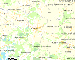
canton of Buzançais (canton de Buzançais)

- canton of France
- Country:

- Capital: Buzançais
- Coordinates: 46° 53' 27" N, 1° 25' 24" E


- GPS tracks (wikiloc): [Link]
- Population: 20813
- Wikipedia en: wiki(en)
- Wikipedia: wiki(fr)
- Wikidata storage: Wikidata: Q890406
- Wikipedia Commons Category: [Link]
- INSEE canton code: [3604]
Includes regions:


La Chapelle-Orthemale
- commune in Indre, France
- Country:
- Postal Code: 36500
- Coordinates: 46° 50' 35" N, 1° 27' 9" E
- GPS tracks (wikiloc): [Link]
- Area: 16.8 sq km
- Population: 117


Sougé
- commune in Indre, France
- Country:
- Postal Code: 36500
- Coordinates: 46° 57' 48" N, 1° 29' 15" E
- GPS tracks (wikiloc): [Link]
- Area: 13.02 sq km
- Population: 145
- Web site: [Link]


Méobecq
- commune in Indre, France
- Country:
- Postal Code: 36500
- Coordinates: 46° 44' 17" N, 1° 24' 44" E
- GPS tracks (wikiloc): [Link]
- Area: 35.56 sq km
- Population: 361
- Web site: [Link]


Neuillay-les-Bois
- commune in Indre, France
- Country:
- Postal Code: 36500
- Coordinates: 46° 45' 55" N, 1° 28' 32" E
- GPS tracks (wikiloc): [Link]
- Area: 47.63 sq km
- Population: 671
- Web site: [Link]


Chezelles
- commune in Indre, France
- Country:
- Postal Code: 36500
- Coordinates: 46° 53' 24" N, 1° 34' 33" E
- GPS tracks (wikiloc): [Link]
- Area: 17.32 sq km
- Population: 478


Argy
- commune in Indre, France
- Country:
- Postal Code: 36500
- Coordinates: 46° 56' 21" N, 1° 26' 18" E
- GPS tracks (wikiloc): [Link]
- Area: 38.89 sq km
- Population: 612

Buzançais
- commune in Indre, France
- Country:
- Postal Code: 36500
- Coordinates: 46° 53' 24" N, 1° 25' 21" E
- GPS tracks (wikiloc): [Link]
- Area: 58.64 sq km
- Population: 4473
- Web site: [Link]

Villedieu-sur-Indre
- commune in Indre, France
- Country:
- Postal Code: 36320
- Coordinates: 46° 50' 47" N, 1° 32' 24" E
- GPS tracks (wikiloc): [Link]
- AboveSeaLevel: 150 м m
- Area: 57.77 sq km
- Population: 2745
- Web site: [Link]


Vendœuvres
- commune in Indre, France
- Country:
- Postal Code: 36500
- Coordinates: 46° 48' 6" N, 1° 21' 30" E
- GPS tracks (wikiloc): [Link]
- AboveSeaLevel: 118 м m
- Area: 96.45 sq km
- Population: 1098

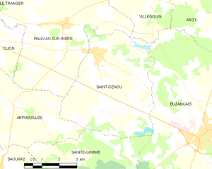
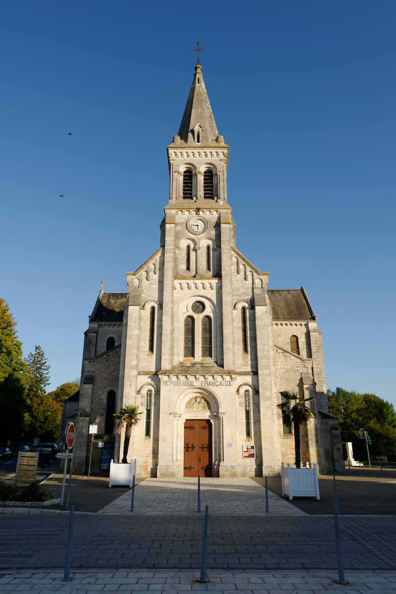
Saint-Genou
- commune in Indre, France
- Country:
- Postal Code: 36500
- Coordinates: 46° 55' 46" N, 1° 20' 17" E
- GPS tracks (wikiloc): [Link]
- Area: 24.41 sq km
- Population: 982
- Web site: [Link]


Saint-Lactencin
- commune in Indre, France
- Country:
- Postal Code: 36500
- Coordinates: 46° 53' 53" N, 1° 29' 35" E
- GPS tracks (wikiloc): [Link]
- AboveSeaLevel: 149 м m
- Area: 32.2 sq km
- Population: 430