Argy (Argy)

- commune in Indre, France
- Country:

- Postal Code: 36500
- Coordinates: 46° 56' 21" N, 1° 26' 18" E


- GPS tracks (wikiloc): [Link]
- Area: 38.89 sq km
- Population: 612
- Wikipedia en: wiki(en)
- Wikipedia: wiki(fr)
- Wikidata storage: Wikidata: Q379205
- Wikipedia Commons Category: [Link]
- Freebase ID: [/m/03nv8_w]
- GeoNames ID: Alt: [6452284]
- SIREN number: [213600075]
- BnF ID: [15257311d]
- INSEE municipality code: 36007
Shares border with regions:


Sougé
- commune in Indre, France
- Country:
- Postal Code: 36500
- Coordinates: 46° 57' 48" N, 1° 29' 15" E
- GPS tracks (wikiloc): [Link]
- Area: 13.02 sq km
- Population: 145
- Web site: [Link]


Saint-Pierre-de-Lamps
- commune in Indre, France
- Country:
- Postal Code: 36110
- Coordinates: 46° 58' 16" N, 1° 30' 45" E
- GPS tracks (wikiloc): [Link]
- Area: 10.28 sq km
- Population: 53


Pellevoisin
- commune in Indre, France
- Country:
- Postal Code: 36180
- Coordinates: 46° 59' 1" N, 1° 24' 51" E
- GPS tracks (wikiloc): [Link]
- Area: 25.62 sq km
- Population: 776

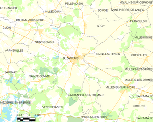
Buzançais
- commune in Indre, France
- Country:
- Postal Code: 36500
- Coordinates: 46° 53' 24" N, 1° 25' 21" E
- GPS tracks (wikiloc): [Link]
- Area: 58.64 sq km
- Population: 4473
- Web site: [Link]


Villegouin
- commune in Indre, France
- Country:
- Postal Code: 36500
- Coordinates: 46° 57' 51" N, 1° 22' 23" E
- GPS tracks (wikiloc): [Link]
- Area: 24.03 sq km
- Population: 346


Saint-Lactencin
- commune in Indre, France
- Country:
- Postal Code: 36500
- Coordinates: 46° 53' 53" N, 1° 29' 35" E
- GPS tracks (wikiloc): [Link]
- AboveSeaLevel: 149 м m
- Area: 32.2 sq km
- Population: 430


Francillon
- commune in Indre, France
- Country:
- Postal Code: 36110
- Coordinates: 46° 56' 30" N, 1° 33' 43" E
- GPS tracks (wikiloc): [Link]
- Area: 10.27 sq km
- Population: 75