canton of Chaulnes (canton de Chaulnes)
- canton of France (until March 2015)
- Country:

- Capital: Chaulnes
- Coordinates: 49° 48' 59" N, 2° 48' 17" E


- GPS tracks (wikiloc): [Link]
- Wikipedia en: wiki(en)
- Wikipedia: wiki(fr)
- Wikidata storage: Wikidata: Q166931
- Freebase ID: [/m/03y1nd3]
- INSEE canton code: [8015]
Includes regions:


Berny-en-Santerre
- commune in Somme, France
- Country:
- Postal Code: 80200
- Coordinates: 49° 51' 53" N, 2° 50' 59" E
- GPS tracks (wikiloc): [Link]
- Area: 4.43 sq km
- Population: 155

Herleville
- commune in Somme, France
- Country:
- Postal Code: 80340
- Coordinates: 49° 51' 43" N, 2° 45' 6" E
- GPS tracks (wikiloc): [Link]
- Area: 6.05 sq km
- Population: 191
- Web site: [Link]


Belloy-en-Santerre
- commune in Somme, France
- Country:
- Postal Code: 80200
- Coordinates: 49° 52' 59" N, 2° 51' 19" E
- GPS tracks (wikiloc): [Link]
- Area: 5.49 sq km
- Population: 154


Lihons
- commune in Somme, France
- Country:
- Postal Code: 80320
- Coordinates: 49° 49' 27" N, 2° 45' 58" E
- GPS tracks (wikiloc): [Link]
- Area: 12.42 sq km
- Population: 423
- Web site: [Link]


Fay
- commune in Somme, France
- Country:
- Postal Code: 80200
- Coordinates: 49° 53' 8" N, 2° 48' 31" E
- GPS tracks (wikiloc): [Link]
- Area: 3.9 sq km
- Population: 106

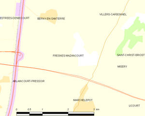
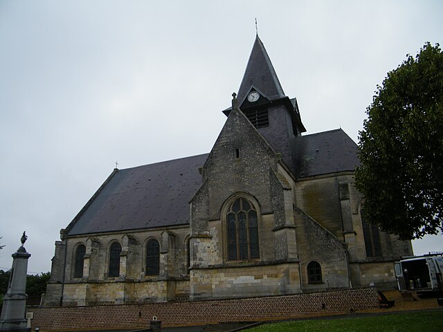
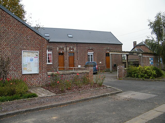
Fresnes-Mazancourt
- commune in Somme, France
- Country:
- Postal Code: 80320
- Coordinates: 49° 51' 6" N, 2° 51' 55" E
- GPS tracks (wikiloc): [Link]
- Area: 5.7 sq km
- Population: 135


Framerville-Rainecourt
- commune in Somme, France
- Country:
- Postal Code: 80131
- Coordinates: 49° 51' 38" N, 2° 42' 47" E
- GPS tracks (wikiloc): [Link]
- AboveSeaLevel: 100 м m
- Area: 9.91 sq km
- Population: 468


Fontaine-lès-Cappy
- commune in Somme, France
- Country:
- Postal Code: 80340
- Coordinates: 49° 53' 54" N, 2° 46' 51" E
- GPS tracks (wikiloc): [Link]
- Area: 3.47 sq km
- Population: 53

Foucaucourt-en-Santerre
- commune in Somme, France
- Country:
- Postal Code: 80340
- Coordinates: 49° 52' 29" N, 2° 46' 31" E
- GPS tracks (wikiloc): [Link]
- AboveSeaLevel: 82 м m
- Area: 6.91 sq km
- Population: 282

Puzeaux
- commune in Somme, France
- Country:
- Postal Code: 80320
- Coordinates: 49° 47' 53" N, 2° 49' 18" E
- GPS tracks (wikiloc): [Link]
- Area: 3.75 sq km
- Population: 290
- Web site: [Link]


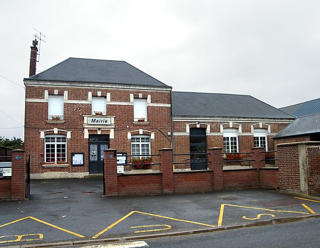
Ablaincourt-Pressoir
- commune in Somme, France
- Country:
- Postal Code: 80320
- Coordinates: 49° 50' 23" N, 2° 49' 19" E
- GPS tracks (wikiloc): [Link]
- AboveSeaLevel: 83 м m
- Area: 9.46 sq km
- Population: 272


Assevillers
- commune in Somme, France
- Country:
- Postal Code: 80200
- Coordinates: 49° 53' 47" N, 2° 50' 7" E
- GPS tracks (wikiloc): [Link]
- Area: 5.47 sq km
- Population: 290
- Web site: [Link]


Omiécourt
- former commune in Somme, France
- Country:
- Postal Code: 80320
- Coordinates: 49° 48' 32" N, 2° 50' 46" E
- GPS tracks (wikiloc): [Link]
- Area: 5.54 sq km
- Population: 251


Hyencourt-le-Grand
- former commune in Somme, France
- Country:
- Postal Code: 80320
- Coordinates: 49° 49' 18" N, 2° 50' 2" E
- GPS tracks (wikiloc): [Link]
- Area: 2.95 sq km
- Population: 77


Chuignes
- commune in Somme, France
- Country:
- Postal Code: 80340
- Coordinates: 49° 54' 1" N, 2° 45' 12" E
- GPS tracks (wikiloc): [Link]
- Area: 4.56 sq km
- Population: 136


Chaulnes
- commune in Somme, France
- Country:
- Postal Code: 80320
- Coordinates: 49° 48' 56" N, 2° 48' 15" E
- GPS tracks (wikiloc): [Link]
- Area: 8.46 sq km
- Population: 2006

Vermandovillers
- commune in Somme, France
- Country:
- Postal Code: 80320
- Coordinates: 49° 51' 1" N, 2° 46' 55" E
- GPS tracks (wikiloc): [Link]
- Area: 5.83 sq km
- Population: 146

Proyart
- commune in Somme, France
- Country:
- Postal Code: 80121
- Coordinates: 49° 53' 13" N, 2° 42' 26" E
- GPS tracks (wikiloc): [Link]
- Area: 9.86 sq km
- Population: 687

Dompierre-Becquincourt
- commune in Somme, France
- Country:
- Postal Code: 80980
- Coordinates: 49° 54' 27" N, 2° 48' 18" E
- GPS tracks (wikiloc): [Link]
- AboveSeaLevel: 100 м m
- Area: 11.05 sq km
- Population: 701
- Web site: [Link]


Soyécourt
- commune in Somme, France
- Country:
- Postal Code: 80200
- Coordinates: 49° 51' 45" N, 2° 47' 43" E
- GPS tracks (wikiloc): [Link]
- Area: 5.16 sq km
- Population: 169


Estrées-Deniécourt
- commune in Somme, France
- Country:
- Postal Code: 80200
- Coordinates: 49° 52' 30" N, 2° 49' 25" E
- GPS tracks (wikiloc): [Link]
- Area: 6.45 sq km
- Population: 332


Vauvillers
- commune in Somme, France
- Country:
- Postal Code: 80131
- Coordinates: 49° 50' 56" N, 2° 42' 15" E
- GPS tracks (wikiloc): [Link]
- Area: 6.22 sq km
- Population: 260