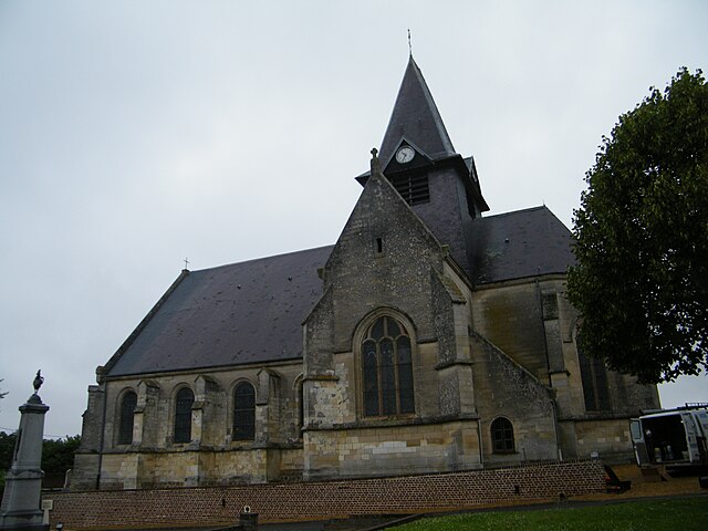
Lihons (Lihons)

- commune in Somme, France
- Country:

- Postal Code: 80320
- Coordinates: 49° 49' 27" N, 2° 45' 58" E


- GPS tracks (wikiloc): [Link]
- Area: 12.42 sq km
- Population: 423
- Web site: http://www.mairie-lihons.fr/
- Wikipedia en: wiki(en)
- Wikipedia: wiki(fr)
- Wikidata storage: Wikidata: Q1156596
- Wikipedia Commons Category: [Link]
- Freebase ID: [/m/03qmjxb]
- GeoNames ID: Alt: [2998339]
- SIREN number: [218004588]
- BnF ID: [152769597]
- INSEE municipality code: 80481
Shares border with regions:

Herleville
- commune in Somme, France
- Country:
- Postal Code: 80340
- Coordinates: 49° 51' 43" N, 2° 45' 6" E
- GPS tracks (wikiloc): [Link]
- Area: 6.05 sq km
- Population: 191
- Web site: [Link]


Rosières-en-Santerre
- commune in Somme, France
- Country:
- Postal Code: 80170
- Coordinates: 49° 48' 51" N, 2° 42' 10" E
- GPS tracks (wikiloc): [Link]
- Area: 12.98 sq km
- Population: 3007
- Web site: [Link]


Framerville-Rainecourt
- commune in Somme, France
- Country:
- Postal Code: 80131
- Coordinates: 49° 51' 38" N, 2° 42' 47" E
- GPS tracks (wikiloc): [Link]
- AboveSeaLevel: 100 м m
- Area: 9.91 sq km
- Population: 468

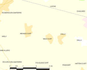
Maucourt
- commune in Somme, France
- Country:
- Postal Code: 80170
- Coordinates: 49° 47' 38" N, 2° 45' 16" E
- GPS tracks (wikiloc): [Link]
- AboveSeaLevel: 91 м m
- Area: 3.68 sq km
- Population: 175


Méharicourt
- commune in Somme, France
- Country:
- Postal Code: 80170
- Coordinates: 49° 47' 55" N, 2° 43' 55" E
- GPS tracks (wikiloc): [Link]
- Area: 7.01 sq km
- Population: 579


Chaulnes
- commune in Somme, France
- Country:
- Postal Code: 80320
- Coordinates: 49° 48' 56" N, 2° 48' 15" E
- GPS tracks (wikiloc): [Link]
- Area: 8.46 sq km
- Population: 2006

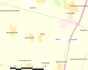
Chilly
- commune in Somme, France
- Country:
- Postal Code: 80170
- Coordinates: 49° 47' 39" N, 2° 46' 1" E
- GPS tracks (wikiloc): [Link]
- Area: 4.85 sq km
- Population: 188

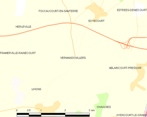
Vermandovillers
- commune in Somme, France
- Country:
- Postal Code: 80320
- Coordinates: 49° 51' 1" N, 2° 46' 55" E
- GPS tracks (wikiloc): [Link]
- Area: 5.83 sq km
- Population: 146


Vauvillers
- commune in Somme, France
- Country:
- Postal Code: 80131
- Coordinates: 49° 50' 56" N, 2° 42' 15" E
- GPS tracks (wikiloc): [Link]
- Area: 6.22 sq km
- Population: 260