canton of Créon (canton de Créon)

- canton of France
- Country:

- Capital: Créon
- Coordinates: 44° 46' 52" N, 0° 24' 1" E


- GPS tracks (wikiloc): [Link]
- Population: 46439
- Wikipedia en: wiki(en)
- Wikipedia: wiki(fr)
- Wikidata storage: Wikidata: Q949378
- INSEE canton code: [3311]
Includes regions:


Camblanes-et-Meynac
- commune in Gironde, France
- Country:
- Postal Code: 33360
- Coordinates: 44° 45' 54" N, 0° 29' 15" E
- GPS tracks (wikiloc): [Link]
- Area: 8.68 sq km
- Population: 2836
- Web site: [Link]


Madirac
- commune in Gironde, France
- Country:
- Postal Code: 33670
- Coordinates: 44° 45' 48" N, 0° 24' 15" E
- GPS tracks (wikiloc): [Link]
- Area: 1.86 sq km
- Population: 226
- Web site: [Link]


Sallebœuf
- commune in Gironde, France
- Country:
- Postal Code: 33370
- Coordinates: 44° 50' 32" N, 0° 23' 51" E
- GPS tracks (wikiloc): [Link]
- Area: 14.8 sq km
- Population: 2364
- Web site: [Link]


Créon
- commune in Gironde, France
- Country:
- Postal Code: 33670
- Coordinates: 44° 46' 28" N, 0° 20' 53" E
- GPS tracks (wikiloc): [Link]
- Area: 8.02 sq km
- Population: 4579
- Web site: [Link]


Saint-Léon
- commune in Gironde, France
- Country:
- Postal Code: 33670
- Coordinates: 44° 46' 7" N, 0° 16' 21" E
- GPS tracks (wikiloc): [Link]
- Area: 4.49 sq km
- Population: 342
- Web site: [Link]
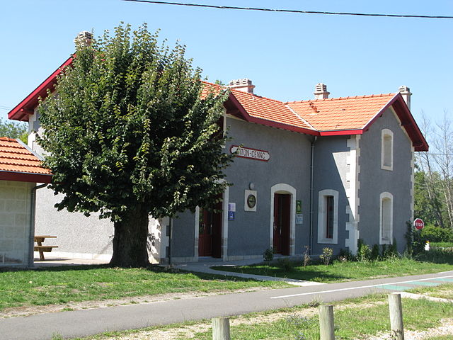

Cénac
- commune in Gironde, France
- Country:
- Postal Code: 33360
- Coordinates: 44° 46' 47" N, 0° 27' 37" E
- GPS tracks (wikiloc): [Link]
- Area: 7.5 sq km
- Population: 1808

Croignon
- commune in Gironde, France
- Country:
- Postal Code: 33750
- Coordinates: 44° 49' 11" N, 0° 20' 43" E
- GPS tracks (wikiloc): [Link]
- Area: 4.62 sq km
- Population: 602
- Web site: [Link]


Le Pout
- commune in Gironde, France
- Country:
- Postal Code: 33670
- Coordinates: 44° 48' 8" N, 0° 21' 37" E
- GPS tracks (wikiloc): [Link]
- Area: 3.93 sq km
- Population: 589
- Web site: [Link]

Lignan-de-Bordeaux
- commune in Gironde, France
- Country:
- Postal Code: 33360
- Coordinates: 44° 47' 46" N, 0° 25' 40" E
- GPS tracks (wikiloc): [Link]
- Area: 8.94 sq km
- Population: 808
- Web site: [Link]


Baurech
- commune in Gironde, France
- Country:
- Postal Code: 33880
- Coordinates: 44° 43' 31" N, 0° 26' 23" E
- GPS tracks (wikiloc): [Link]
- Area: 7.68 sq km
- Population: 816


Bonnetan
- commune in Gironde, France
- Country:
- Postal Code: 33370
- Coordinates: 44° 49' 16" N, 0° 24' 41" E
- GPS tracks (wikiloc): [Link]
- Area: 4.29 sq km
- Population: 916


Blésignac
- commune in Gironde, France
- Country:
- Postal Code: 33670
- Coordinates: 44° 46' 31" N, 0° 15' 29" E
- GPS tracks (wikiloc): [Link]
- Area: 2.5 sq km
- Population: 316
- Web site: [Link]


Cambes
- commune in Gironde, France
- Country:
- Postal Code: 33880
- Coordinates: 44° 43' 56" N, 0° 27' 48" E
- GPS tracks (wikiloc): [Link]
- Area: 5.34 sq km
- Population: 1449

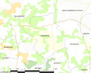
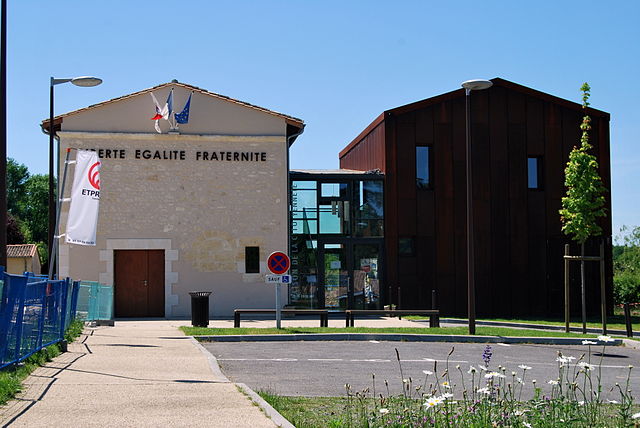
Camarsac
- commune in Gironde, France
- Country:
- Postal Code: 33750
- Coordinates: 44° 49' 57" N, 0° 21' 53" E
- GPS tracks (wikiloc): [Link]
- Area: 5.35 sq km
- Population: 993
- Web site: [Link]


Carignan-de-Bordeaux
- commune in Gironde, France
- Country:
- Postal Code: 33360
- Coordinates: 44° 48' 54" N, 0° 28' 29" E
- GPS tracks (wikiloc): [Link]
- AboveSeaLevel: 80 м m
- Area: 8.78 sq km
- Population: 3781
- Web site: [Link]


Cursan
- commune in Gironde, France
- Country:
- Postal Code: 33670
- Coordinates: 44° 48' 13" N, 0° 20' 14" E
- GPS tracks (wikiloc): [Link]
- Area: 6.07 sq km
- Population: 641
- Web site: [Link]


Quinsac
- commune in Gironde, France
- Country:
- Postal Code: 33360
- Coordinates: 44° 45' 19" N, 0° 29' 16" E
- GPS tracks (wikiloc): [Link]
- Area: 8.14 sq km
- Population: 2160
- Web site: [Link]

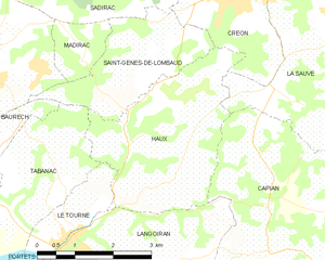
Haux
- commune in Gironde, France
- Country:
- Postal Code: 33550
- Coordinates: 44° 44' 0" N, 0° 21' 37" E
- GPS tracks (wikiloc): [Link]
- Area: 10.21 sq km
- Population: 810
- Web site: [Link]


Fargues-Saint-Hilaire
- commune in Gironde, France
- Country:
- Postal Code: 33370
- Coordinates: 44° 49' 23" N, 0° 26' 48" E
- GPS tracks (wikiloc): [Link]
- Area: 7.02 sq km
- Population: 2793
- Web site: [Link]


Pompignac
- commune in Gironde, France
- Country:
- Postal Code: 33370
- Coordinates: 44° 51' 4" N, 0° 26' 13" E
- GPS tracks (wikiloc): [Link]
- Area: 11.62 sq km
- Population: 2895
- Web site: [Link]


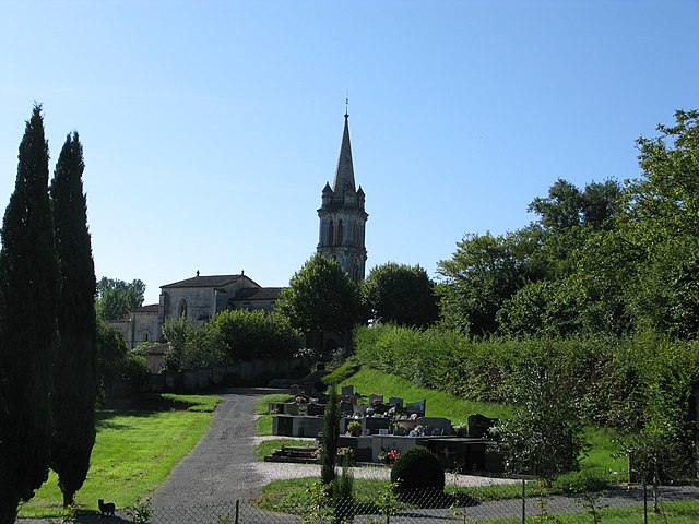
La Sauve
- commune in Gironde, France
- Country:
- Postal Code: 33670
- Coordinates: 44° 46' 10" N, 0° 18' 43" E
- GPS tracks (wikiloc): [Link]
- AboveSeaLevel: 81 м m
- Area: 18.64 sq km
- Population: 1437
- Web site: [Link]


Le Tourne
- commune in Gironde, France
- Country:
- Postal Code: 33550
- Coordinates: 44° 42' 38" N, 0° 24' 4" E
- GPS tracks (wikiloc): [Link]
- Area: 2.53 sq km
- Population: 799
- Web site: [Link]


Latresne
- commune in Gironde, France
- Country:
- Postal Code: 33360
- Coordinates: 44° 47' 6" N, 0° 29' 47" E
- GPS tracks (wikiloc): [Link]
- Area: 10.39 sq km
- Population: 3388
- Web site: [Link]


Saint-Caprais-de-Bordeaux
- commune in Gironde, France
- Country:
- Postal Code: 33880
- Coordinates: 44° 45' 2" N, 0° 26' 10" E
- GPS tracks (wikiloc): [Link]
- Area: 10.26 sq km
- Population: 3049
- Web site: [Link]


Tabanac
- commune in Gironde, France
- Country:
- Postal Code: 33550
- Coordinates: 44° 43' 14" N, 0° 24' 20" E
- GPS tracks (wikiloc): [Link]
- Area: 8 sq km
- Population: 1073
- Web site: [Link]
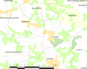
Loupes
- commune in Gironde, France
- Country:
- Postal Code: 33370
- Coordinates: 44° 48' 19" N, 0° 23' 36" E
- GPS tracks (wikiloc): [Link]
- Area: 4.87 sq km
- Population: 746
- Web site: [Link]

Saint-Genès-de-Lombaud
- commune in Gironde, France
- Country:
- Postal Code: 33670
- Coordinates: 44° 45' 12" N, 0° 22' 54" E
- GPS tracks (wikiloc): [Link]
- Area: 6.14 sq km
- Population: 378
- Web site: [Link]


Sadirac
- commune in Gironde, France
- Country:
- Postal Code: 33670
- Coordinates: 44° 46' 53" N, 0° 24' 36" E
- GPS tracks (wikiloc): [Link]
- Area: 19.11 sq km
- Population: 4119
- Web site: [Link]